Active AlertsJamestown, TX
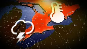
...The Flood Warning continues for the following rivers inLouisiana...Texas...Sabine River Near BurkevilleSabine River Near Bon WierSabine River Near DeweyvilleNeches River Near EvadaleNeches River Near Town BluffNeches River at Neches River Saltwater BarrierPine Island Bayou Near Sour Lake...The Flood Warning is extended for the following rivers in Texas...Village Creek Near KountzeAdditional information is available at www.weather.gov.The next statement will be issued Sunday evening at 900 PM CDT.* WHAT...Minor flooding is occurring and minor flooding is forecast.* WHERE...Sabine River near Burkeville.* WHEN...Until early Thursday morning.* IMPACTS...At 36.0 feet, Residential flooding in the River BendSubdivision occurs.* ADDITIONAL DETAILS...- At 8:15 PM CDT Saturday the stage was 37.2 feet.- Recent Activity...The maximum river stage in the 24 hoursending at 8:15 PM CDT Saturday was 37.3 feet.- Forecast...The river is expected to fall below flood stageearly Wednesday afternoon and continue falling to 35.8 feetThursday evening.- Flood stage is 36.0 feet.- http://www.weather.gov/safety/flood
...The Flood Warning continues for the following rivers inLouisiana...Texas...Sabine River Near BurkevilleSabine River Near Bon WierSabine River Near DeweyvilleNeches River Near EvadaleNeches River Near Town BluffNeches River at Neches River Saltwater BarrierPine Island Bayou Near Sour Lake...The Flood Warning is extended for the following rivers in Texas...Village Creek Near KountzeAdditional information is available at www.weather.gov.The next statement will be issued Sunday evening at 900 PM CDT.* WHAT...Moderate flooding is occurring and moderate flooding isforecast.* WHERE...Sabine River near Deweyville.* WHEN...Until further notice.* IMPACTS...At 27.9 feet, This flooding will be similar to theflooding expierenced in the flood of March 2001. Homes inDeweyville have water in them.* ADDITIONAL DETAILS...- At 7:45 PM CDT Saturday the stage was 27.2 feet.- Recent Activity...The maximum river stage in the 24 hoursending at 7:45 PM CDT Saturday was 27.3 feet.- Forecast...The river is expected to rise to a crest of 27.5feet early tomorrow afternoon.- Flood stage is 24.0 feet.- http://www.weather.gov/safety/flood