Active AlertsClyde, MO
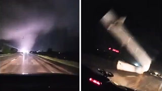
A Tornado Watch remains in effect until 1100 PM CDT for northwesternMissouri.Remain alert for a possible tornado! Tornadoes can develop quicklyfrom severe thunderstorms. If you spot a tornado go at once into thebasement or small central room in a sturdy structure.For your protection move to an interior room on the lowest floor of abuilding.
At 622 PM CDT, a severe thunderstorm was located near Maryville,moving east at 40 mph. Another severe thunderstorm was developingjust east of Fairfax.HAZARD...Ping pong ball size hail and 60 mph wind gusts.SOURCE...Emergency management. Quarter size hail was reported inSkidmore at 612 pm.IMPACT...People and animals outdoors will be injured. Expect haildamage to roofs, siding, windows, and vehicles. Expect winddamage to roofs, siding, and trees.Locations impacted include...Maryville, Maitland, Skidmore, Barnard, Graham, Guilford, Arkoe, andQuitman.