Active AlertsLadd, IL
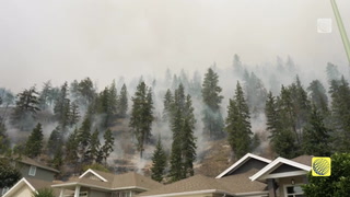
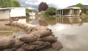
If outdoors, consider seeking shelter inside a building.Torrential rainfall is occurring and may lead to localized flooding.Do not drive your vehicle through flooded roadways.Frequent cloud to ground lightning is occurring with these storms.Lightning can strike 10 miles away from a thunderstorm. Seek a safeshelter inside a building or vehicle.
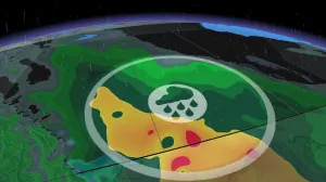
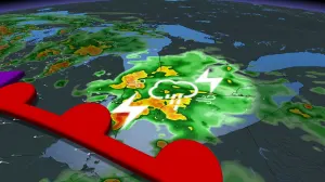
At 516 AM CDT, Doppler radar was tracking strong thunderstorms alonga line extending from near Delmar to near Le Claire to Woodhull.Movement was northeast at 40 mph.HAZARD...Wind gusts up to 50 mph and penny size hail.SOURCE...Radar indicated.IMPACT...Strong winds could break small tree limbs and blow aroundunsecured objects. Minor damage to outdoor objects ispossible.Locations impacted include...Davenport, Moline, Rock Island, Bettendorf, Clinton, East Moline,Morrison, Cambridge, Silvis, Geneseo, Eldridge, DeWitt, Colona,Milan, Camanche, Le Claire, Coal Valley, Fulton, Savanna, andProphetstown.This includes the following highways...Interstate 74 in Iowa between mile markers 1 and 5.Interstate 80 in Iowa between mile markers 293 and 306.Interstate 80 in Illinois between mile markers 1 and 35.Interstate 74 in Illinois between mile markers 1 and 31.Interstate 88 between mile markers 1 and 36.Interstate 280 between mile markers 16 and 18.