This part of Canada may be milder than Mexico on Thanksgiving weekend

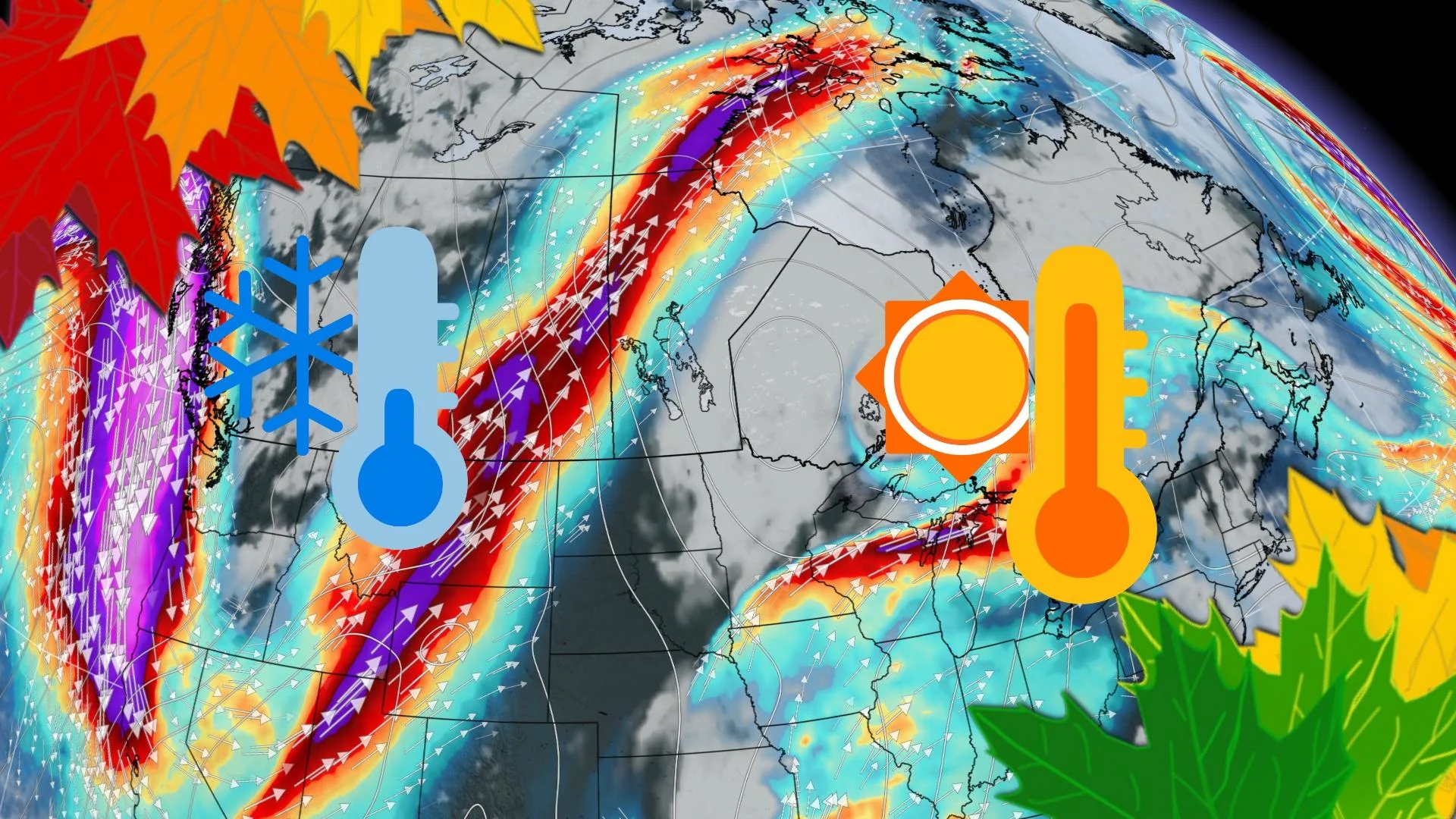
Canada will feature a little bit of everything during the upcoming Thanksgiving weekend -- from mild and cold temperatures to sun, showers and maybe even some snow.
Now that you're here after reading that seemingly hyperbolic headline: Let me assure you that it's not an exaggeration.
WESTERN CANADA:
There are many locations where you'll be able to chill the beer by simply leaving it on the back porch this weekend, if it's any consolation. For Vancouver, we're looking at the coolest Thanksgiving since 2008; that's when the airport stayed below 12°C on Oct. 13, 2008.
High-elevation snows are a Thanksgiving appetizer with an approaching frontal system due in on Saturday -- then gusty, chilly winds dominate after the front blows by.
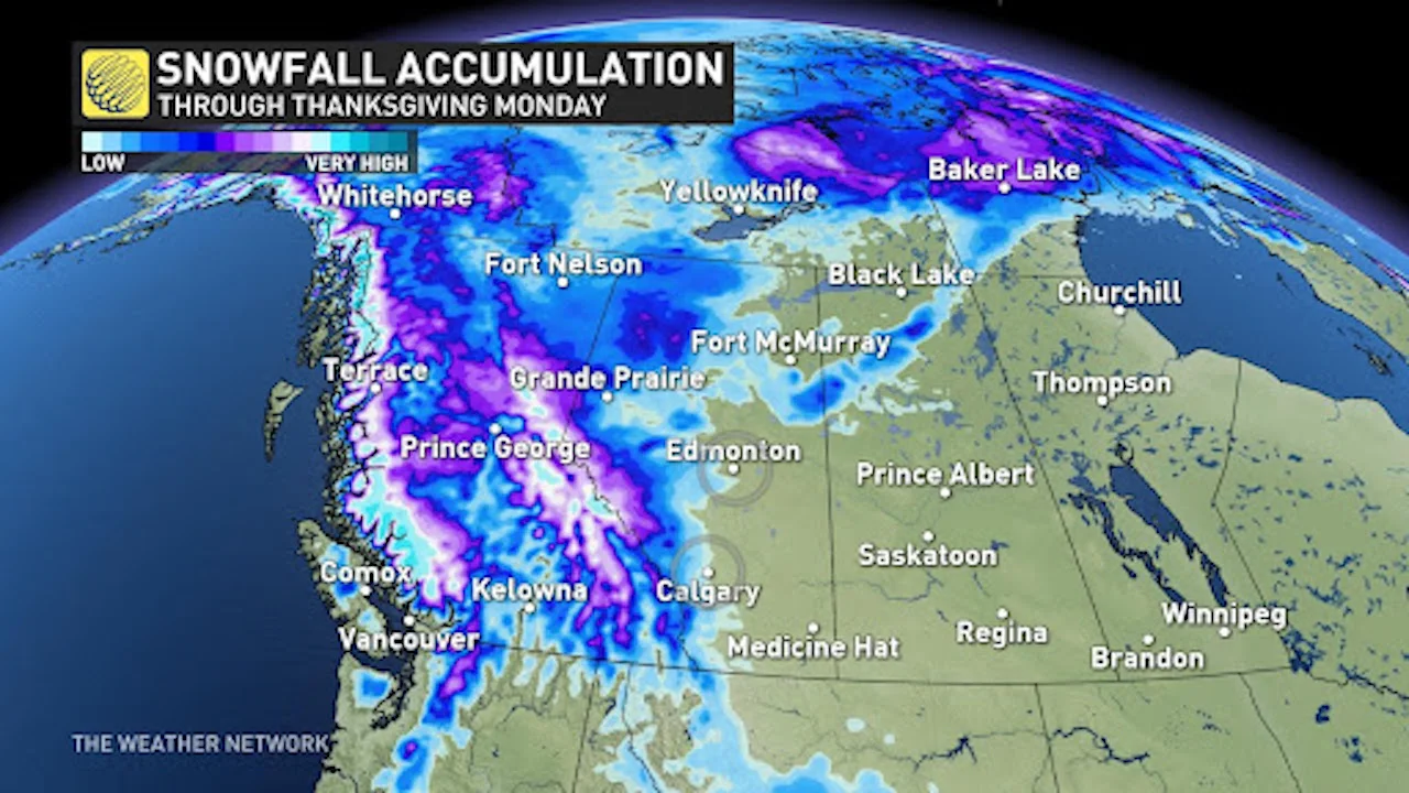
Just single-digit highs are featured in the Interior and across Alberta by next Monday, and we're carefully watching snow spill off the foothills into early next week. Calgary, nothing is off the table. Much of Alberta can also expect single-digit highs and overnight lows below the freezing mark.
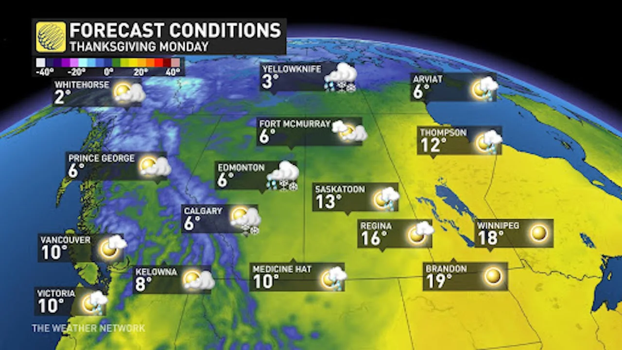
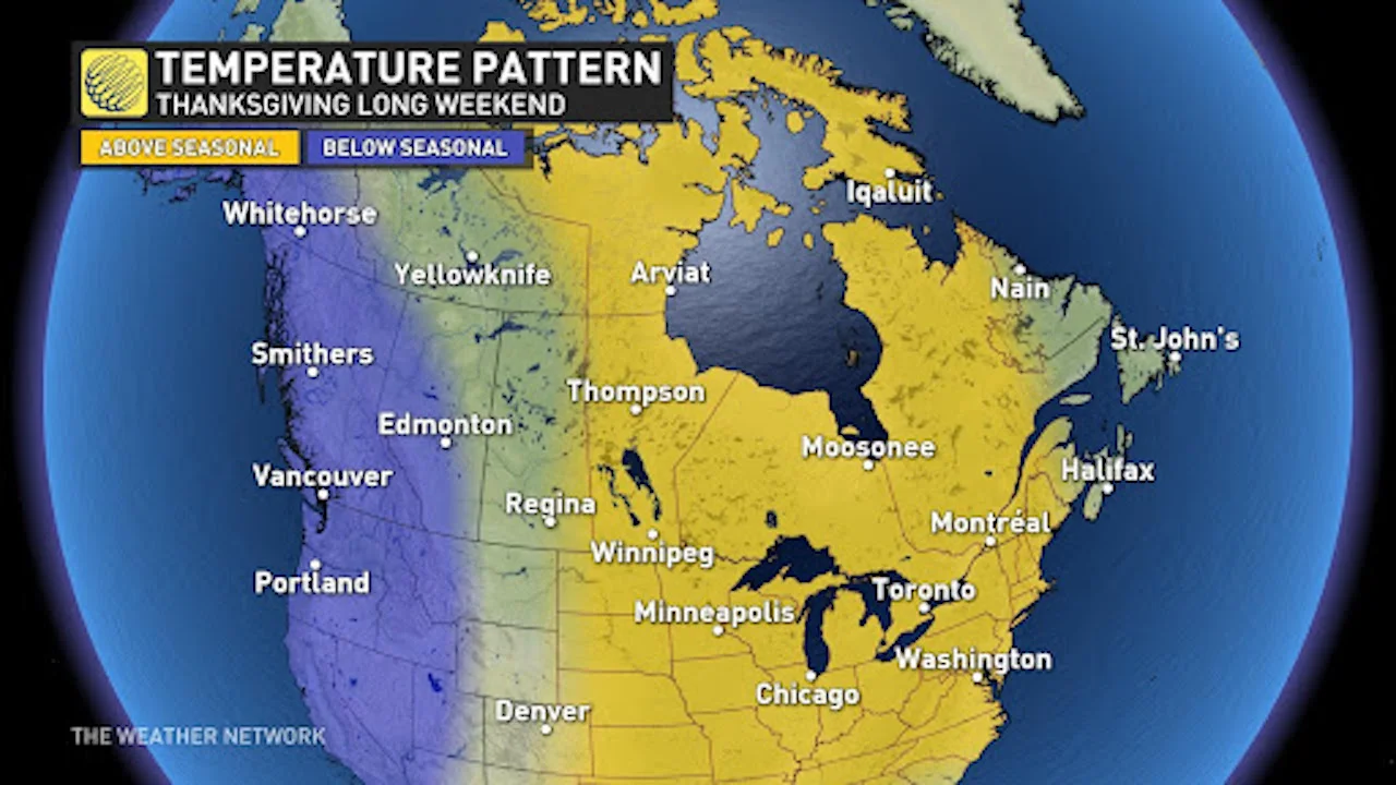
The eastern Prairies remain on the periphery of high pressure with above seasonal temperatures, but an active storm track through Manitoba and Ontario means bouts of rain; the atmosphere is a little unstable, so there will be a threat of thundershowers, as well -- a little unusual for this time of year.
EASTERN CANADA:
A couple of sneaky disturbances and upper troughs undercut the high pressure, so there'll be a round of showers and even thunderstorms through the weekend. Temperatures soaring well into the 20s across northern Ontario steals the show, beating out high temperatures in California, and even the Baja Peninsula in Mexico.
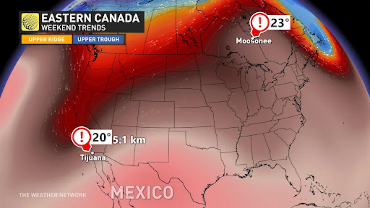
In fact, on Friday, the shores of Hudson Bay could be warmer than the beaches of Mexico, depending on the position of the warm front. Temperatures are more than 10°C above normal across Ontario, while several degrees below normal in California and northern Mexico.
You can smell some overachieve temperature potential for parts of southern Ontario on Monday. A lot can go wrong this time of year to verify extreme warmth; wind direction and cloud cover are subtle features that have drastic temperature influence in October.
If favourable wind direction and sunny breaks develop, it'll be the warmest Thanksgiving in a decade -- when Toronto Pearson hit 25.5°C on Oct. 10, 2011.
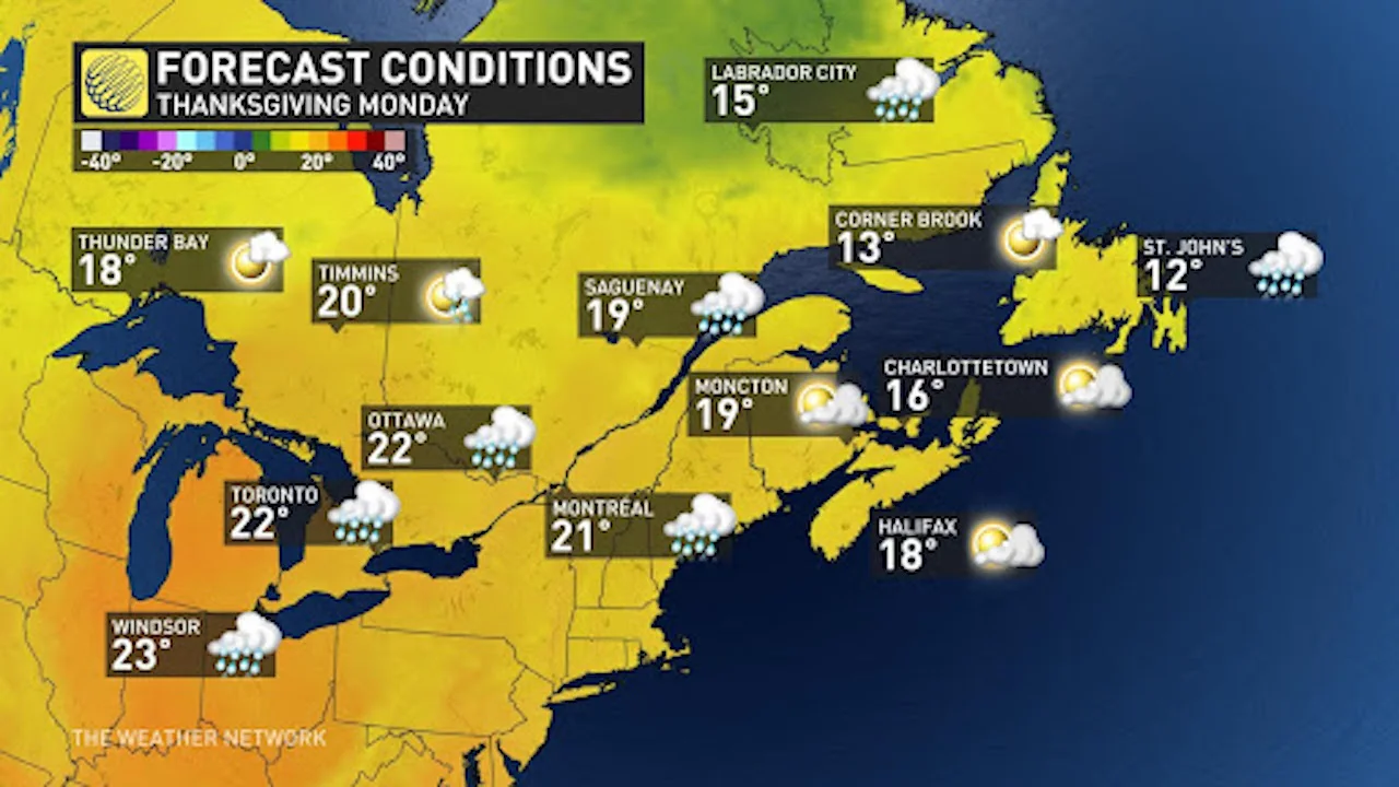
The warmth spreads into southern Quebec, with most of the weekend remaining rain-free and temperatures popping into the lower 20s at times.
Atlantic Canada, you'll be under the influence of a trough and some northerly flow that parks over Newfoundland for the first half of the weekend. In fact, Newfoundland will be on the receiving end of what is known as a "weather bomb" -- a rapid a drop of pressure of at least 24 millibars in 24 hours. In technical terms, it is what is called cyclogenesis.
Sorry, St. John’s, but you might not see the sun at all across the holiday weekend. Potentially damaging wind gusts of 80-100+ km/h are possible for the Avalon and Bonavista peninsulas, with the potential for 20-40 mm of rain through Saturday. Temperatures will improve on Thanksgiving Monday for the Maritimes as high pressure nudges in from the west.


