Wintry weather on tap for lower elevations in British Columbia

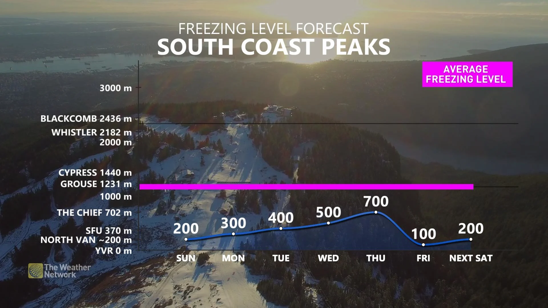
Freezing levels will remain low in British Columbia Sunday – which already enabled a dash of light, wet snow to areas as low as the outer reaches of Metro Vancouver. The secon round arrives Sunday night into Monday, and will bring a heftier opportunity for accumulating snow to the Lower Mainland. More on the timing and impacts, below.
Visit our Complete Guide to Winter 2022 for an in-depth look at the Winter Forecast, tips to plan for it, and much more!
SUNDAY AND BEYOND: SECOND DOSE OF SNOW TO START NEXT WEEK
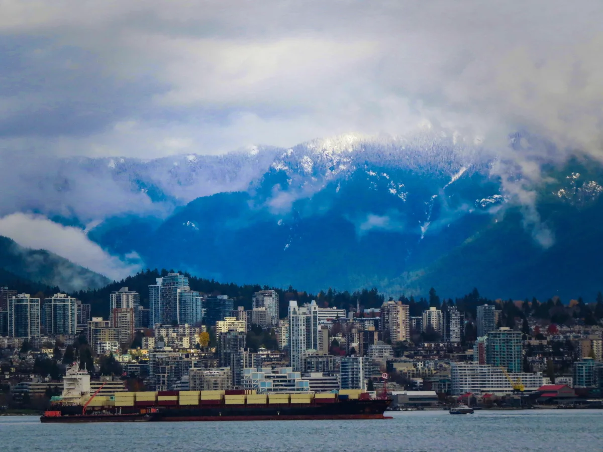
A cold airmass over western Canada ushered in the first snow of the season for parts of British Columbia unused to regular snowfall, with even parts of Metro Vancouver seeing a few wayward flakes.
Those freezing levels will be no higher than around 200 metres Sunday, enabling still more snow as a new system targets the region beginning Sunday night.
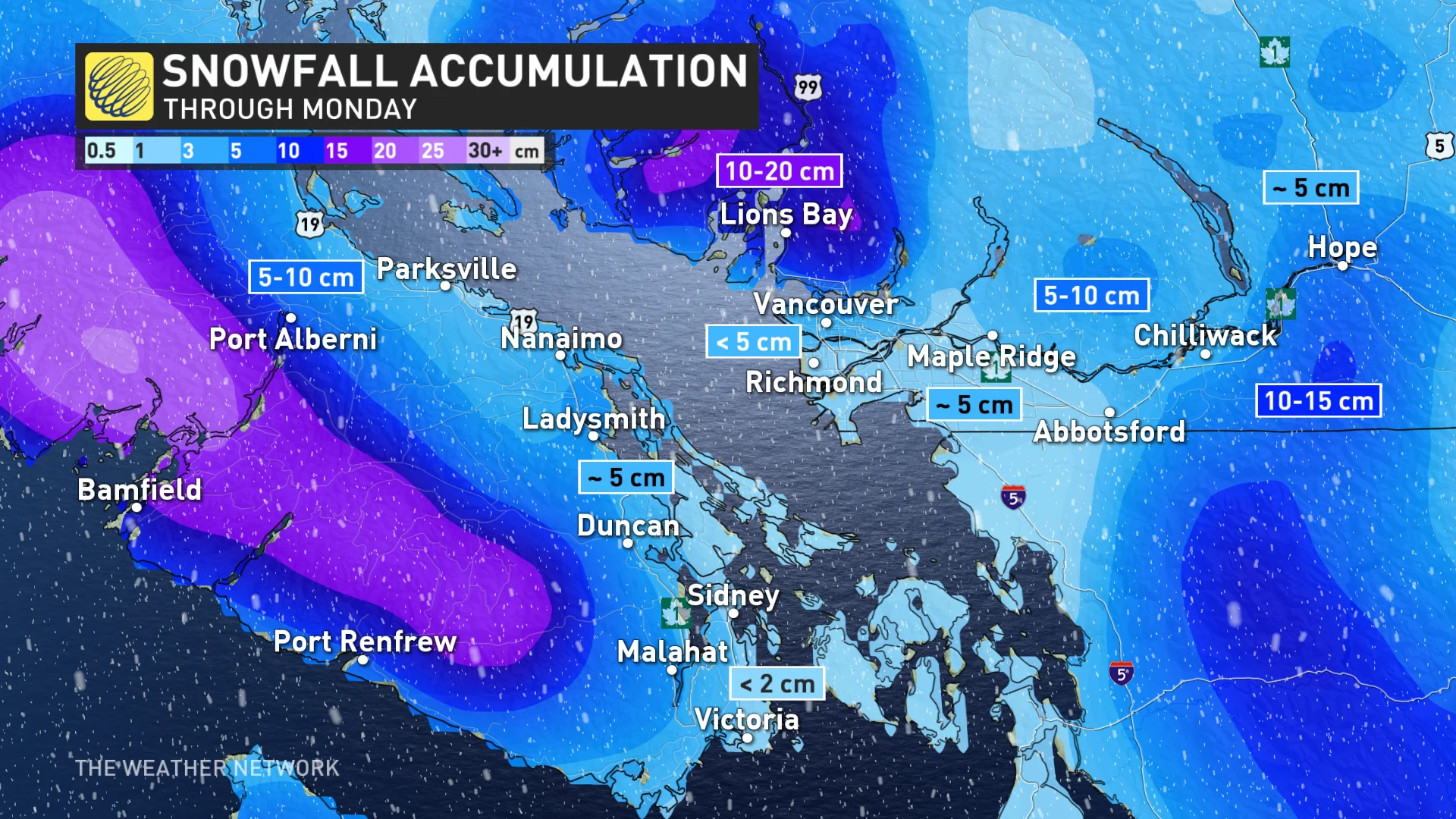
This second system will have more moisture and a little more cold air to work with, allowing for widespread accumulating snow for inland areas and bringing the potential for accumulations even closer to the coast.
Parts of Metro Vancouver could see a dusting to a couple of centimetres of snow on Sunday night into Monday morning, depending on elevation and proximity to the coast. Inland areas will see higher totals, with 5-10 cm for many areas and higher totals at higher elevations.
The next chance for active weather in southern B.C. will arrive mid-week, bringing the region another chance for snow. Regardless of the snowfall potential, below-seasonal temperatures are likely across the region through the week.
Thumbnail couresty of Ron Macdonald
Check back as we monitor the forecast across British Columbia.