Winter strikes back! Arctic air plunges south across Central Canada

While the country eagerly awaits the arrival of spring, conditions over the next couple of weeks will serve as a strong reminder that March is generally not a warm month across Canada.
Hope springs eternal this time of year, and for good reason! Earlier sunrises and later sunsets are quite noticeable with a few minutes of daylight added with each passing day. Also, seasonal temperatures are rapidly climbing, gaining roughly 2 degrees per week across much of Canada.
Visit our Complete Guide to Spring 2022 for an in-depth look at the Spring Forecast, tips to plan for it and much more!
However, when it comes to early spring weather, sometimes our optimism gets ahead of reality, and it is necessary to remind ourselves that the month that follows February is March (not May) and March is generally not a warm month across Canada.
The next couple of weeks will strongly illustrate that point.
CROSS-POLAR FLOW SENDS COLD AIR INTO CENTRAL CANADA
As we head into the second week of March, a strong blocking pattern will develop over Alaska. This is a classic cold weather set-up, as this pattern floods central Canada with air straight out of the Arctic, and in this case straight out of Siberia.
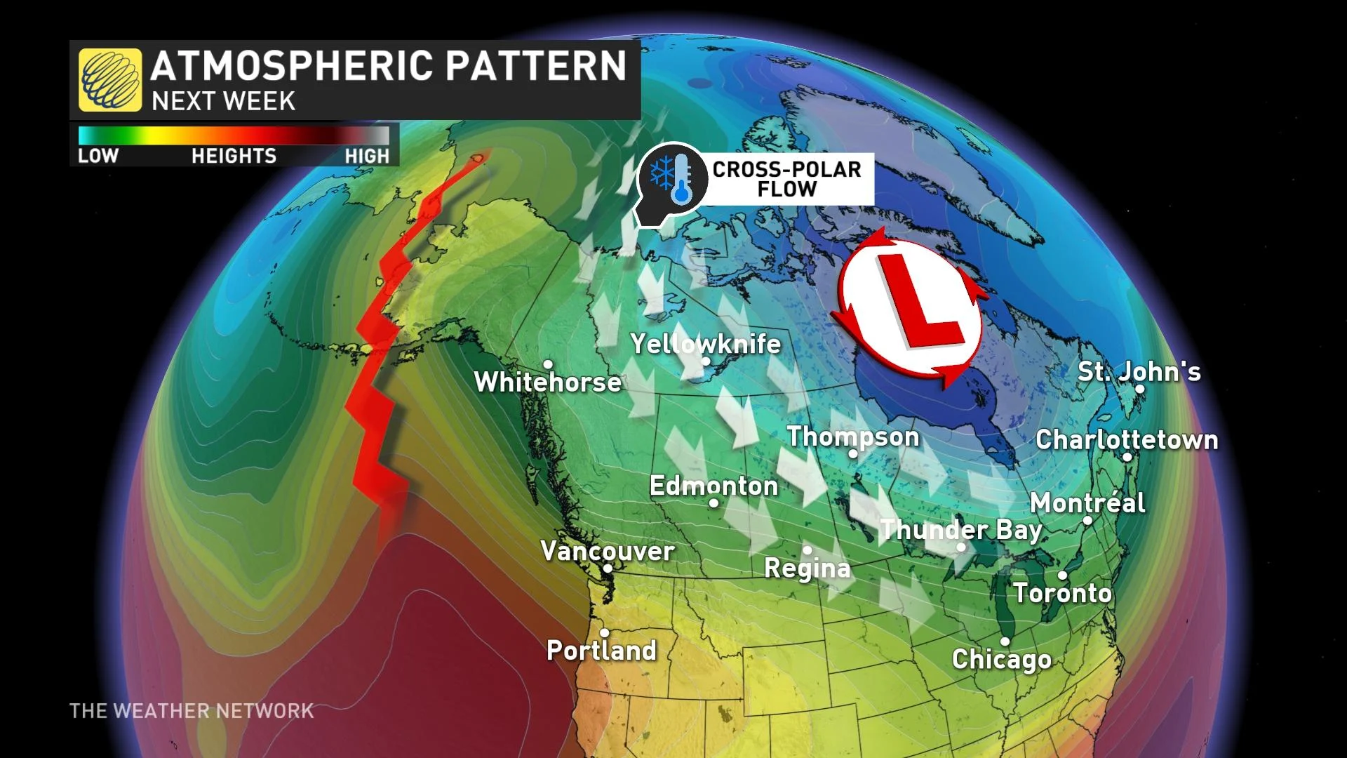
While it won’t be nearly as cold as what we saw at times earlier in the winter, temperatures will be much colder than normal for early/mid-March. This Arctic air will plunge south deep into the central United States and spread east into the Great Lakes region.
The graphic below is a model forecast for temperature anomalies for next week (March 7-11). The various shades of blue, green, and violet highlight the widespread colder-than-normal temperatures.
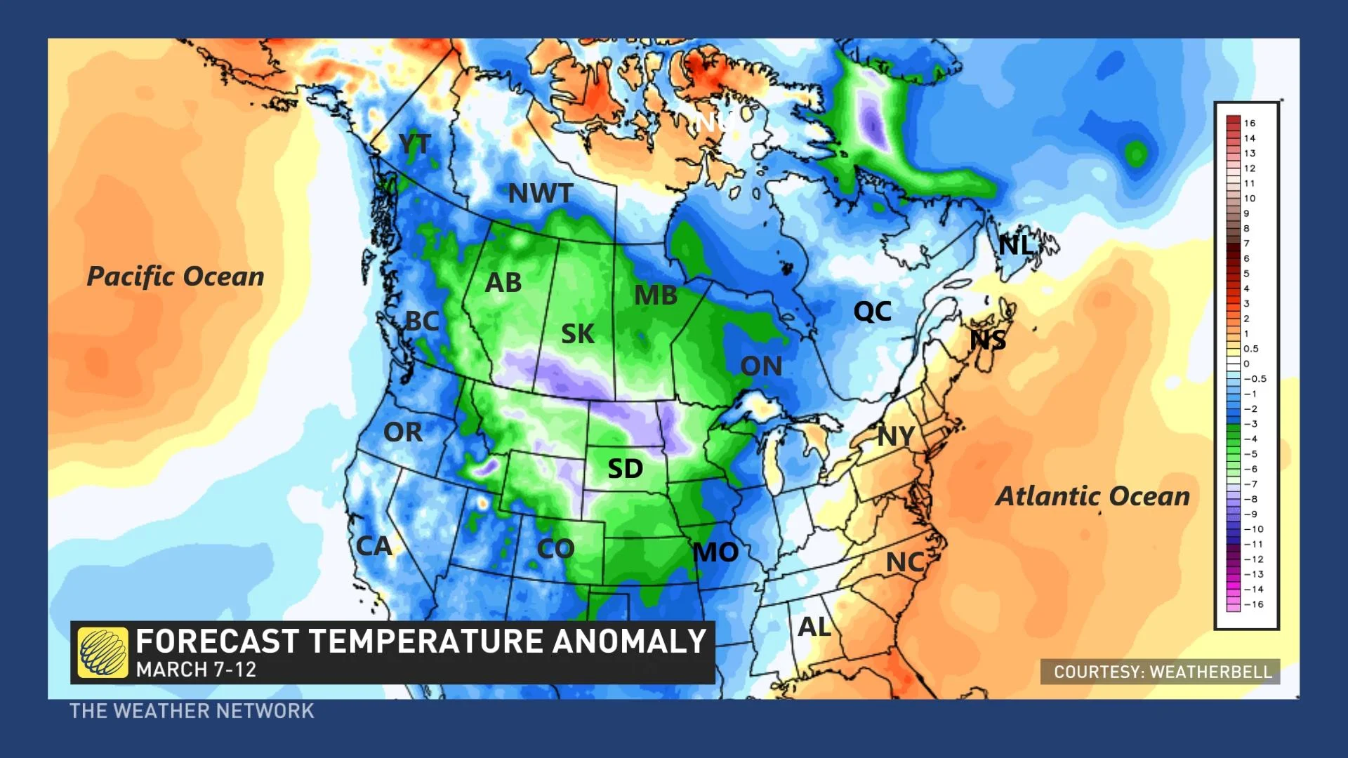
Meanwhile, very mild weather across the eastern United States will continue to make attempts at surging north across the border into southern Ontario, southern Quebec, and into the Maritimes.
This clash in contrasting temperatures from the Great Lakes to the Maritimes will give us an active pattern with changeable temperatures and the potential for messy and wintry systems.
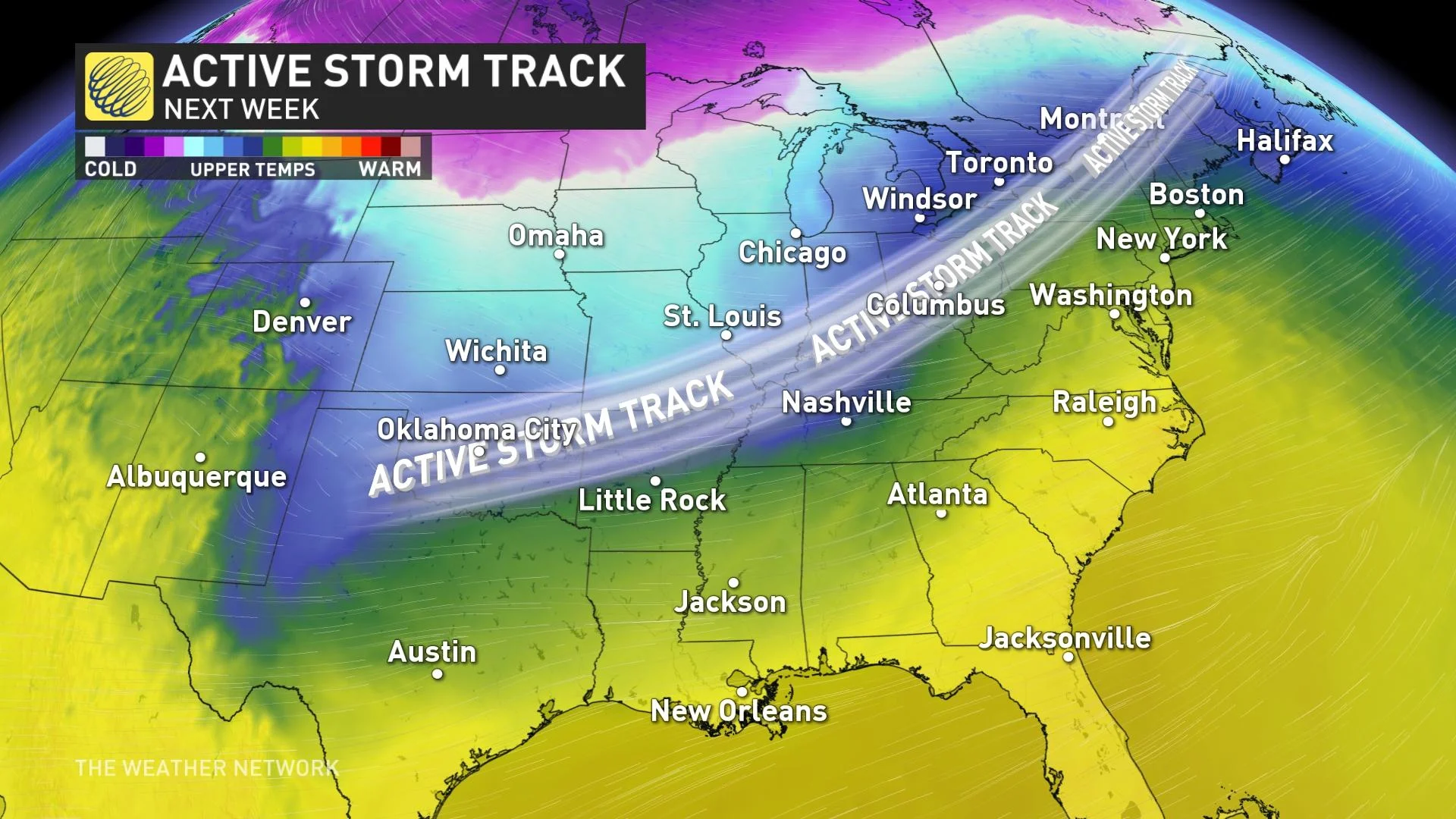
The exact track of individual storms will be the key to which places will see primarily snow, ice, or rain (or all of the above), but it is too soon to tell you exactly what you will see from each system. However, if you live in this region you will want to stay current on the changeable and active weather.
CHILLY PATTERN CONTINUES INTO THE SECOND HALF OF MARCH
This pattern is expected to persist well into the third week of March, but the focus of the coldest air is expected to shift east, resulting in colder temperatures for Ontario and Quebec and into Atlantic Canada with a risk for significant snow events.
However, the one way that we could escape seeing substantial snow totals is if the storm track gets pushed so far south that the heavy snow stays south of the U.S. border.
The map below is a model forecast for the third week of March.
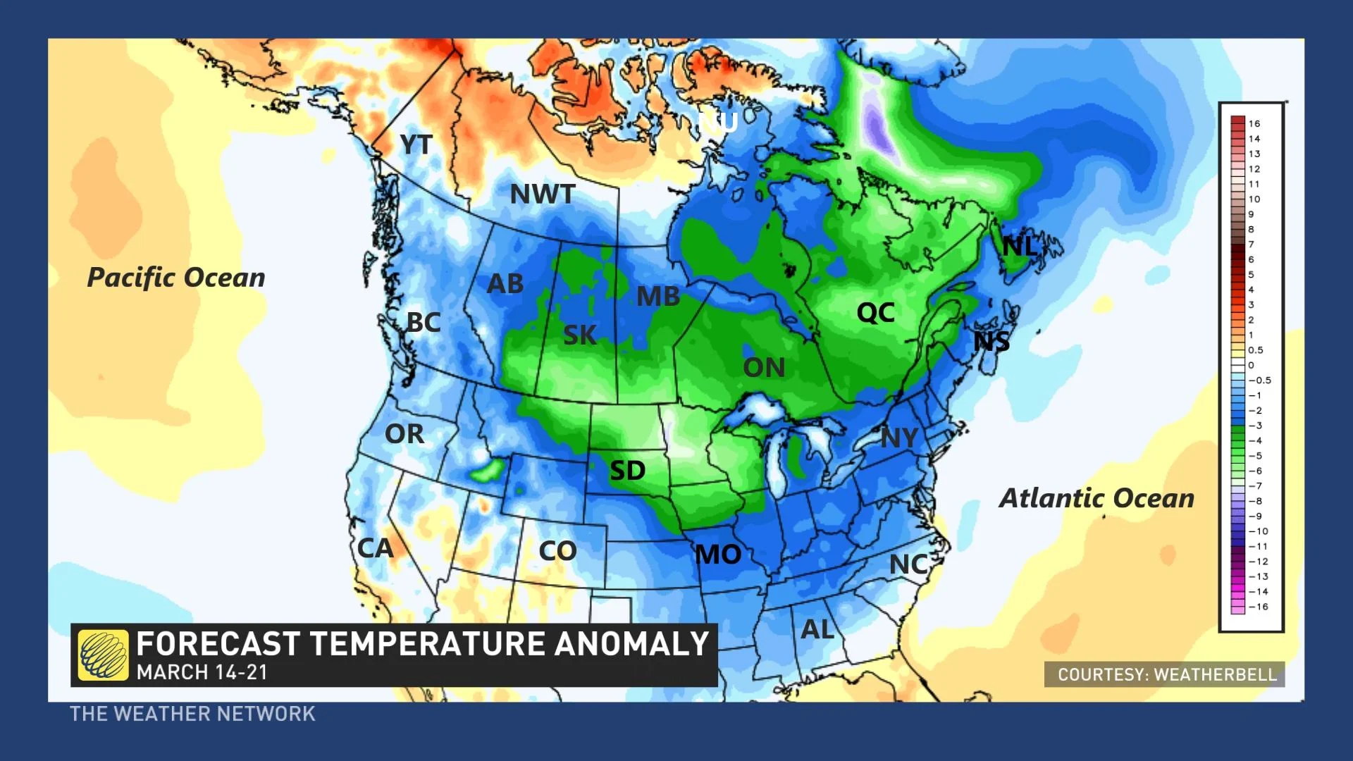
The widespread cold air may well be overdone in this model forecast as we think that milder Pacific air will start to spread back into western Canada as we progress through the third week of March. However, this illustrates well that winter isn’t finished with us yet with widespread colder-than-normal temperatures expected for mid-March.
This pattern is expected to slowly break down as we head into the final 10 days of March
So, while spring will test our patience during the next few weeks, don’t lose hope – warmer weather will come! The days are getting longer, and the sun angle is getting higher in the sky with each passing day – that is something we can definitely count on. While it is still March, May is coming!
What can you expect heading into spring? Check out The Weather Network’s spring forecast and prepare for whatever heads your way.