Winter storm buries city with over 40 cm of snow, next system hot on its heels

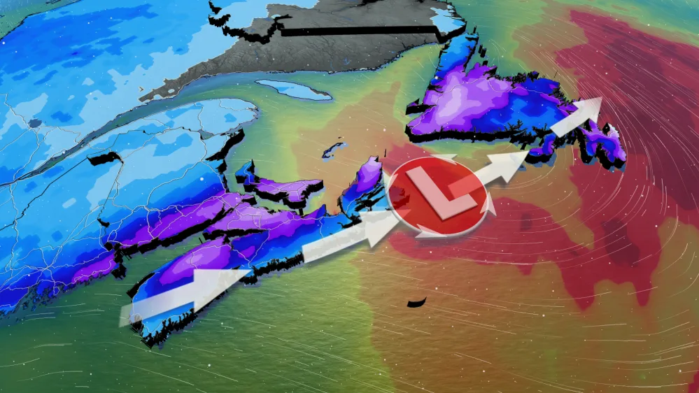
The Colorado low that left a wintry mess across Ontario, Quebec and the Maritimes is bringing a substantial blanket of snow to parts of Newfoundland to this weekend.
READ MORE: Simple tips for checking the safety of your winter tires
Halifax Stanfield International Airport cautioned travellers to confirm their flight details before heading to the airport as the storm could prompt flight delays and cancellations.
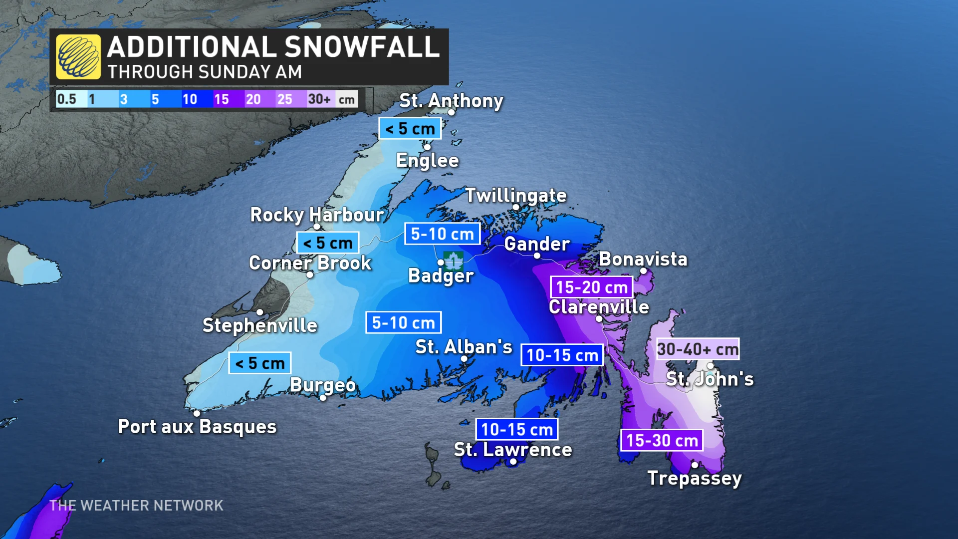
The low slightly intensified as it tracked up from the Maritimes, impacting Newfoundland Saturday and into Sunday morning, with heavy snowfall rates continuing across eastern sections of the island and northern areas of the Avalon Peninsula.
Eastern Newfoundland has been seeing intense winds, in addition to the snow, gusting upwards to 80 km/h throughout Saturday and into Sunday. This will lead to heavy, blowing snow and whiteout conditions.
Blizzard conditions were met in St. John's earlier Saturday. There have also been reports of thundersnow across parts of the Avalon.
As heavy snow and winds continue Saturday overnight and into Sunday morning, St. John's can expect to see another 20+ cm of snow.
SEE ALSO: Winter 'vacation' will end soon with return of classic Canadian cold
Like Halifax, St. John’s is also facing the prospect of possibly doubling this season’s snowfall with this storm. The city has recorded 39.2 cm of snow so far this season, as of Jan. 19. Total snow accumulations could reach 40+ cm, locally, from this event. Amounts of 40 cm have already been reported as of Saturday evening.
Environment and Climate Change Canada (ECCC) has issued winter storm and snowfall warnings in Newfoundland, advising residents of those regions to consider postponing non-essential travel until conditions improve.
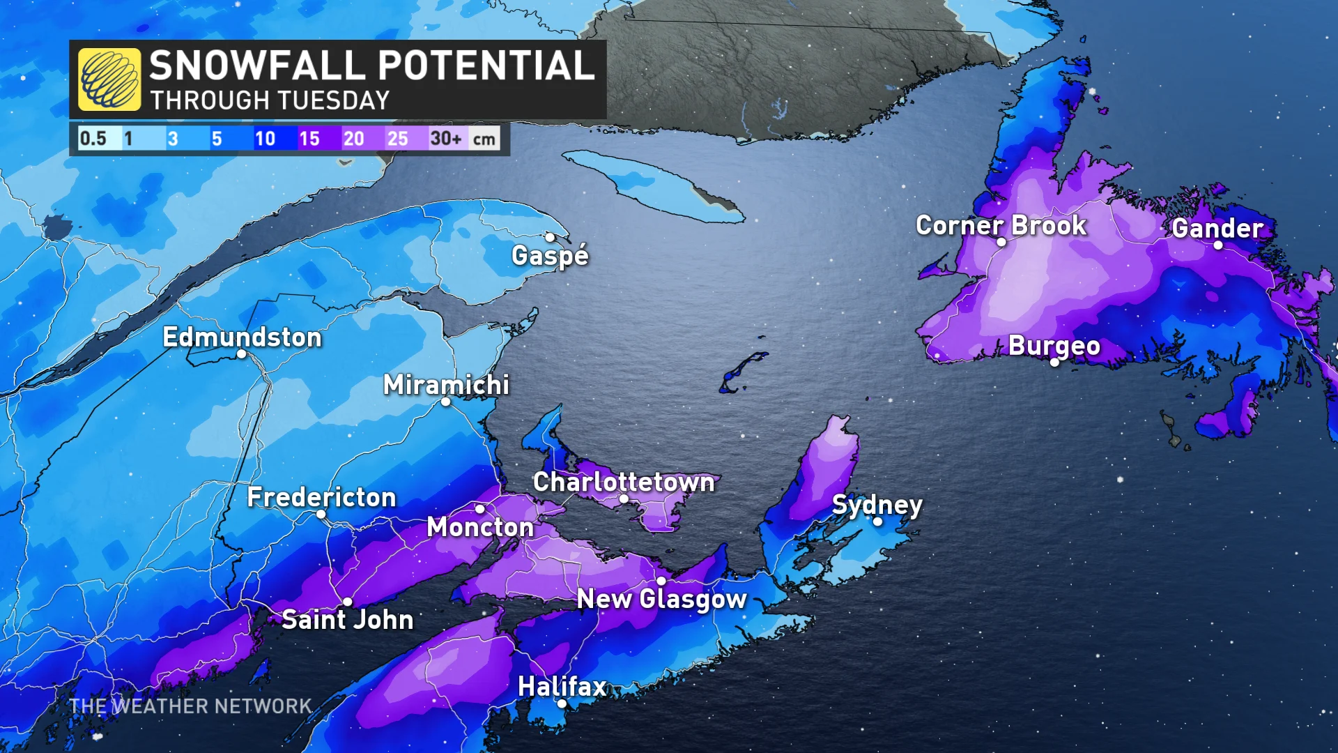
This system will exit Newfoundland early Sunday morning, but it will not be long before the next one arrives in Atlantic Canada.
As we head into Sunday evening, cloud cover builds in across the Maritimes, with snow returning to southern New Brunswick, P.E.I., and northern Nova Scotia overnight into Monday morning.
Nova Scotia will be on the warm side of the system at first with a southwesterly wind, seeing heavy amounts of rainfall throughout Monday afternoon. ECCC has already issued special weather statements.
A snow-rain mix will arrive in Newfoundland by late Monday morning, with predominantly rain for the island.
This could cause localized flooding across parts of Atlantic Canada that will see rain, due to rapid snowmelt from rising temperatures. Halifax is forecast to hit a daytime high of 7°C on Monday.
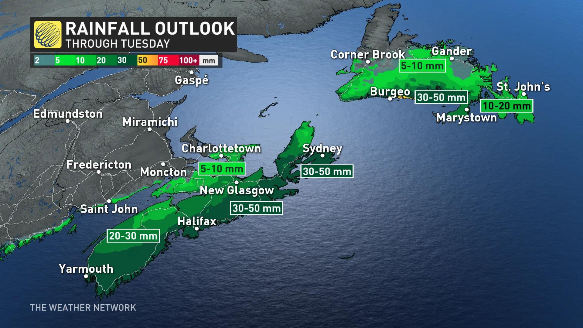
Nova Scotia's southern coastline will be seeing the most rainfall, with amounts of 30-50 mm possible by Tuesday.
Halifax airport has already reported 98 mm of rain so far this month, well above the monthly average of 83.5 mm. This means that this rain event could make this month one of the rainiest on record for the city.
WATCH: Halifax jumps back into winter with more snow than entire season so far
Check back for the latest as this wintry system approaches Atlantic Canada.


