Prepare for a tricky, wintry Friday commute in southern Ontario

Overnight snow will peak during the Friday morning commute in southern Ontario, likely leading to travel headaches across the region.
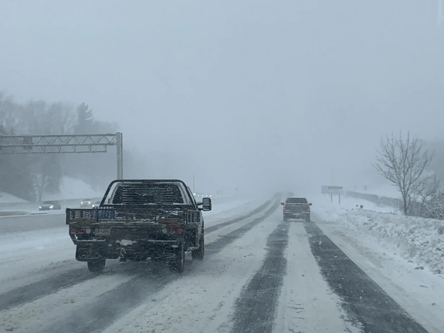
Get ready for a messy morning commute on Friday as another dose of snow moves into southern Ontario. Accumulating snow will push across the region through Friday morning, likely extending your morning commute with slick roadways. More on the snow timing, accumulations, and expected impacts, below.
MUST SEE: Pothole 101: Why February has been the worst month for roads
INTO FRIDAY: BRACE FOR SLOW COMMUTE TIMES, WINTER TRAVEL ADVISORIES IN PLACE
Snow will push into southwestern Ontario late Thursday evening and spread into the Greater Toronto Area (GTA) during the overnight hours. Snowfall rates will pick up through dawn. Snow will reach its heaviest as it spreads east Friday morning, making for a tricky commute.
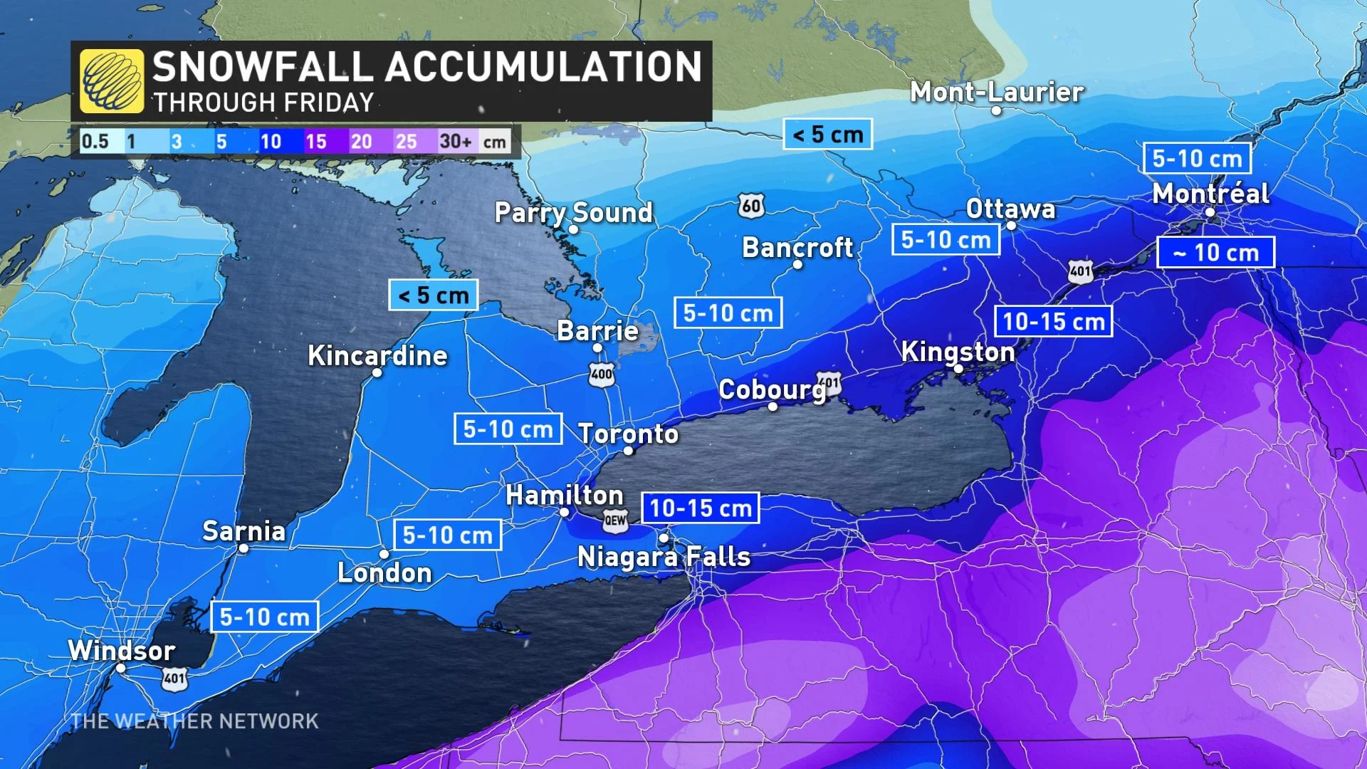
Amounts of 5-10 cm expected along the 401 corridor. Forecasters are watching the potential for locally higher amounts up to 20 cm, especially for areas near Kingston and the west end of Lake Ontario due to lake enhancement with a northeasterly wind. The lake-enhancement may occur Thursday overnight, then subsiding late Friday morning as winds shift to a westerly direction.
This will be a fluffier snow, so it’ll accumulate faster on the ground and should make for a bit of an easier cleanup.
Winter weather travel advisories span the region urging drivers to adjust travel plans accordingly. Surfaces such as highways, roads, walkways and parking lots may become difficult to navigate due to accumulating snow and visibility may be suddenly reduced at times in periods of heavy snow.
RARE TO SEE ALL SNOW THIS LATE IN THE SEASON
"This is an unusually cold system to watch for this late in the winter season," says Dr. Doug Gillham, a meteorologist at The Weather Network.
While we all know snow is very normal at the end of February, it is more typical to see messy systems that bring a combination of rain, ice and snow, due to the climbing daytime high temperatures at this time of year. But due to well below normal temperatures, precipitation will manifest as snow for southern Ontario.
Conditions will remain cold into Saturday, with a quick period of snow and gusty winds bringing a few additional centimetres on Sunday.
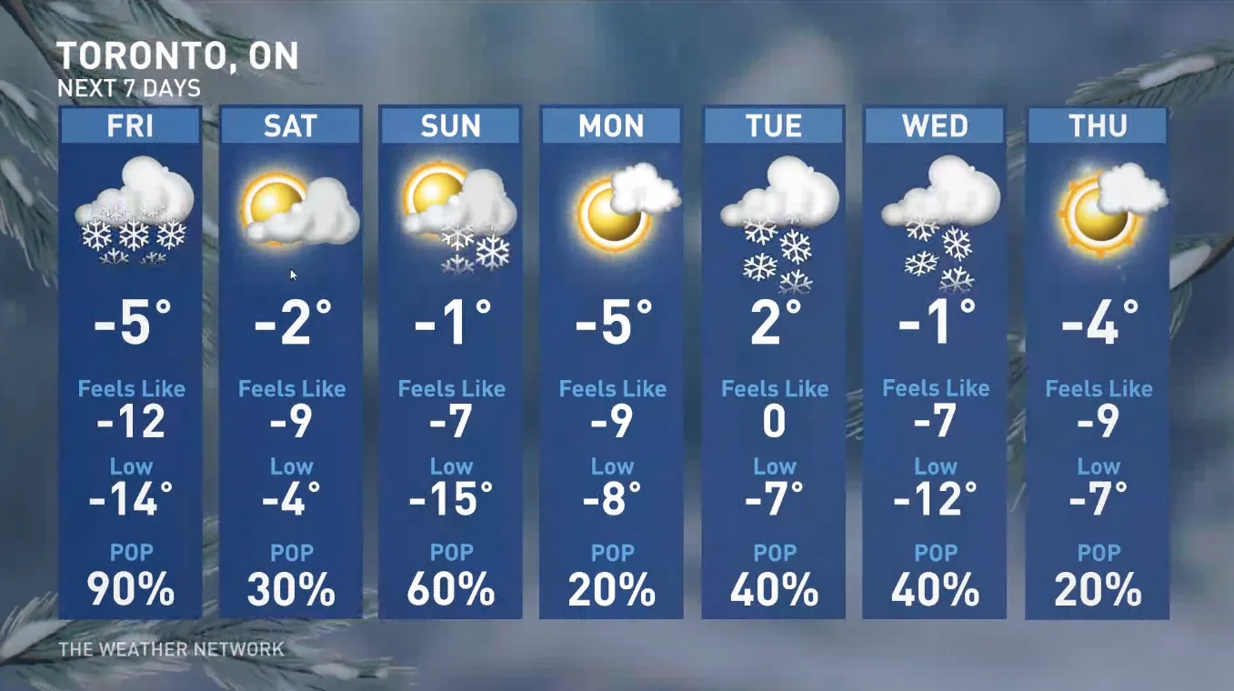
A fair and cold start to next week, but forecasters will be watching the potential for a clipper on Tuesday. Milder weather will attempt to spread east into the region mid- and late next week, but it could also run into resistance.
There is also the potential for a wintry pattern during the second week of March, as Arctic air over Central Canada attempts to press into the region while warm weather over the eastern U.S. also tries to push north.
Be sure to check back for the latest updates on this late week snow threat in southern Ontario.
Subscribe to 'This Day in Weather History': Apple Podcasts | Amazon Alexa | Google Assistant | Spotify | Google Podcasts | iHeartRadio | Overcast'