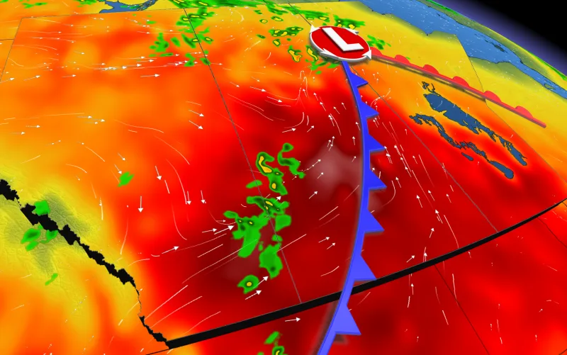
Heat warnings span the Prairies as temperatures soar above the 30-degree mark

Widespread heat warnings blanket the Prairie provinces as temperatures soar through this week, creating a risk to health.
June is starting out with sauna-like conditions across the Prairies, marked by heat warnings ranging across most of the region. With temperatures soaring into the 30s this week, humidex values will be approaching 40 by Friday. Conditions will also be quite dry, with the next chance of any rain coming Friday for Alberta, as well as a slight risk of thunderstorms, though a potent upper ridge is helping prevent any significant systems from swinging through. More on just how warm things will get, and when the region may see some rain again, below.
Visit our Complete Guide to Summer 2021 for an in-depth look at the Summer Forecast, tips to plan for it and much more!
THIS WEEK: WIDESPREAD SUMMER SIZZLE PROMPTS HEAT WARNINGS, SPECIAL WEATHER STATEMENTS
The heat was already on for Wednesday, and the curve is only upward, with heat warnings, issued by Environment Canada, blanketing almost the whole region.
Widespread temperatures into the mid-30s are expected, and a few spots could even reach the upper 30s. To close out the week, parts of southern Manitoba, including Winnipeg, are in line for humidex values near 40.
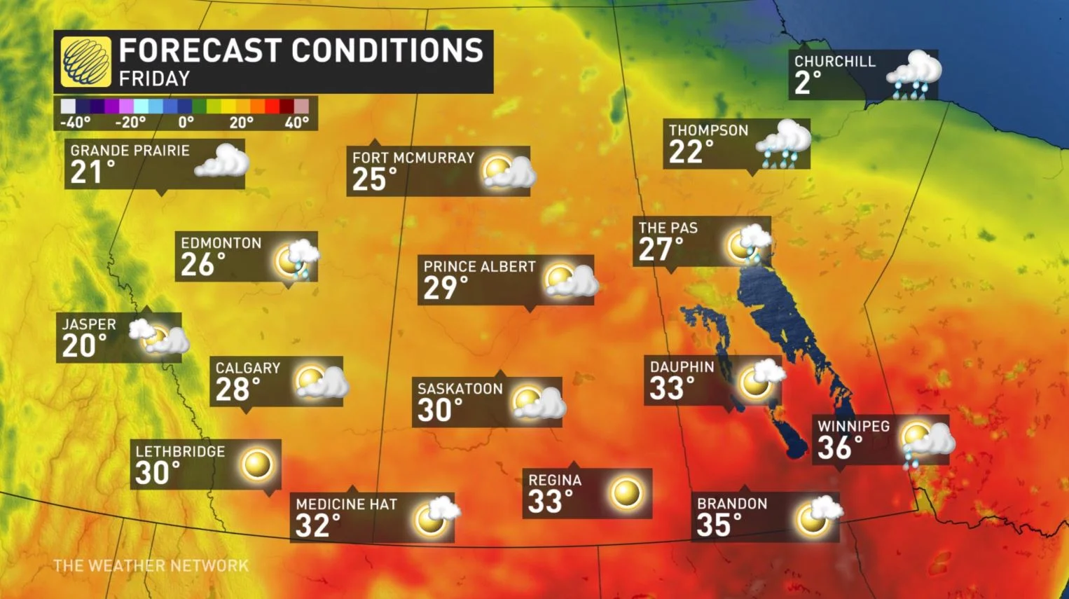
Residents are being urged to plan outdoor activities during cooler hours of the day, as well as take frequent breaks from the heat and drink plenty of water to stay hydrated.
"The risks are greater for young children, pregnant women, older adults, people with chronic illnesses and people working or exercising outdoors," says Environment Canada in the warning.
"Watch for the effects of heat illness: Swelling, rash, cramps, fainting, heat exhaustion, heat stroke and the worsening of some health conditions."
LATE WEEK: MORE WIDESPREAD CHANCE FOR RAIN AND THUNDERSTORMS, SLIGHT REPRIEVE FROM THE HEAT
Accompanying the warm-up will be abundant sunshine, continuing through until late week — resulting in a drier pattern once more.
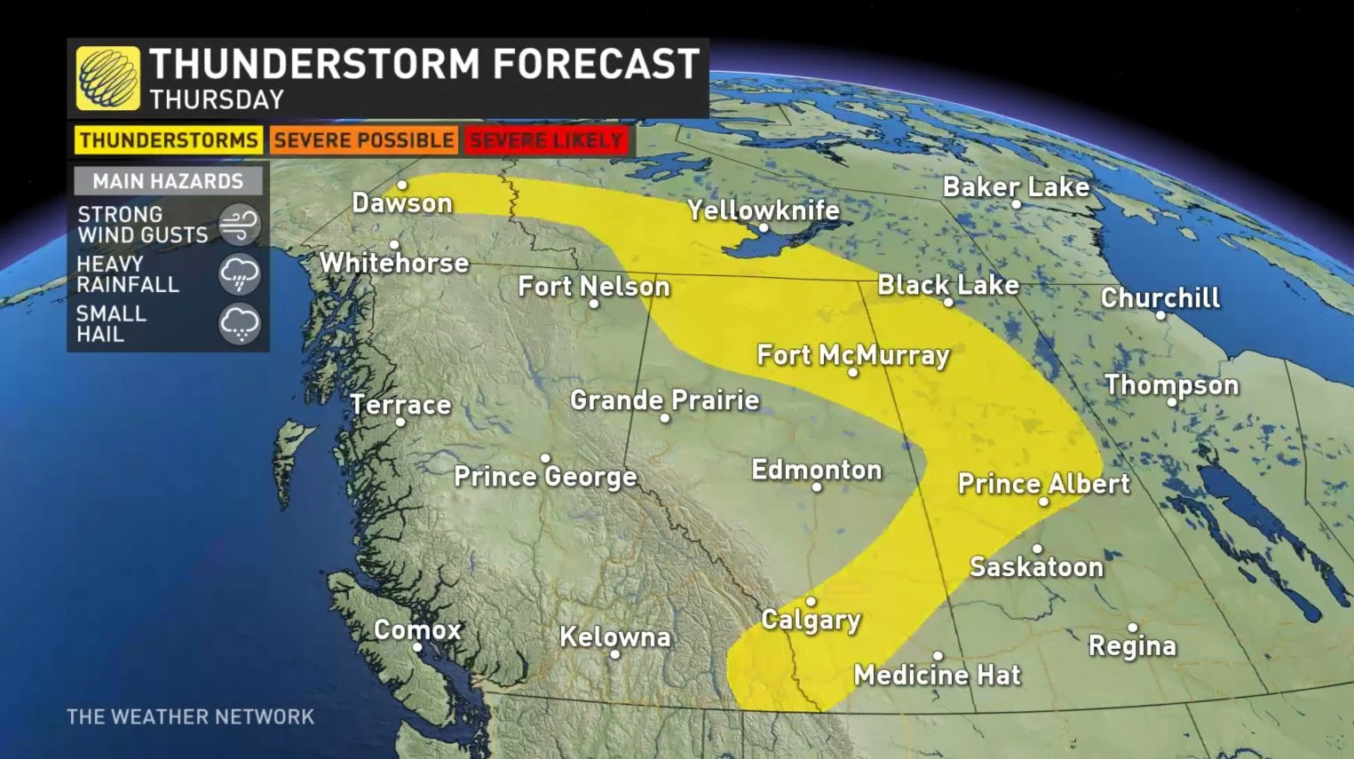
Thunderstorms are possible for parts of Alberta and central Saskatchewan on Thursday and Friday, with the potential for some to be strong or severe.
More widespread rain and thunderstorms are anticipated for parts of the region this weekend as a system develops over Alberta and tracks east.
South of the widespread rain, there is the potential risk for thunderstorms, some could be strong or severe in nature, but overall the southern Prairies will become very dry again. But forecasters are watching the potential for a more stormy pattern for next week.
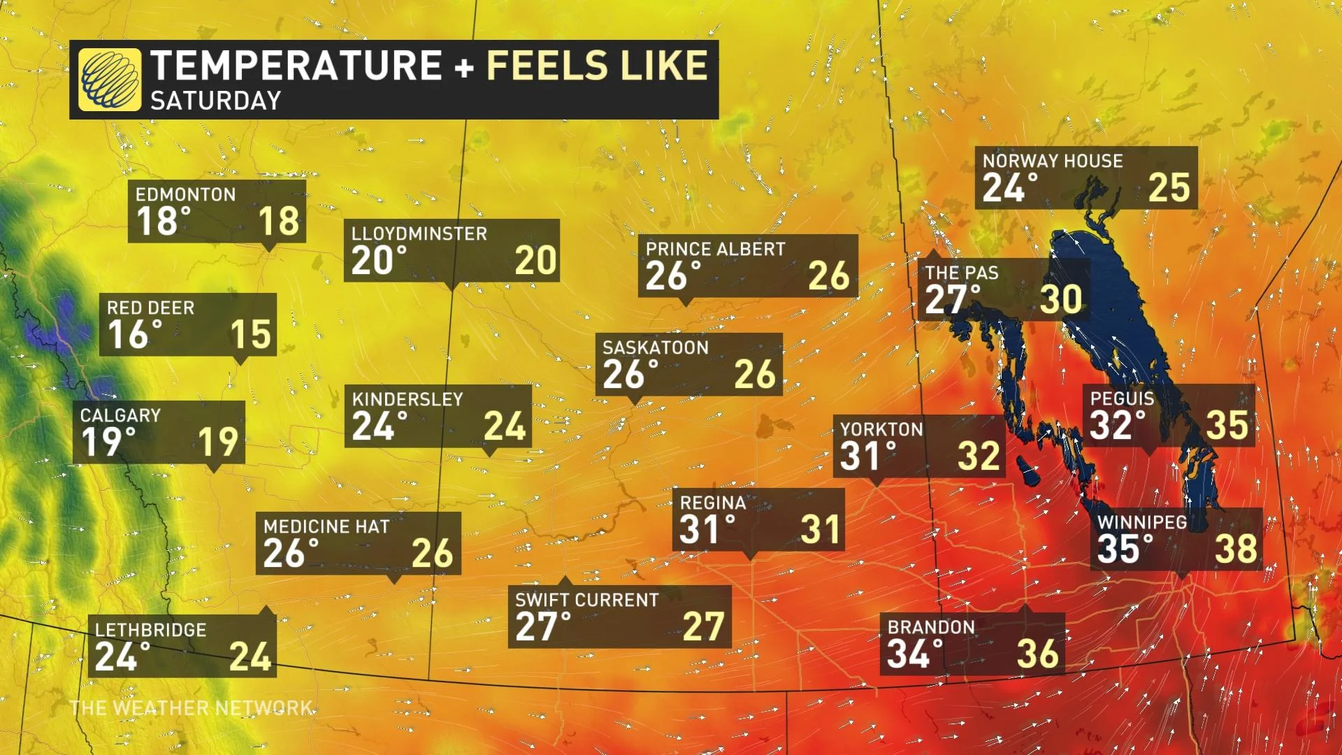
The hot weather will continue across southern Manitoba and into southern Saskatchewan at times through the middle of next week, but will be much cooler for western parts of the region by the weekend and early next week.
LITTLE RELIEF FOR DROUGHT CONDITIONS AS MOST OF THE WEEK REMAINS DRY
While there was some beneficial rain last month -- helping to push some drought-stricken areas out of "severe" territory -- some areas in southern Manitoba still remain very dry.

Parts of southern Alberta remain in a moderate drought, which will likely worsen this week with the rising temperatures and lack of widespread rain.
The upper ridge in place will deter any systems from moving into the region, which could become a growing concern once again, with some regions already in desperate need of some rain.
Stay tuned to The Weather Network for the latest forecast updates for the Prairies.