
Travel remains tricky in Quebec as worst of the snowstorm pushes east

Though the worst of the snowstorm is over for western Quebec including Montreal, areas east of Quebec City still have to contend with another 5-20 cm of snowfall Sunday, depending on location. The Gaspé Peninsula is in store for 10-20 cm of additional snow, adding to its hefty totals from Saturday. Flurries will linger for areas near the St. Lawrence River Sunday morning, while the snow in eastern areas will continue through the afternoon before tapering off. Once the system fully departs, there will be quite the chill in the air for early next week. Pools of Arctic air will send temperatures plummeting Monday morning and beyond. For what's left to come, see below.
WEATHER HIGHLIGHTS:
Flurries in western Quebec Sunday morning, snow continues through the afternoon in far eastern areas
Additional 10-20 cm of snow for Gaspé Peninsula Sunday, travel remains hazardous
Colder weather returns for much of Quebec next week
SUNDAY: HEAVY SNOW PUSHES EAST, DIFFICULT TRAVEL CONTINUES
The potent winter storm that left its mark on eastern Ontario and Quebec, with more than 20 cm of snow in some areas, continues its march east Sunday, with the heaviest snowfall remaining in extreme eastern sections of the latter.
While only flurries linger in western Quebec Sunday morning, snow will continue in the far eastern areas through the afternoon, including the Gaspé Peninsula, tapering off in the evening hours. Snowfall and winter storm warnings remain in place east of Quebec City, including the Laurentians.
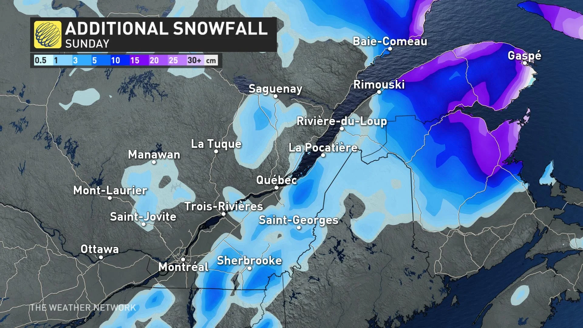
An additional 10-20 cm of snowfall is possible in the Gaspé Peninsula, on top of what has already fallen, so travel conditions will remain difficult through the day due to blowing snow, as well.
"Rapidly accumulating snow could make travel difficult over some locations. Visibility will be suddenly reduced to near zero at times in heavy snow and blowing snow," Environment Canada says in the winter storm warning.
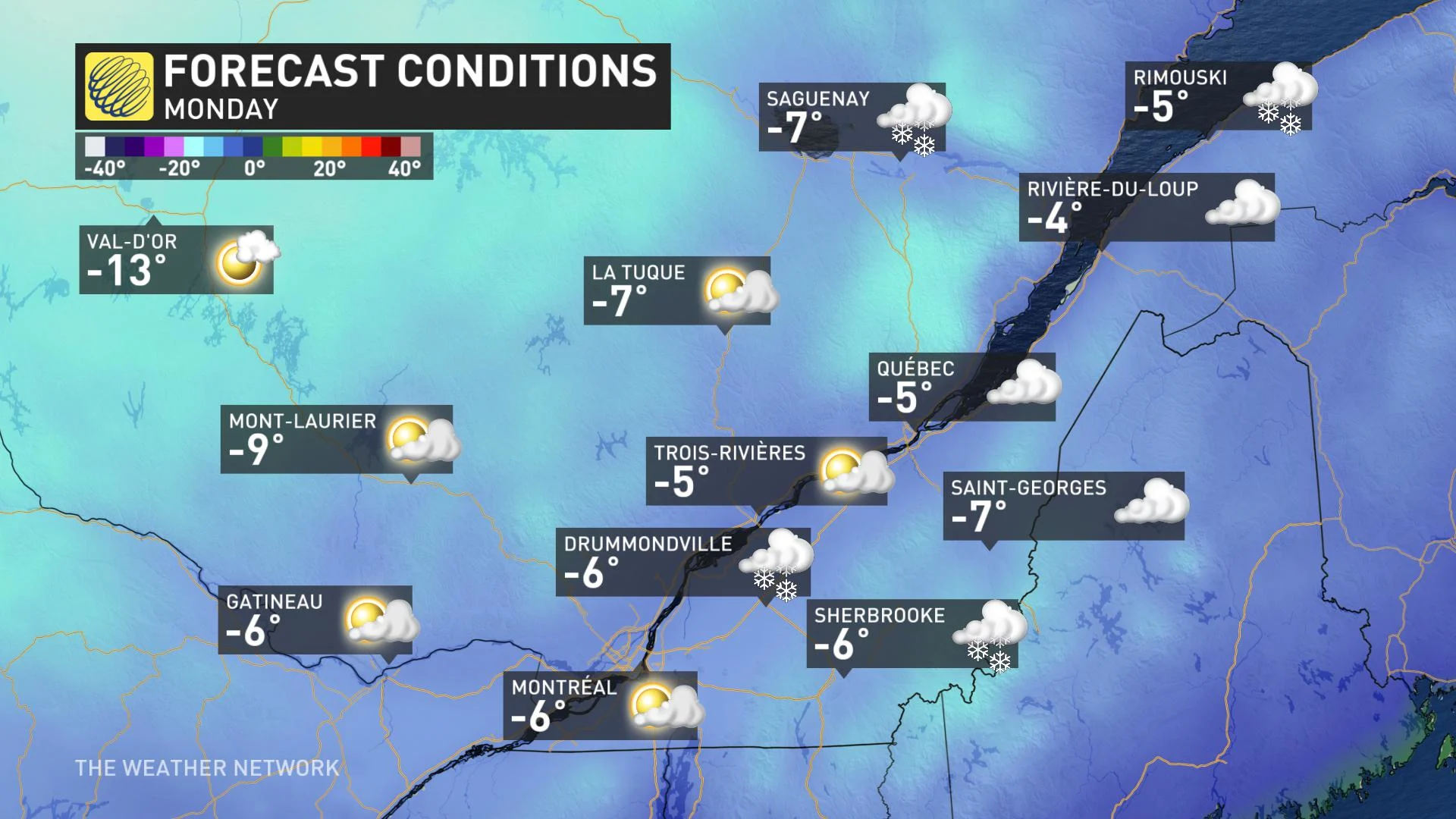
BEYOND: COLDER TEMPERATURES RETURN AT LAST
Hot on the heels of this potent winter storm will be an end to above-seasonal temperatures for Quebec, falling several degrees below seasonal by early next week. Thanks to the first shot of Arctic air Monday morning, and by Wednesday, daytime highs for most places will struggle to rise above -10°C, feeling a few degrees colder with the wind chill.
The next chance of snow comes from a fast-moving clipper moving through the Great Lakes region, though it's unclear what effects it will have on Quebec.
Thumbnail courtesy of Marx Córdova in Île-Perrot, Que.