Vancouver's Chinook: Meet the Bora

Calgary, want to trade your warm Chinook for a west coast bora?
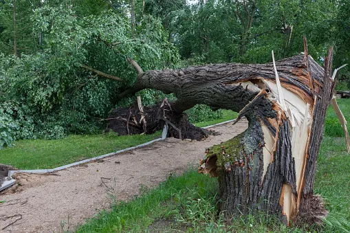
This Wednesday a damaging wind event pushed across isolated sections of the Lower Mainland – some barely noticing more than a breeze, while other sections saw significant damage.
What happened?
A couple of factors are at play, let's first start large scale.
The pressure gradient, a force where air with different pressures exists in proximity, is a large scale driver of winds. Cold air is less dense, and that's exactly what was going on in the Interior of British Columbia. Cold, dense air accelerated towards the Lower Mainland like a freight train.
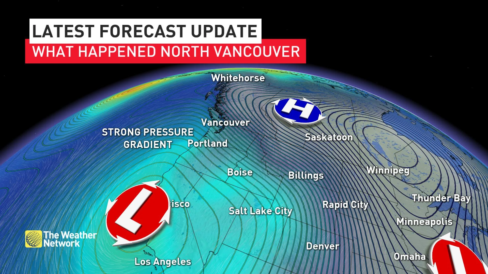
The cold air mass was significantly deep and spilled over the tops of some of the local topographic features in North Vancouver.
Meet, the Bora.
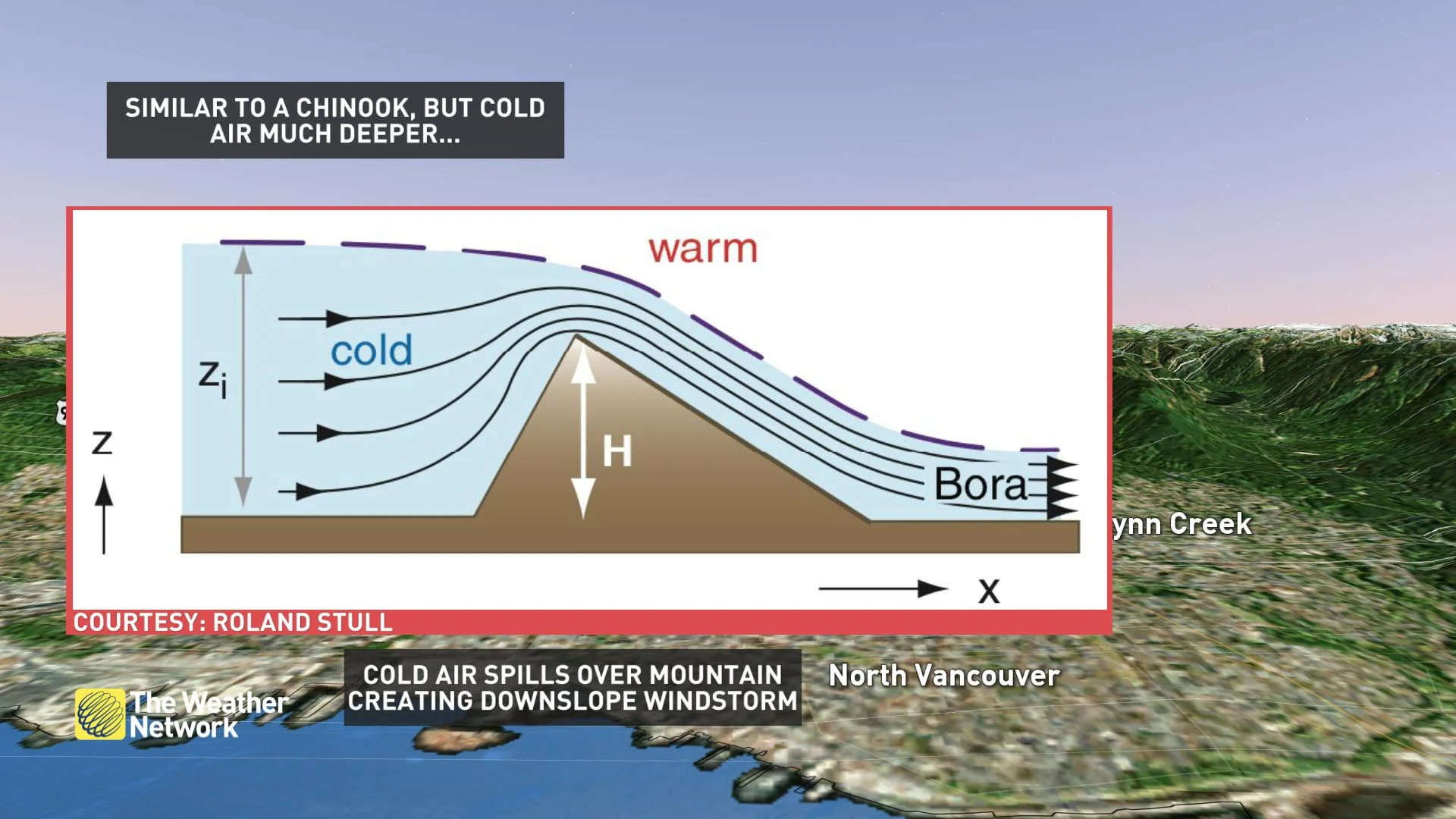
No, it's not as warm (or as famous) as The Chinook, the warm dry wind that descends the Rockies. This cold wind means business, and as the air is forced to descend, it compresses and accelerates downward reaching speeds over 90 km/h.
This gets a little technical, but using a weather sounding, a type of weather balloon that samples the atmosphere, revealed the cooler, denser air above an inversion, a layer of warmer air. This is a big clue to a probable bora event.
You also look for wind flow bisecting the terrain, along with the aforementioned warm air aloft.
This bora hypothesis likely explained the localized nature of the wind event and probably isn't as rare as we think.
Calgary, want to trade your warm Chinook for a west coast bora?
Probably not, but we'll understand.


