Canada takes the weekend off in a time notorious for strong storms

We don't typically see a quiet nation-wide pattern like this in November, so be sure to take advantage of the last weekend of the month, before the official start to winter takes hold later in December.
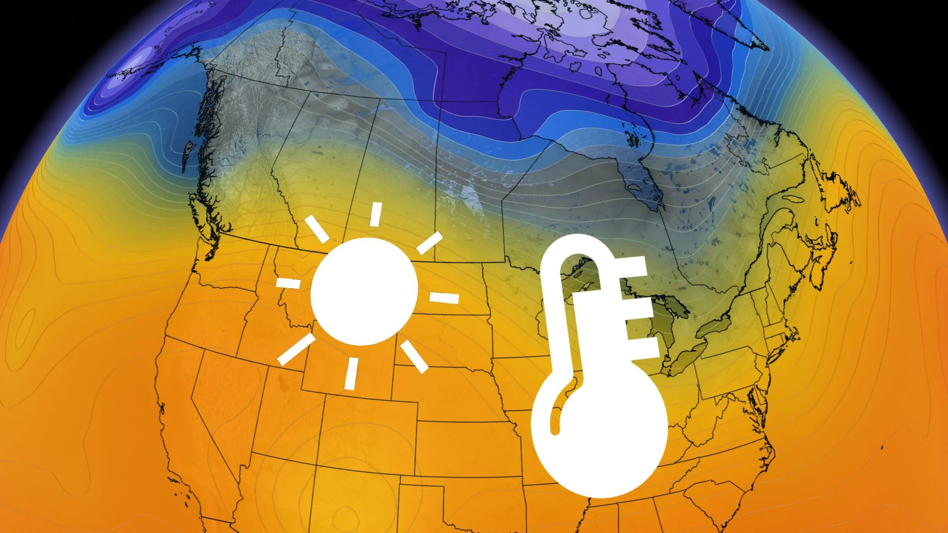
In a time of year that's notorious for strong and impactful fall storms, much of the country will take a huge weather breather, allowing for a few days of relatively quiet and milder conditions right across the board.
It all aligns nicely with the weekend as well, in fact, the last one of November this year.
WINTER FORECAST: On Monday, November 30 The Weather Network releases the official 2020/21 Winter Forecast. Tune in!
From damaging winds to heavy rain, dangerous blizzard conditions, frigid wind chills and huge piles of snow -- basically every part of Canada has had their fair share of potent, and even record-breaking, fall weather already.
We'll put a pause on all of that this weekend however, as the weather just stays...quiet!
"It isn't all that unusual for the pattern to take a breather for a few days after a period of active weather, but the lack of arctic air and sub-freezing temperatures are a little more remarkable for this time of year," says Weather Network meteorologist Dr. Doug Gillham.
PRAIRIES TAKE THE CAKE FOR EXTENDED WARMTH
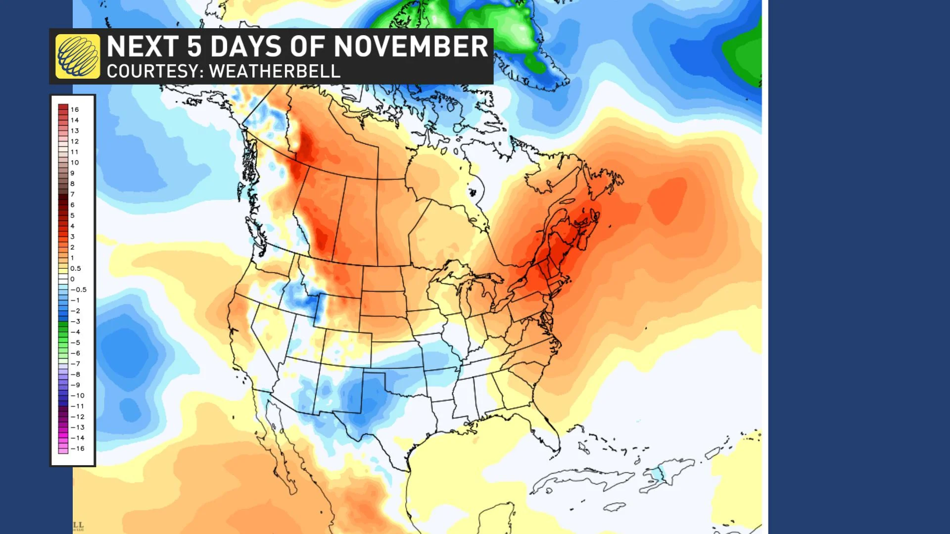
Aside from some quick shots of near normal temperatures, the Prairies in particular will have quite an extended stretch -- beyond the weekend -- of above normal temperatures. But remember, normal temperatures have dropped so much over the past month, that it may not feel as dramatic as it really is compared to what the normals are.
Temperatures could end up being 10-20 degrees above seasonal for some places.
"For the first week of December, places like Edmonton will be much warmer than they were for extended periods during the second half of October even," Gillham says, adding that the above seasonal temperatures are expected to continue well into the second week of December also.
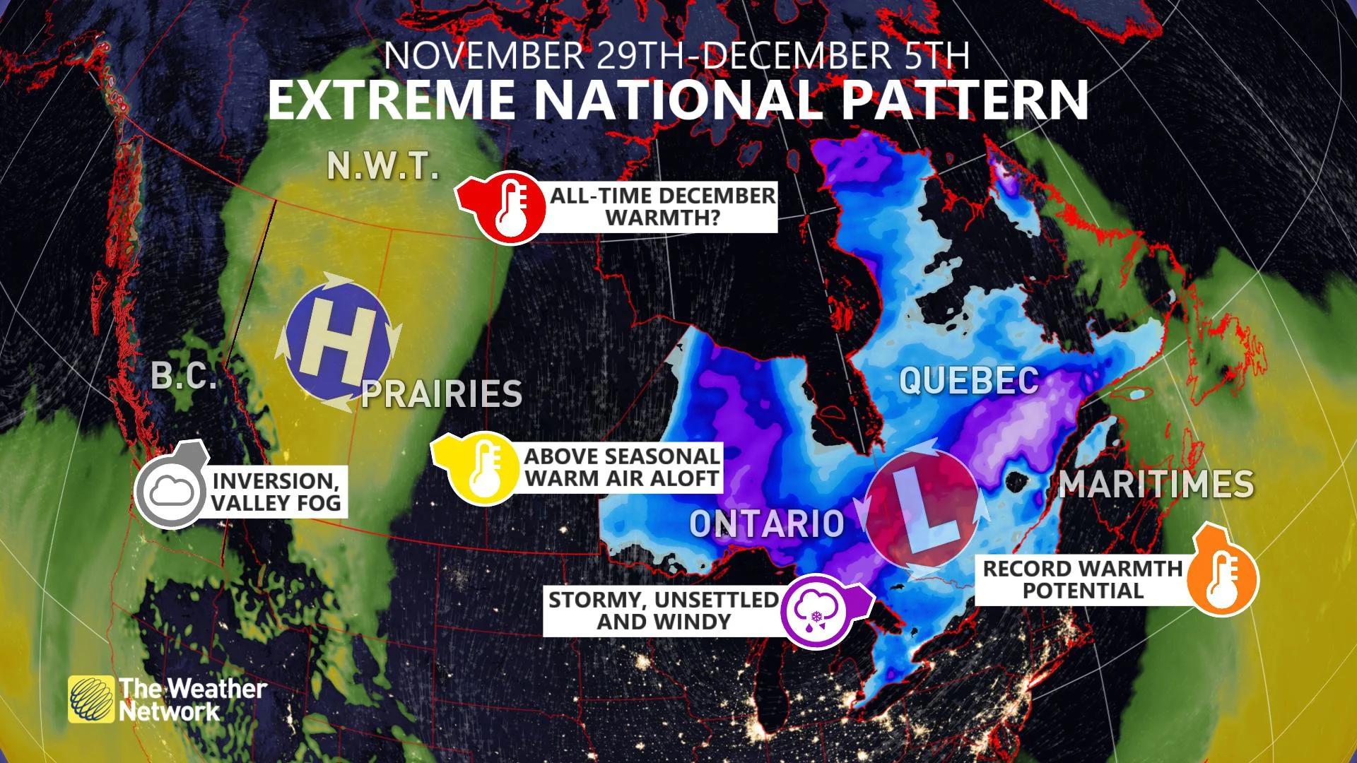
The very mild pattern will extend into the Northwest Territories and Nunavut as well, with warm temperature records likely as we look ahead to December.
PARTS OF B.C. NOT INCLUDED (SORRY!)
The one exception from this calmer weekend shaping up will be northern British Columbia, which remains "very wet and very white." Not all bad for the ski resorts that are reveling in the alpine snow.
But for the overwhelming majority of the population, the pattern will also turn unusually quiet.
November is typically the wettest month of the year for the South Coast, but after Friday, a stretch of dry weather is coming, starting this weekend and continuing well into next week.
SOUTHERN ONTARIO AND QUEBEC, ENJOY IT WHILE YOU CAN
For much of southern Ontario and Quebec, the brief weather breather will be just that -- brief.
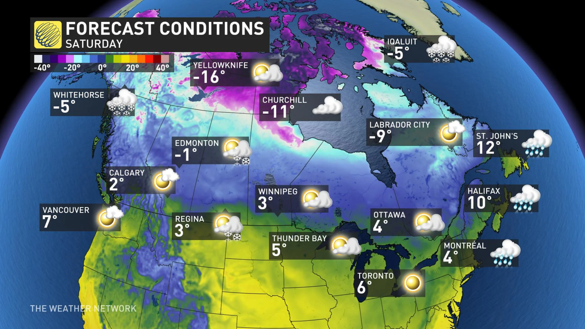
Sunday in particular however, looks like a gorgeous late fall day as abundant sunshine and well above seasonal temperatures span the region. Parts of southern and eastern Ontario, near the St. Lawrence, could see daytime highs climb into the double digits.
By Monday however, a very unsettled pattern develops amid a highly amplified jet stream that develops over the eastern U.S. While the exact storm track and impacts are uncertain at this time, areas of low pressure have the potential to bring heavy rain and a band of heavy, wet snow through the middle of next week. Heavy snow is also likely for parts of western Quebec.
"We should see a couple of days of colder, near seasonal weather, as we start the month of December, and we're also watching for signs to transition into a more consistent and typical early winter pattern as we head into the second week of December," Gillham says.
EAST COAST BREAKS OUT OF THE WHOPPING 70+ CM OF SNOW
And finally, across much of Atlantic Canada, the rain and heavy snow will ease for the weekend, allowing for a well deserved break from some of the recent record-setting storms.
Saturday offers a very mild day across Newfoundland, with widespread double-digit daytime highs expected. There will be a brief shot of cooler weather for the Maritimes into Sunday, but those temperatures will reach the low to mid-teens for the middle of next week and first couple of days of December.
It's not often when we see a quiet pattern like this nation-wide, so be sure to take advantage of the much calmer end to November before the official start to the winter season begins next month.
Be sure to also check back on Monday, November 30 as we release the 2020/21 Winter Forecast.