
Under pressure: Canadian high pressure pushes the envelope

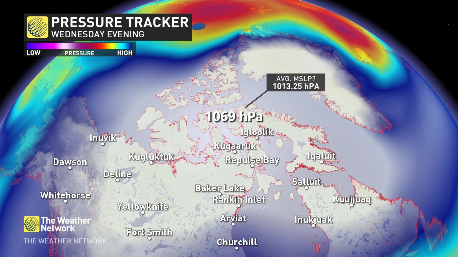
By late-Wednesday, a massive region of high pressure is forecast to encompass all of Canada's northern territories.
A high-pressure system soars to new heights.
Low-pressure systems often get the most attention as they correlate to adverse weather. A potent high-pressure system is expected to intensify in Northern Canada. By late-Wednesday, a massive region of high pressure is forecast to encompass all Canada's northern territories.
The core of the sinking air mass is situated just north of Hudson Bay and will provide robust high pressure to the Yukon, Northwest Territories and Nunavut...at the same time.
ATMOSPHERIC PRESSURE BASICS
The average mean sea-level pressure is 1013.25 hPa. This has been standardized by calculating the mean sea-level pressure, to account for pressure differences across varying elevations.
But first, what the heck is atmospheric pressure? It's simply the pressure applied by the weight of the entire atmospheric column of air above a given point.
THE FORECAST
This high-pressure system is expected to soar to a pressure of 1068 hPa by Wednesday evening, but is that a Canadian record? Not exactly, but potentially for the region. The highest pressure measured in North America goes to Dawson City, Yukon on Feb. 2, 1989 with an eye-popping reading of 1079.6 hPa.
How unusual is this case? According to WeatherBell Analytics, it's between 4-5 standard deviations outside of normal climatology.
Moreover, the most unique aspect is the specific location this high-pressure system is developing in, which is most atypical.
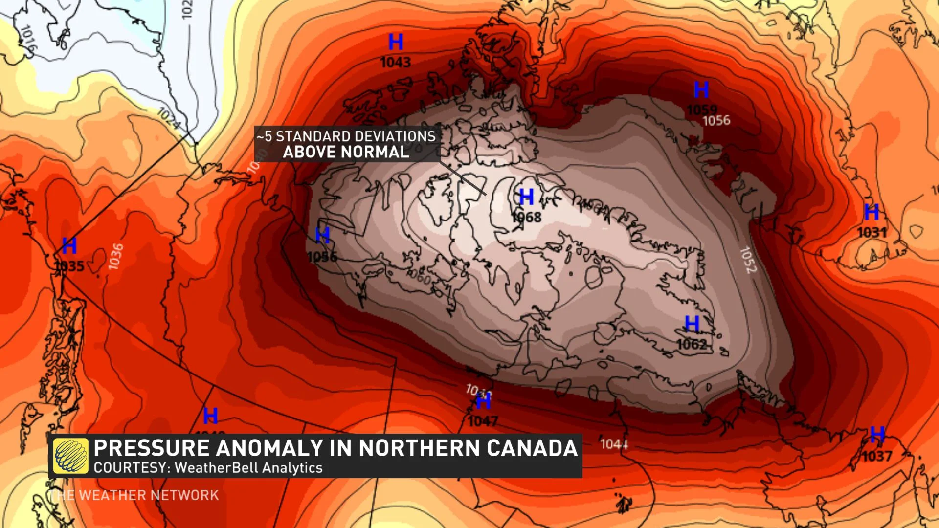
Historically, the strongest highs in Canada develop over the Yukon.
RAPID ANTICYCLOGENESIS?
You might have heard the term 'bomb cyclone' or bombogenesis, the rapid intensification of a low-pressure system.
The academic literature in the past has hinted at a value greater than 5 hPa in 24 hours would suffice to meet the definition for a rapid increase in high pressure.
What is this high-pressure system set to increase at? Approximately, 15 hPa increase in 24 hours is possible from Tuesday evening to Wednesday evening.
ATMOSPHERIC GRIDLOCK
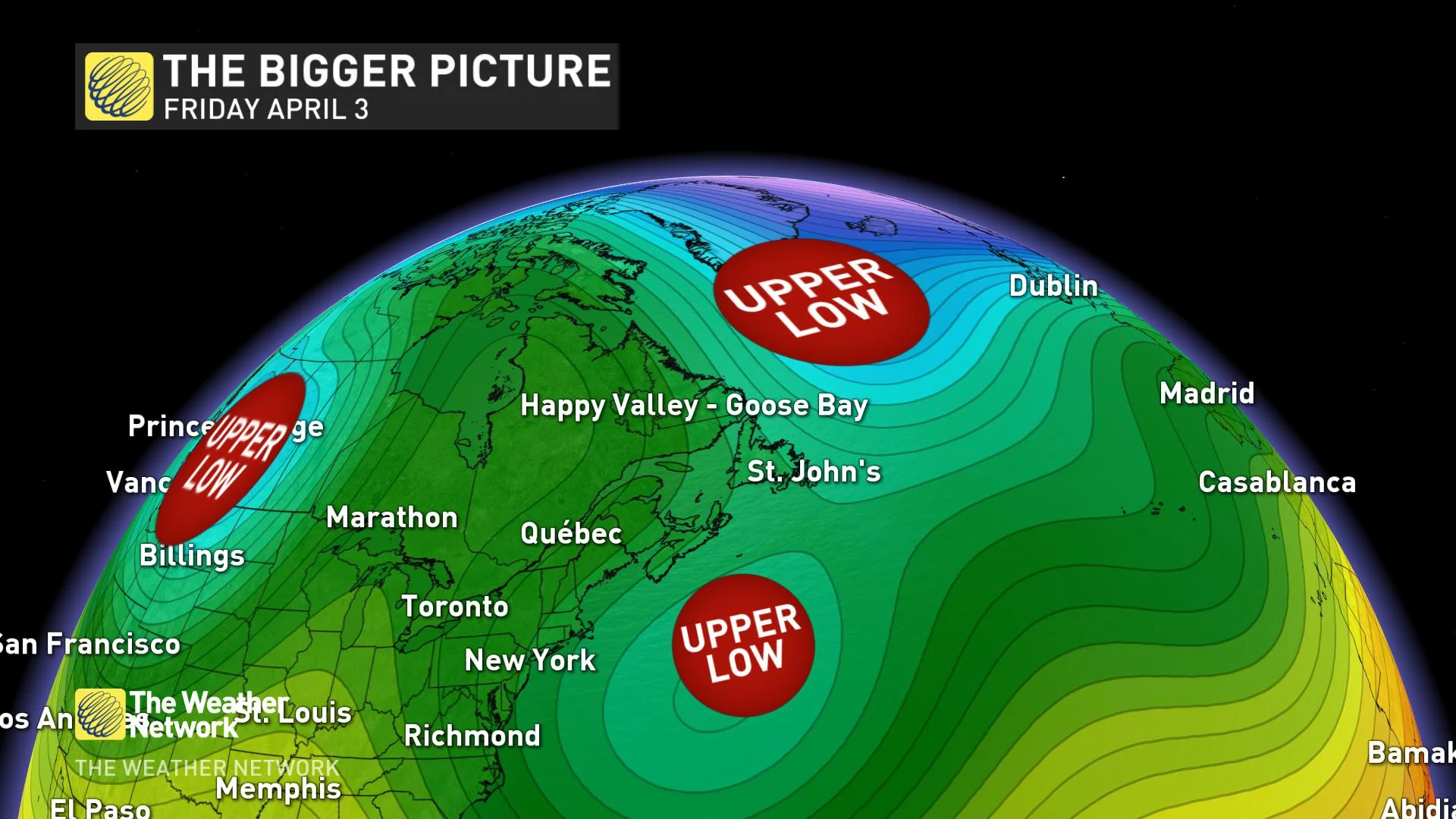
The bigger picture.
Recently, atmospheric-blocking, large-scale patterns that are nearly stationary have developed across parts of North America. It's something we haven't seen with regularity in recent months.
The blocking pattern is moving west as we approach the weekend, with an upper trough anchored on either side of North America, creating a bit of an atmospheric traffic-jam.