Travel not recommended as heavy snow blasts southern Alberta

Snowfall and winter storm warnings line southern Alberta, with drivers being urged to avoid any non-essential travel through Tuesday morning.
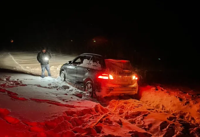
Heavy snow picked up during the overnight hours on Monday, with over 20 cm already reported in the Calgary area before dawn on Tuesday. This has made travel treacherous across the region.
"Be prepared to adjust your driving with changing road conditions," says Environment and Climate Change Canada (ECCC) in the snowfall warning. "Visibility may be suddenly reduced at times in heavy snow. Surfaces such as highways, roads, walkways and parking lots may become difficult to navigate due to accumulating snow."
If traveling, drivers are also being urged to plan ahead and to keep others informed of their travel plans, as well as carry an emergency kit and mobile phone with them at all times.
A potent Arctic front slicing across eastern British Columbia and western Alberta will continue to bring upsloping snow to the regions into Tuesday. The low-pressure system has plenty of cold air and Pacific moisture to work with, which is a contributing factor in higher snowfall totals.
The heavier snowfall rates will linger through Tuesday morning, becoming lighter in the afternoon and evening. The snow will be light and fluffy because of the Arctic air, so totals could end up being higher than expected.
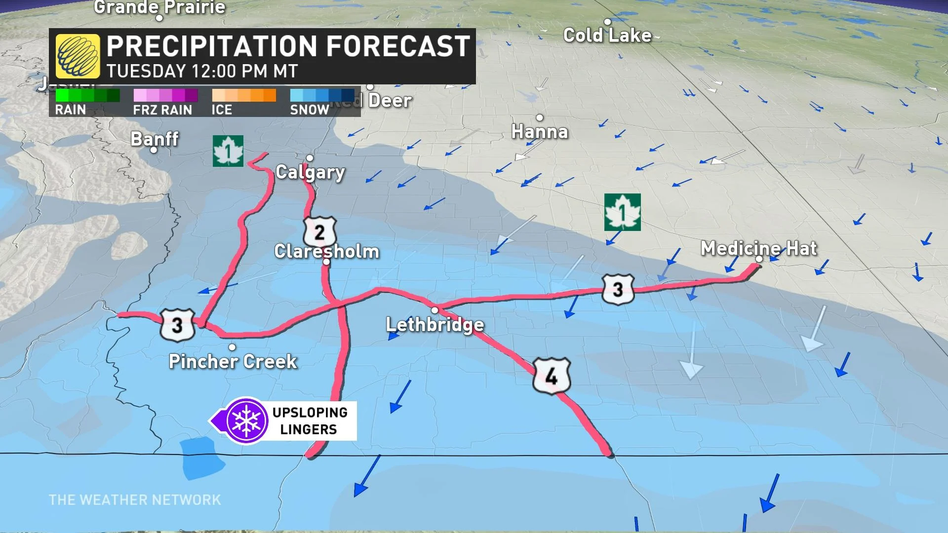
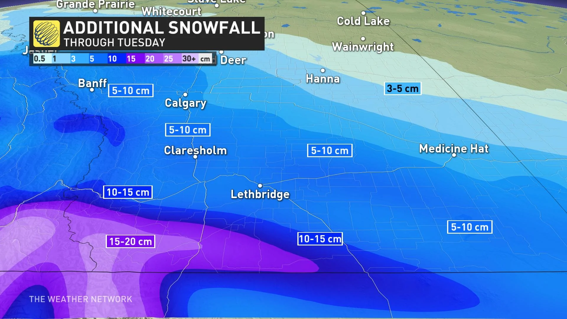
Snowfall totals will be significant across the western half of Alberta, stretching from just south of Grande Prairie to the southern border, and reaching as far east as Medicine Hat. Total amounts in this swath will range from 10-40 cm, with most of it along the foothills where accumulations could reach as high as 50 cm locally.
The city of Calgary, Hinton, and Lethbridge will be right in the middle, with projections of 20-30 cm for these areas. Much has already fallen, but this region can expect an additional 5-15 cm to fall through Tuesday.
As a result, travel will be greatly impacted throughout the southern portions of Alberta as this push of Arctic air forces its way into the region.
Arctic air to send temperatures diving, wind chills set to return
Across the Prairies as a whole, we’ve seen a series of unusually mild temperatures for more than a month now. This stretch of consistently above-seasonal conditions will come to an end in a hurry as this push of Arctic air crashes southward.
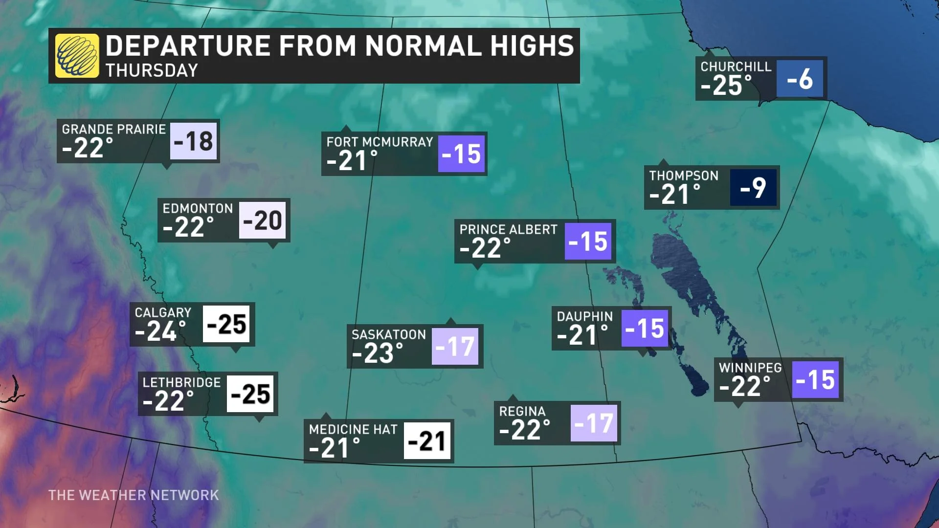
The coldest air associated with the trough will spill across the region on Tuesday and stick around for several days before letting up a bit.
The deep chill pushing into Alberta will keep temperatures in Calgary and Edmonton firmly lodged in the minus double digits, lasting through Saturday morning.
MUST WATCH: So your forecast calls for snow, but which type?
Regina and Saskatoon will see the coldest air arriving on Tuesday. Each city will deal with several days of high temperatures in the -20s, with Saskatoon only predicted to hit -23°C on Wednesday.
Winnipeg will face Wednesday and Thursday with daytime highs only climbing to about -22°C, with overnight lows forecast to reach -30°C multiple times through the week.
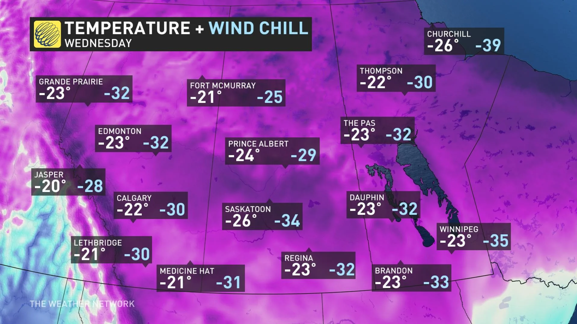
While these certainly aren’t the coldest temperatures we’ve seen, it’s going to feel especially raw given that it’s been so mild on the Prairies in 2023.
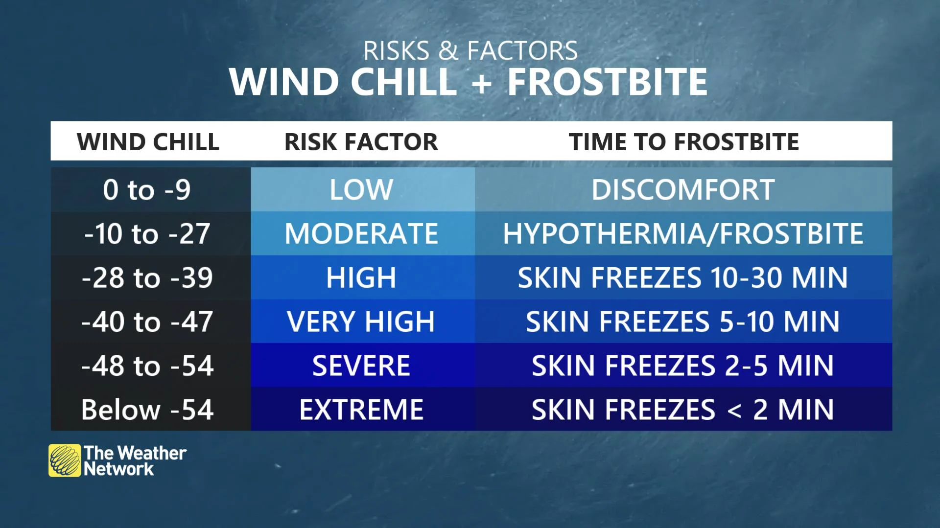
Winds certainly won’t help matters, either. Wind chill values will dip into the -30s and approach -40 for the duration of the coldest air next week, which will increase the risk for frostbite and hypothermia. Exposed skin can develop frostbite in as little as 10 minutes with wind chill values approaching -40.
This spell of cold air isn't scurrying off anytime soon. Below-seasonal temperatures will stick around for much of the Prairies through the end of the month.
Thumbnail courtesy of Braydon Morisseau/Twitter.
Stay with The Weather Network for the latest on conditions across the Prairies.


