Toronto issues extreme cold alert as polar vortex descends

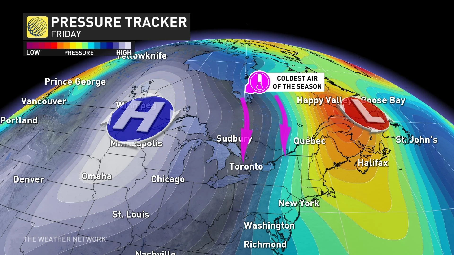
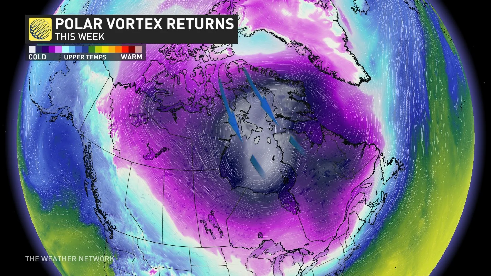
After a prolonged stretch of fairly mild January weather, a potent lobe of the polar vortex is descending, sending temperatures quickly falling across much of Eastern Canada. In fact, this week could bring some of the coldest conditions in years for several major cities.
On Monday morning, the City of Toronto issued an extreme cold weather alert in anticipation of the frigid weather that's about to settle in.
WATCH: How to layer properly as extreme cold targets southern Ontario
MUST SEE: Polar vortex may bring Eastern Canada's coldest temperatures in years
The alerts are declared when the city is forecast to drop to -15°C or colder, or when a wind chill of -20 or below is expected. Temperatures across southern Ontario are expected to be 5-10°C below seasonal for most of this week.
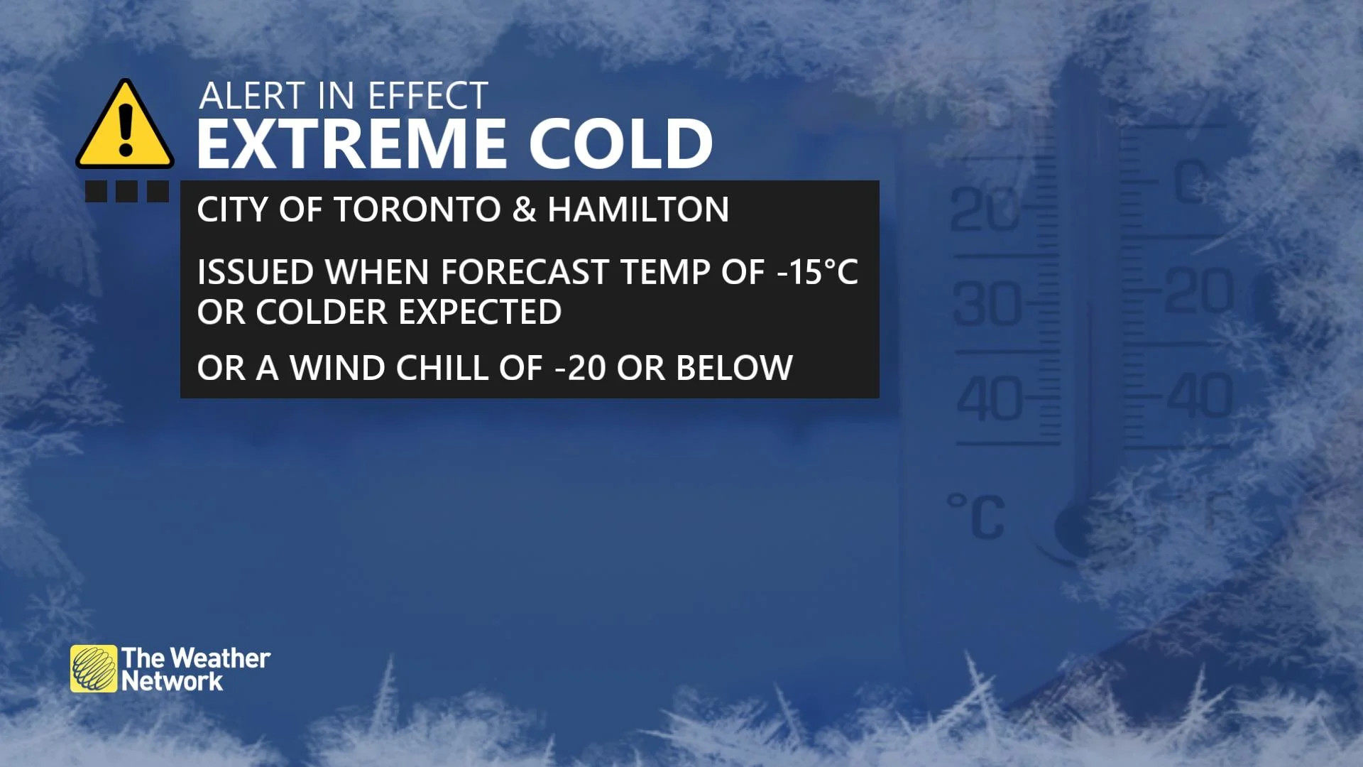
In some cases, however, other factors are considered when these alerts are issued such as "predicted precipitation, a sudden drop in temperatures or consecutive days and nights of colder temperatures."
"Chilly days and nights are exactly what is in the cards this week for the Greater Toronto Area (GTA), thanks to the cold air associated with the polar vortex, which is usually locked in place near the poles," warns Nicole Karkic, a meteorologist at The Weather Network. "This week, the infamous polar vortex will flood south."
You will want to pay particular attention to the wind chill forecast and your overnight lows. In some places, it could be feeling like -20 or colder by the end of the week.
The good news is, though, that by the end of the weekend the extreme cold will relax somewhat. However, rounds of more wintry weather are expected to hang on as we march through the heart of the season in February.