
Pacific low may bring a white Christmas miracle to southern Ontario

A system tracking along a Christmas Eve cold front may be enough to send the flakes flying in southern Ontario later this week.
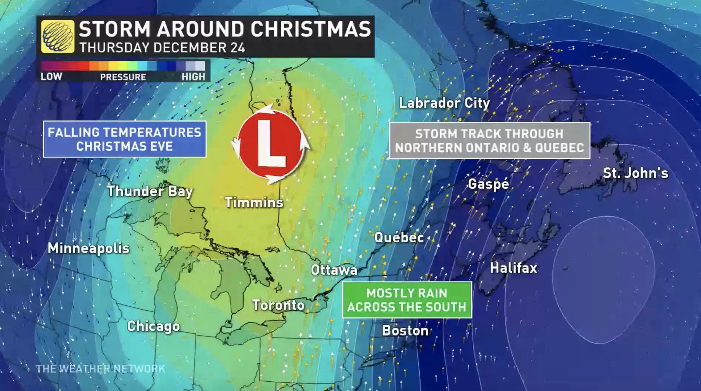
Much of Western Canada is significantly increasing their chances for a White Christmas this week, thanks to a potent Pacific system. Though it will come right down to the wire, parts of southern Ontario still have a shot at some holiday flakes, as well. That's as couple of lows develop and track along a perfectly timed cold front Christmas Eve, making for a buzzer beater finish for the snow on Christmas morning. There is still however, a lot of undertainty regarding the exact timing and lingering moisture, but most of the region can count on at least a dusting of snow, with locally heavier amounts likely. More on what we know so far, and the blustery conditions and lake-effect snow that could impact Christmas day travel, below.
WEATHER HIGHLIGHTS:
Low to bring in rain or snow Christmas Eve/Day, depending on location
Rain moves in Wednesday night, becomes widespread during the day on Christmas Eve
Precipitation switches to snow on Christmas Day, but timing, accumulations still uncertain
Visit our Complete Guide to Winter 2021 for an in depth look at the Winter Forecast, Canada's ski season, and tips to plan for everything ahead!
WEDNESDAY NIGHT TO FRIDAY: CLOSELY WATCHING THE WHITE CHRISTMAS POTENTIAL WITH LOOMING STORM SYSTEM
With just days left until Christmas now, whether it will be a green or white holiday will come right down to the wire in southern Ontario. The definition of a white Christmas means having at least two centimetres of snow on the ground by 7 a.m. that morning.
A Pacific low tracking through Western Canada Tuesday and Wednesday will be boosted by a deep upper trough as it moves into the Great Lakes region for Christmas Eve and Day.
Wednesday night will see warmer air and rain pushing into the northern and eastern shores of Georgian Bay and southwestern Ontario. Widespread rain will then trek across southern and eastern Ontario by Thursday morning and afternoon.
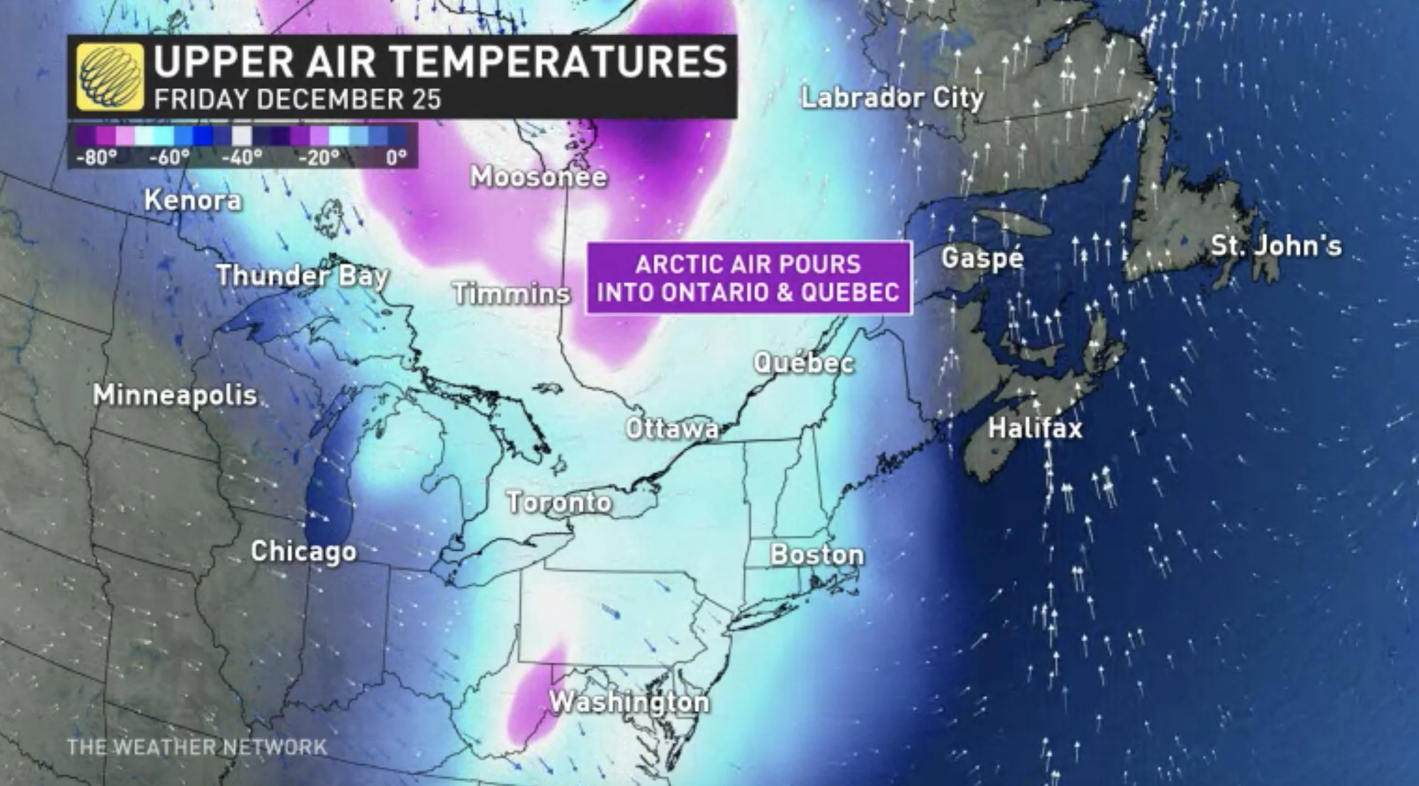
Thursday evening will see the rain switching over to snow across central and southwestern Ontario, including the GTA as a strong cold front crosses the region. Rain looks to continue in eastern areas.
"A couple of lows will develop and track along the cold front and bring the potential for a buzzer beater, photo finish, for a White Christmas," says Weather Network meteorologist Dr. Doug Gillham. "There is still a lot of uncertainty regarding the exact timing of the cold front and the amount of lingering moisture after temperatures fall below freezing, but most of the region should see a dusting to a coating with locally higher amounts."
It's still too early to determine exactly where the heaviest snow will fall.
Dreaming of a snowy festive season? Click here to find out if your holiday wishes will come true!
BLUSTERY CONDITIONS, LAKE-EFFECT SNOW COULD IMPACT TRAVEL CHRISTMAS DAY
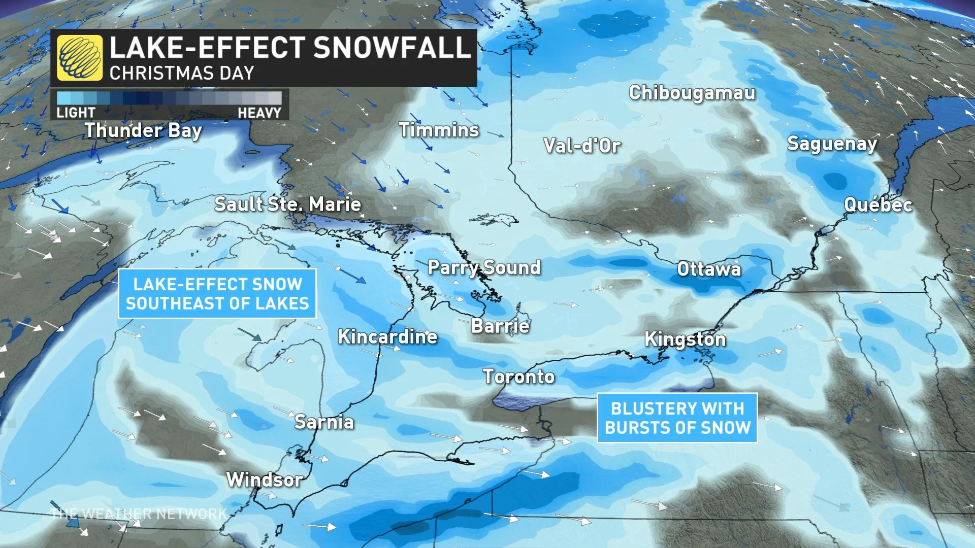
Christmas Day will be blustery and much colder with flurries and lake-effect snow squalls expected to impact travel through the traditional snow belts. Bursts of heavier snow could also extend into parts of the GTA during Christmas Day.
"It will be cold for Boxing Day with bands of lake-effect snow continuing southeast of Georgian Bay and Lake Huron," says Gillham. "By Sunday we'll see the fair and seasonal conditions return, but we're also watching the potential for widespread snow early next week across southern Ontario and into southern Quebec."
Check back as we continue the monitor the forecast for a potential white Christmas in the coming days.