Thunderstorms push through eastern Ontario, Quebec, chance for rotating storms

Thunderstorms prompted warnings across southern Quebec Tuesday, with watches in place that extend into eastern Ontario, too. The main threats will be hail and heavy rain, with a slight chance for some rotating storms.
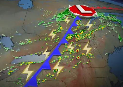
The cold front that started the week with some severe weather across parts of Ontario and Quebec continues to roll through the provinces Tuesday. That front is what will continue to be the trigger for scattered storms, some which have turned severe Tuesday afternoon. Daytime heating will also help the instability build, with most of the storm risk looking to stay across eastern cottage country and towards the Ontario, Quebec border. Strong winds, heavy rain and large hail are the primary threats with storms that develop, but there's also a slight chance of rotating storms that can produce tornadoes. You'll want to stay up-to-date on any of the weather watches and warnings that are issued in your area. More on the timing and impacts, below.
MUST SEE: How hail – of all shapes and sizes – forms, falls from sky
Tuesday: Thunderstorm threat slides east, risk for severe conditions over quebec
Southern Ontario will be given a bit of a break from the recent unstable weather that swept through the region through the overnight hours on Monday.
As the day has progressed, daytime heating has built instability across parts of eastern Ontario and southern Quebec through the Eastern Townships. With the cold front slicing through this unstable air mass, thunderstorms have begun to fire up in the aforementioned regions. Severe storms have prompted warnings in parts of southern Quebec, having the potential to generate strong wind gusts, up to nickel size hail and heavy rain.
Earlier Tuesday afternoon, a thunderstorm went through the Ottawa areas, bringing strong winds and heavy rain. As a result, there were reported power outages near the airport.
While an isolated storm or two may develop across southern Ontario or the Greater Toronto Area (GTA), the main focus for storms will be farther east. Isolated to scattered thunderstorms are forecast for eastern cottage country and towards the Ontario-Quebec border.
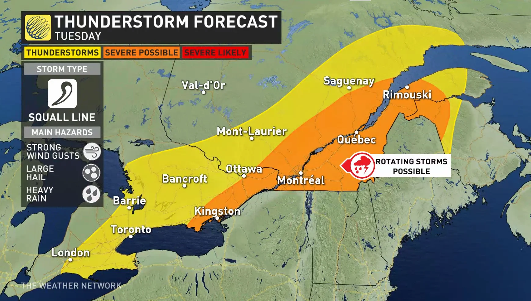
The greater threat for more widespread storms will be across Quebec through the afternoon into the evening.
There is a threat for strong wind gusts, heavy rain, and large hail; in most potent storms nickle to toonie sized hail is possible. The Eastern Townships should be on the lookout with the chance of rotating storms to develop. The risk of localized tornadoes is very low, but not zero.
Heavy rains soak Quebec yard as active weather moves through
Wednesday and beyond: Possible scattered storms and sun
A secondary front is expected to move through the region beginning on Wednesday afternoon.

The front will bring a low risk of scattered storms for Ontario and move on with the same low risk for southern Quebec on Thursday.
Both provinces can expect a return to a quiet and near seasonable pattern, with temperatures just below seasonal for the end of the week. The heat however, will build into the weekend with the possibility of temperatures in the mid thirties next week.

Watch below: Viral video of ominous 'tube-like' cloud explained
Stay tuned to The Weather Network for the latest forecast across Ontario.