Sporadic thunderstorm threat brings little relief to the dry Prairies

The threat of thunderstorms lingers in parts of the southern Prairies Saturday, but most areas won't see any significant rainfall -- with a lack of moisture and forthcoming summer-like heat expected to worsen the existing dry conditions.
The Prairie region has been well below its average precipitation for several months, and this weekend has offered little relief so far, save for a few showers and non-severe storms to the north Saturday. Sunday looks even drier, with only northwestern Ontario and a slice of Manitoba likely to see much precipitation, and then only scattered. The upside: Temperatures are on the rebound, with summer-like warmth returning next week –– potentially bringing 30-degree daytime highs back to parts of Alberta by Tuesday. Details and timing, below.
SUNDAY: STORM THREAT PUSHES EAST, CONDITIONS IMPROVE IN WEST
Sunday’s thunderstorm risk shifts into northwestern Ontario, where there is potential for stronger thunderstorms to develop closer to the international border. The threat extends west a bit into southeastern Manitoba, as well.
Any storms that pop up in this region in the afternoon and evening hours could bring slightly larger hail and heavy rainfall.
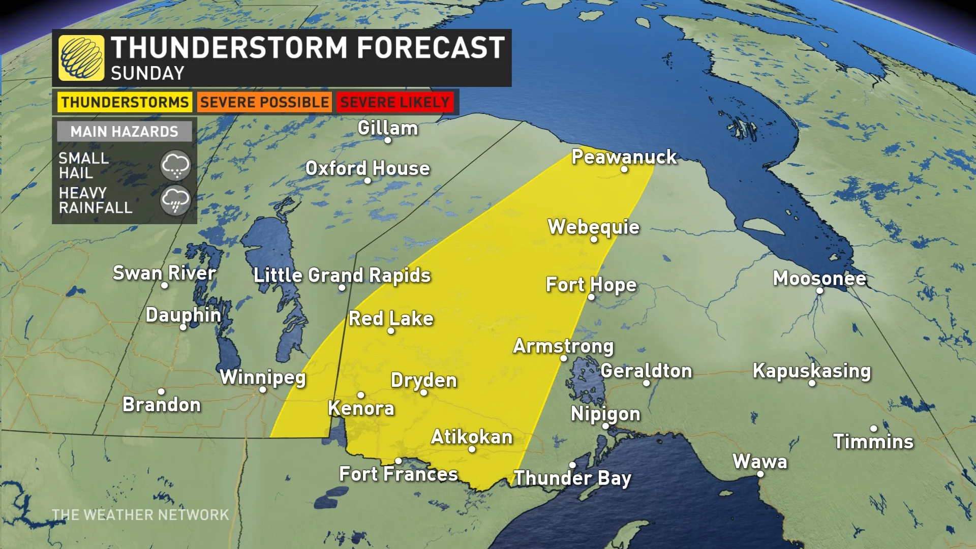
Meanwhile, most of the Prairies will see an improvement over Saturday, with clear skies and temperatures continuing to climb. Daytime highs will be slightly warmer, reaching the low- to mid-20s in southern parts of the region.
LOOK AHEAD: SUMMER-LIKE HEAT, DRY PATTERN RETURNS NEXT WEEK
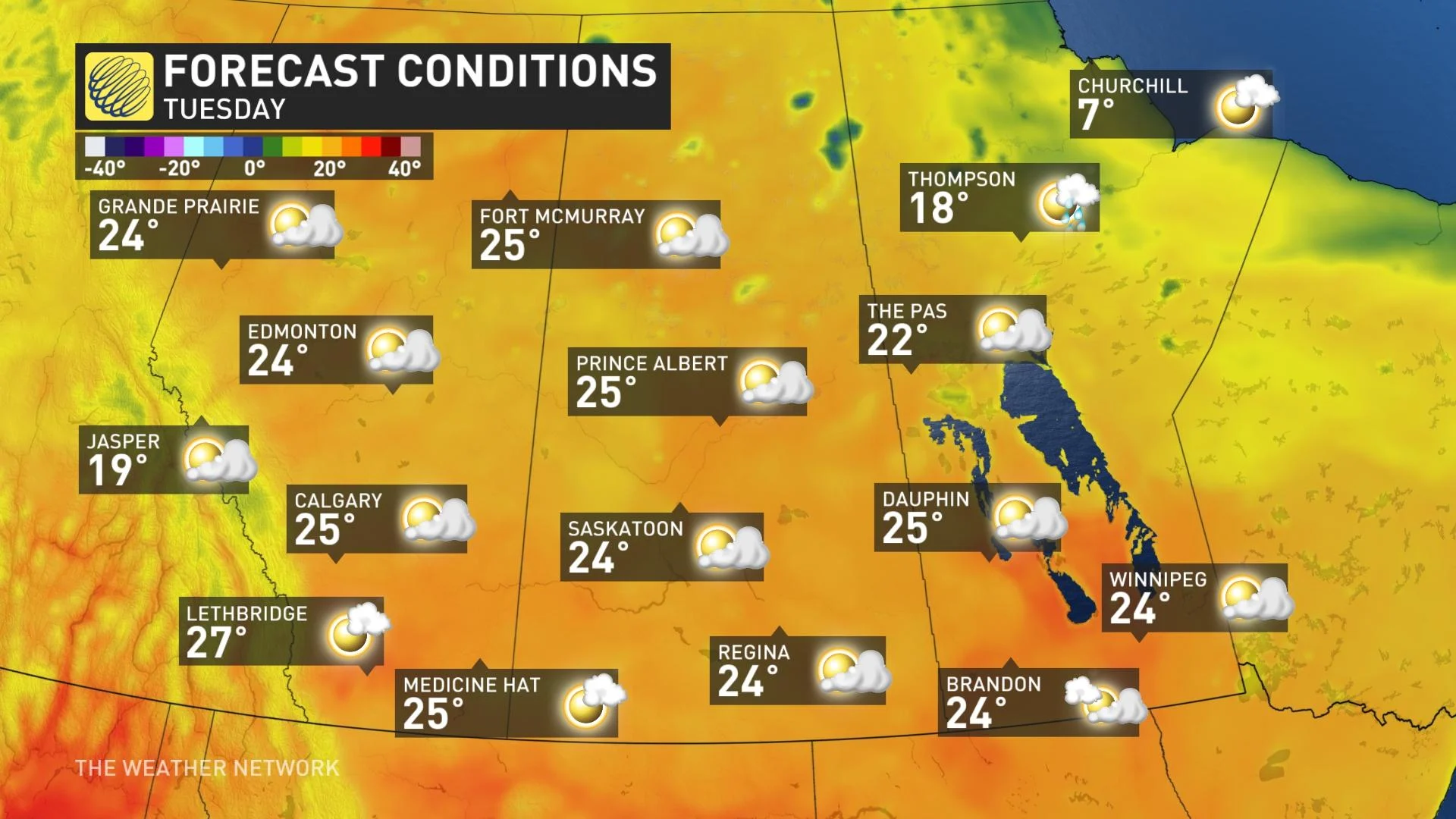
The surge of warmth will push temperatures into the upper 20s for much of the southern Prairies by Tuesday, possibly reaching or exceeding 30°C in southwestern Alberta. By Wednesday, much of southern Alberta will hit or exceed the 30-degree mark, as well as parts of southern Manitoba.
The heat will continue spreading east into southern areas of Saskatchewan and Manitoba by late week.
Accompanying the warm-up will be abundant sunshine, continuing through the middle of the week -- resulting in a dry pattern once more. However, more unsettled conditions will return late week on the weekend, especially for central and northern parts of the Prairies, where significant rainfall is possible. But most of the southern section of the region will see very little rain.
A cooler pattern is expected across the region for next weekend and into the start of the second week of June.
Thumbnail courtesy of NOAA on Unsplash.
Stay tuned to The Weather Network for the latest forecast updates for the Prairies.


