The strongest cyclone of 2022 could soon alter Canada’s weather

A powerful typhoon in the western Pacific Ocean could have big implications for Canada’s weather in about a week and a half.
The world’s most powerful tropical cyclone so far this year could have big implications for Canada’s weather by the middle of September.
DON'T MISS: Canada's monthly outlook: Summer surges into September
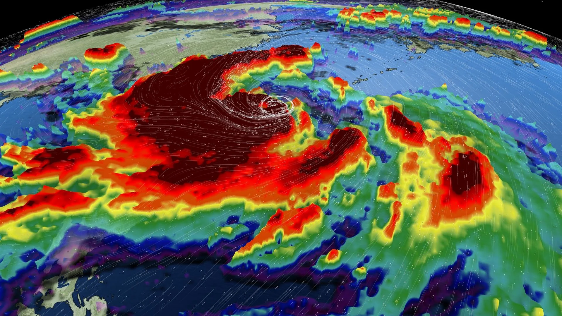
Super Typhoon Hinnamnor grew into a powerhouse of a storm as it churned east of The Philippines this week. The typhoon peaked with the equivalent strength of a category five hurricane before gradually weakening over the past 24 to 36 hours.
Forecasters expect the typhoon to restrengthen as it moves north through this weekend. Hinnamnor could regain much of its strength in the coming days, threatening parts of southern Japan as the equivalent of a category four storm.
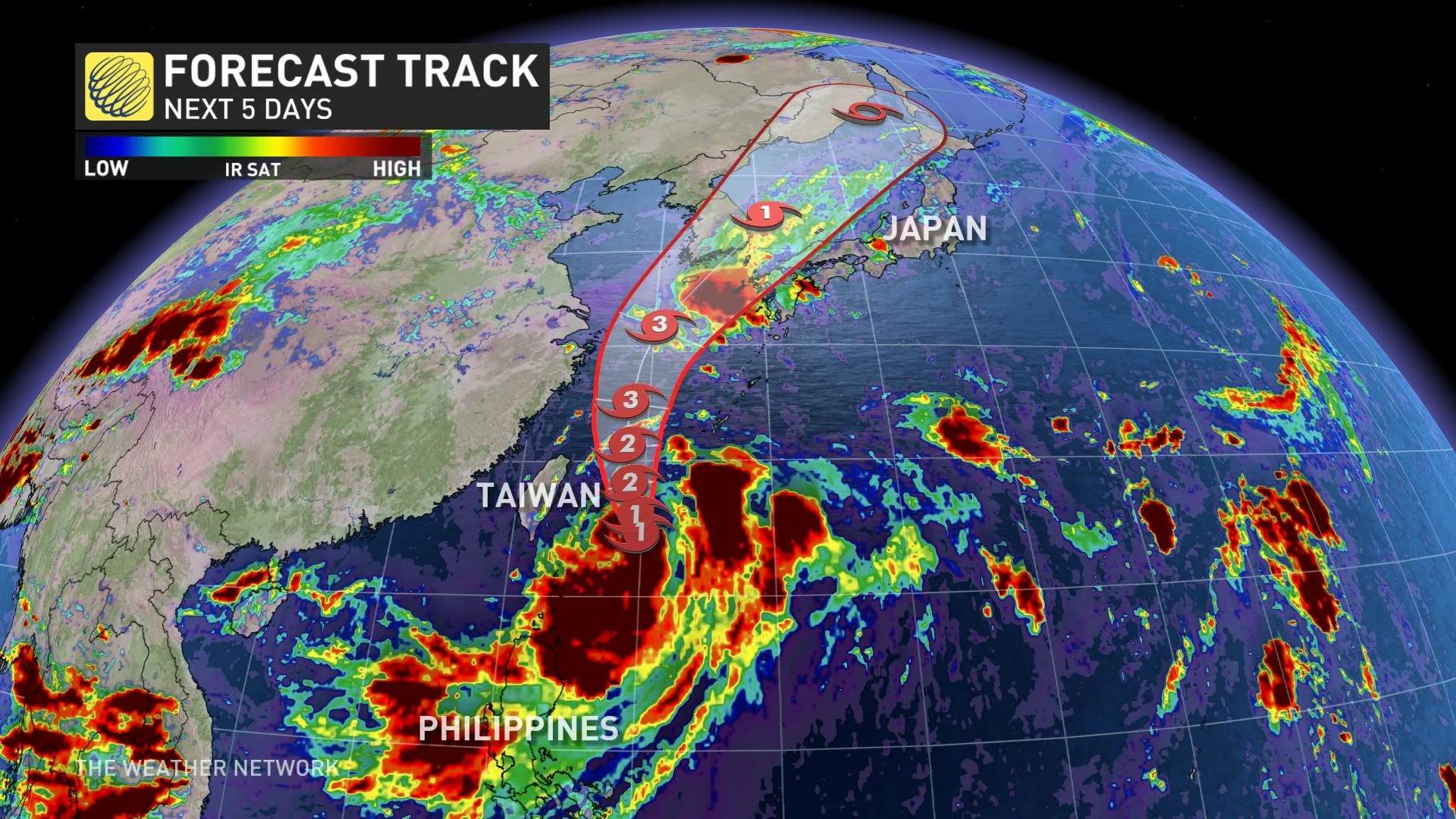
The typhoon will produce damaging winds, flooding rains, rough seas, and a storm surge along its path.
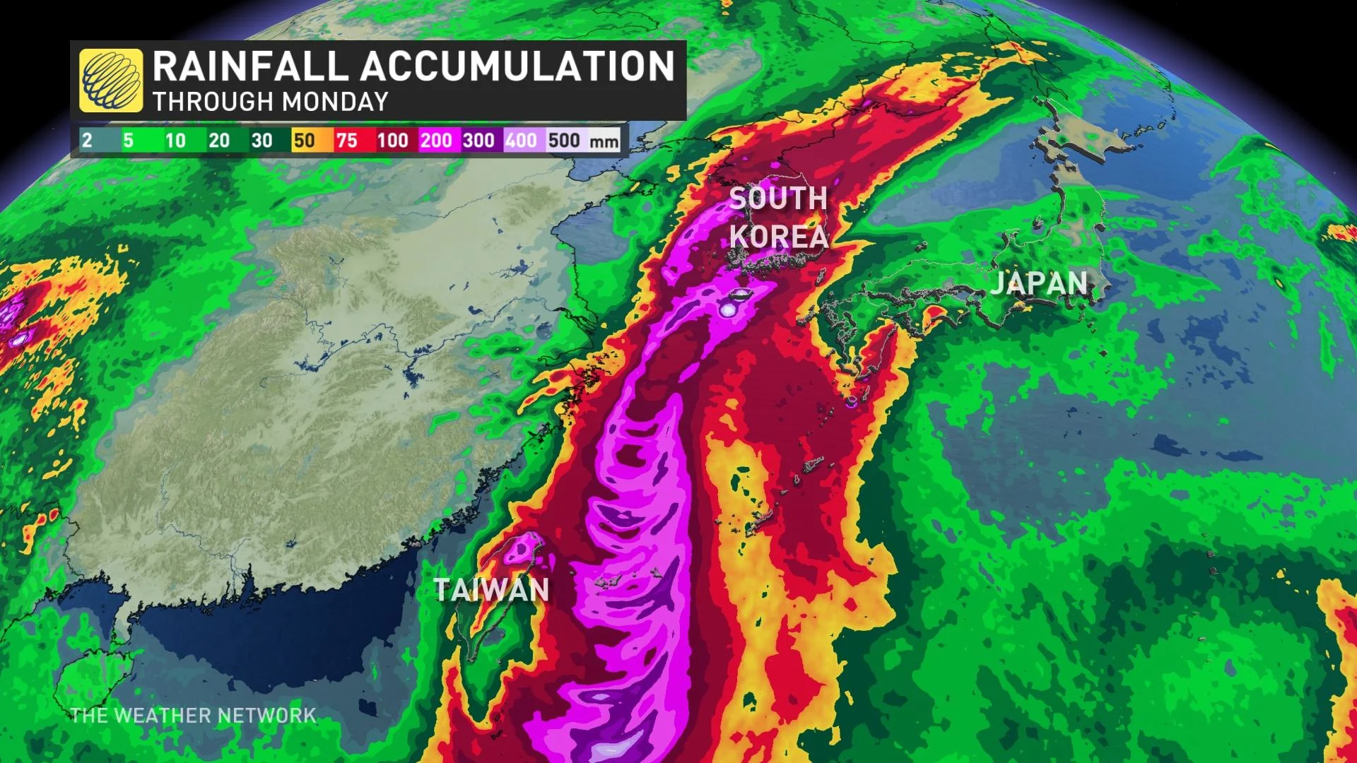
This system could have major impacts in South Korea, in particular, especially if the centre of the storm tracks near or over the southern tip of the Korean Peninsula as predicted.
Regardless of the storm’s strength, 200 to 300 mm of rain could fall across South Korea as Hinnamnor moves through the region, which could lead to significant flash flooding and mudslides throughout the country.
Hinnamnor will lose strength as it climbs higher in latitude, eventually losing its tropical characteristics as it clears eastern Asia and races toward the northern Pacific Ocean.
Even after it dissipates next week, the former typhoon’s influence will still have a reach that extends thousands of kilometres into Canada.
WATCH: Hurricanes, typhoons, tropical cyclones...what's the difference?
Recurving typhoons are notorious for altering the jet stream as they race toward the polar latitudes. This disruption can amplify the jet stream, leading to deeper troughs and stronger ridges that can have a profound effect on weather downstream.
We could begin to see Hinnamnor’s influence on the jet stream here in Canada in about ten days.
It’s far too early to say what specific impacts this jet stream disruption would have on conditions across the country, but it could bring noteworthy temperature shifts—either on the warmer or colder side—for the duration of its passage. Check out our monthly outlook for more details on the patterns you can expect from September in your corner of Canada.
Stay tuned to The Weather Network for the latest as we track this developing pattern.