The technology that can spot hidden tornadoes lurking in storms

Weather radars are able to see debris swirling around inside of a tornado, giving folks in harm’s way a heads up before dangerous storms arrive.
It’s 2:30 a.m. and your phone jolts you awake with a horrendous screech. You’re under a tornado warning, the push alert says, and you have to take shelter right away. You gather up the kids and head downstairs just in time for the lights to flicker out and the winds to grow to a roar against the roof.
Nighttime tornadoes are among the most terrifying weather disasters imaginable, and it wasn’t that long ago that they often came by surprise.
Today’s technology helps meteorologists ‘see’ tornadoes without actually needing to see photos or videos of the tornado churning across the landscape, providing extra time to issue life-saving warnings for folks in harm’s way.
STAY PREPARED: 10 ways The Weather Network app can help you plan for summer weather
Modern radar can sniff out a storm’s secrets
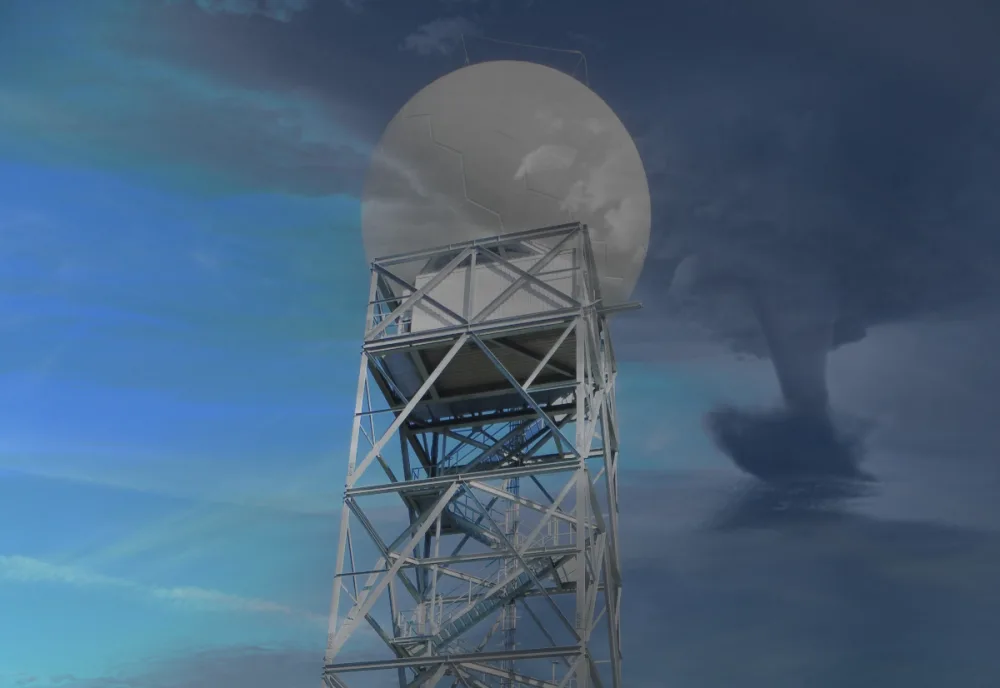
Weather radar works by sending out a pulse of microwave radiation from a large dish that’s protected by a fibreglass dome that looks like a giant golf ball.
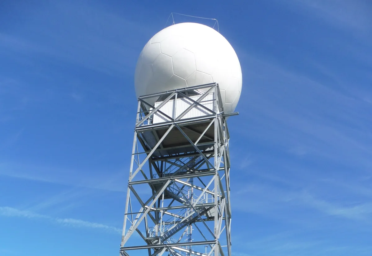
Environment and Climate Change Canada (ECCC) installed this upgraded radar site in Blainville, Quebec, in late 2018. (Image courtesy of Pierre cb via Wikimedia Commons. CC BY-SA 4.0)
This radar beam can extend hundreds of kilometres away from the dish, reflecting off of everything it comes in contact with—raindrops, snowflakes, hailstones, and even objects like trees and antenna towers.
Some of the waves reflect off of those objects and zip back to the radar dish, where computers sort out where that reflected energy came from and how much actually returned to the dish.
DON’T MISS: Violent tornadoes are sorely undercounted, study shows
The distance and intensity of the returning radiation tells us the location and intensity of precipitation, painting the typical radar image we’re all familiar with.
A couple of decades ago, engineers upgraded weather radars to utilize the Doppler effect to tell us which way and how fast those objects are moving, giving us an accurate idea of the winds within a thunderstorm. This innovation was a huge boost in detecting damaging winds or rotation that could produce a tornado.
WATCH: How Canada’s radar network has evolved and grown
A recent high-tech boost improves tornado warnings
Another high-tech improvement came within the past couple of years as Canadian radars were upgraded again with dual-polarization technology. This upgrade began in 2017, and all 33 radar sites across the country are on track for completion by January 2023.
Dual-pol, as it’s often called, sends out two beams of radiation—one vertical beam and one horizontal beam, resulting in a pair of waves that look like a plus sign. When this dual beam hits an object and reflects back to the dish, the computer software can tell the size and shape of the object falling through the atmosphere.
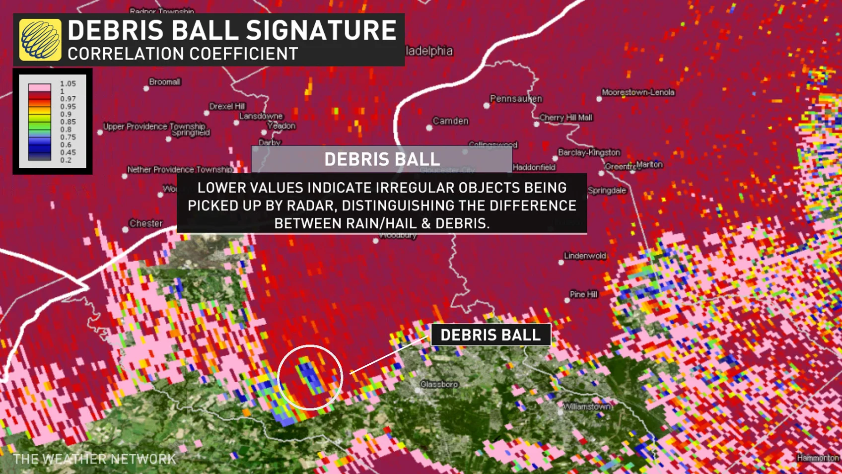
Correlation coefficient radar image of an EF-3 tornado hitting Mullica Hill, New Jersey, on September 1, 2021. (NOAA)
This added tidbit provides a wealth of information for meteorologists. One of the most helpful products produced by dual-pol is called correlation coefficient, or CC for short. CC tells us how similar in size and shape objects are to one another.
Raindrops and snowflakes are pretty uniform, so they show up with a high CC on radar imagery. Objects like hailstones and tornado debris, on the other hand, can vary widely in shape and size, so they show up with a very low CC value on radar.
READ MORE: There's a big difference between an EF0 and EF5: Understanding tornado ratings
For this reason, meteorologists often use CC like a debris tracker. If there’s a sudden drop in CC values in the same area that the radar detects strong rotation, it’s a pretty glaring sign that there’s a tornado that’s lofting debris into the atmosphere.
This modern technology can allow meteorologists to confirm a tornado’s presence without actually having to see it, giving you plenty of advanced warning before the storm reaches your neighbourhood.
Thumbnail image created using images from Pierre cb via Wikimedia Commons and jplenio via Pixabay.