The deep freeze returns to Western Canada to end January

It’s been a month since we’ve seen our last deep freeze in Western Canada, a frigid stretch that saw temperatures dip to -50°C in multiple locations.
Since the departure of that Siberian air mass, temperatures have come in well above seasonal for most of North America, with the greatest temperature anomalies falling over the northern Prairies.
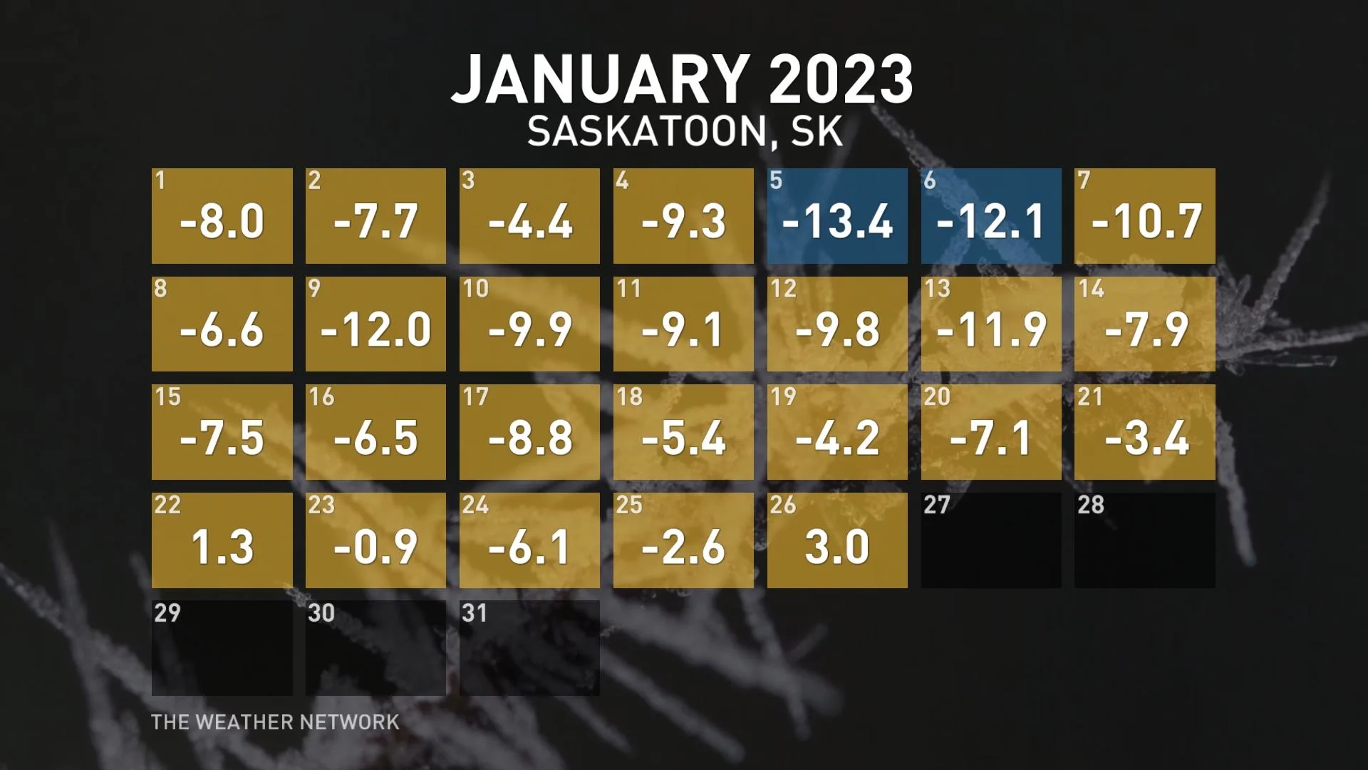
Average temperatures in Saskatoon, Sask., have been nearly 5°C above seasonal so far this month, with daytime highs poking above the freezing mark on a couple of occasions.
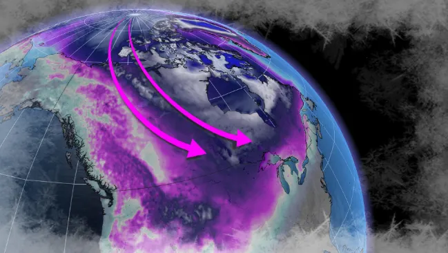
That’s going to come to an abrupt end this week as a pattern reversal sends Arctic air plunging south over the western half of Canada.
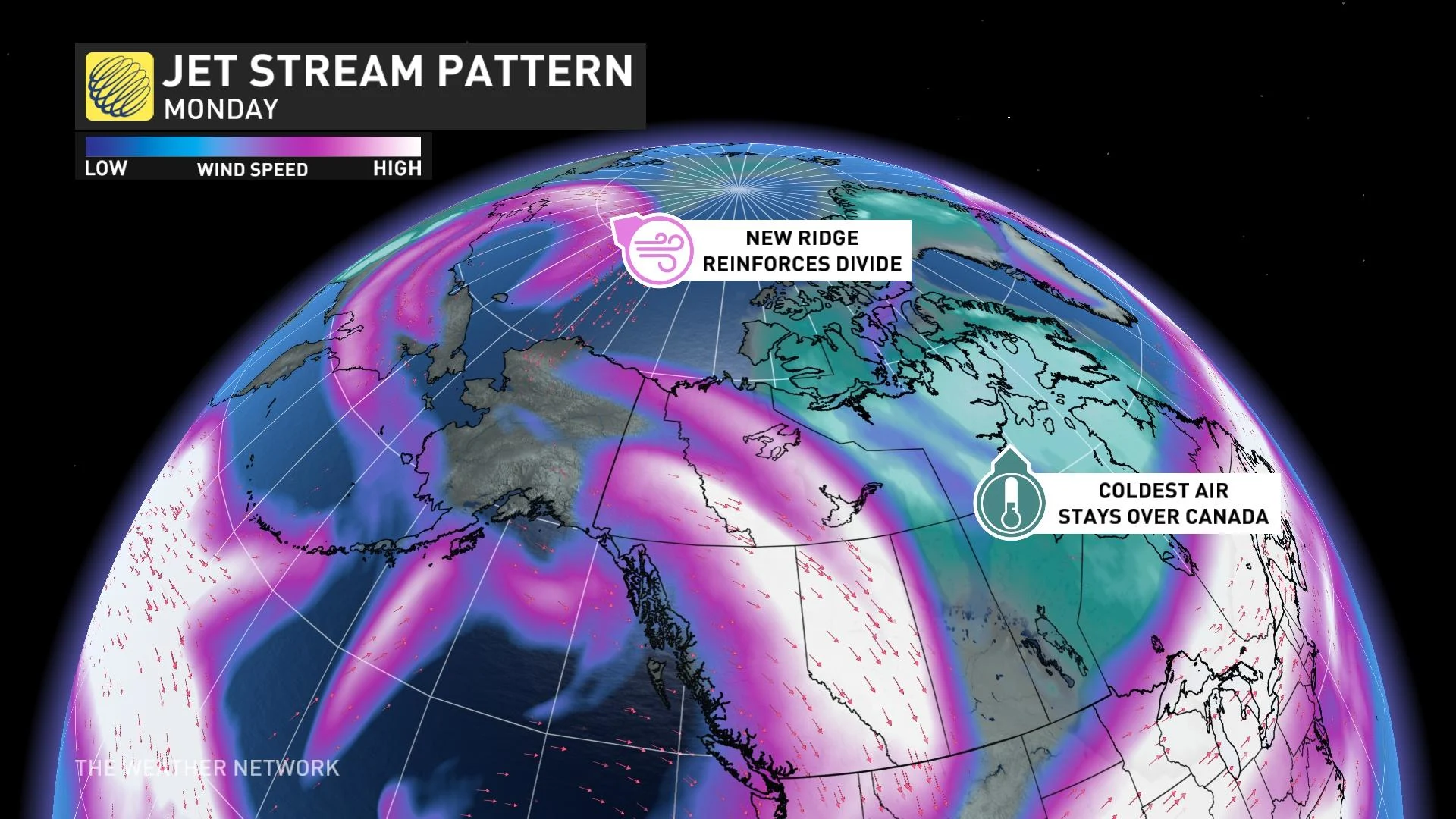
A ridge pumping over the Pacific into Alaska will force the upper-level pattern to shift and break off some of the coldest air in the Northern Hemisphere, trapping it over North America to end the month.
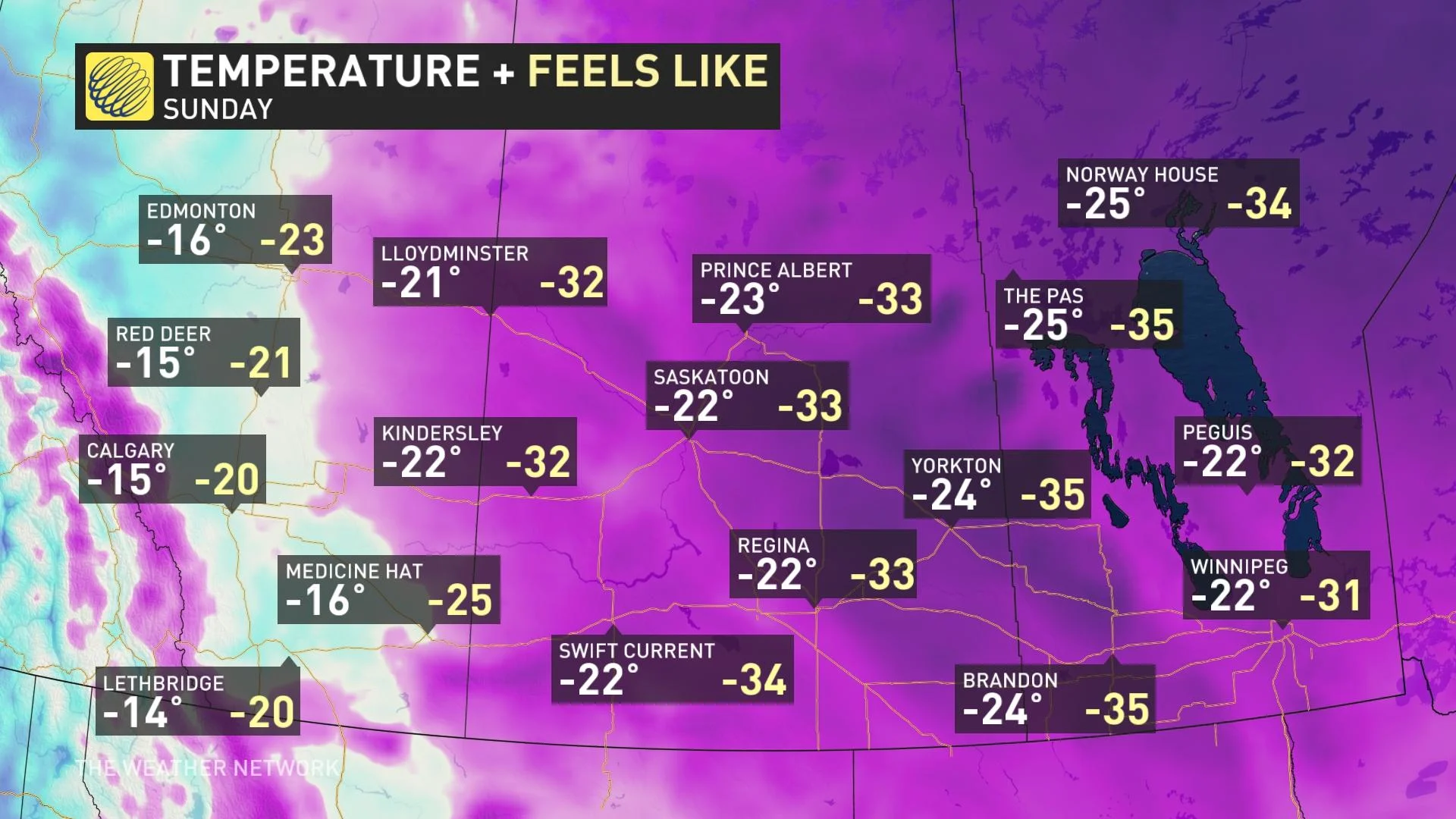
This visit from the polar vortex will target areas farther east in the Prairies than the cold spell we saw in December. British Columbia, Alberta, and the Yukon will avoid the very worst of the cold.
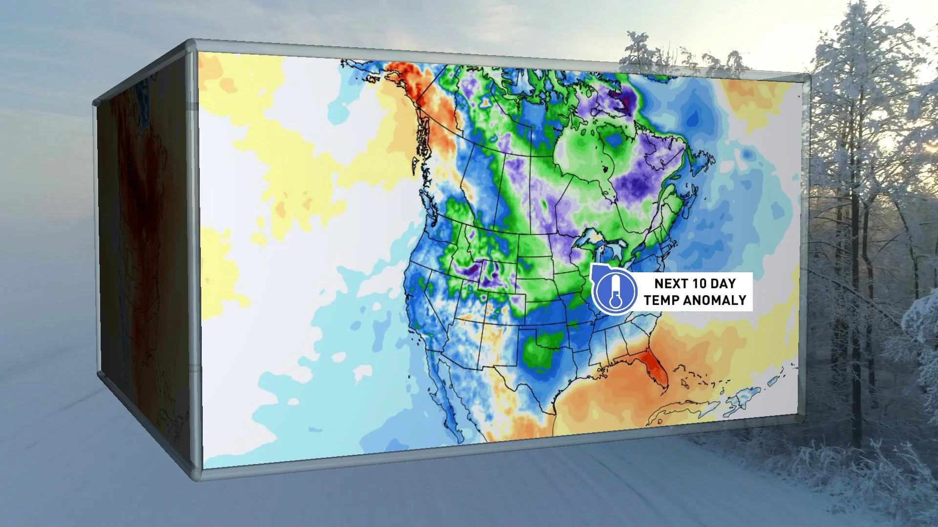
Widespread temperatures in the minus teens and 20s will spread over the eastern Prairies, with wind chills making it feel more like the -30s at times through the final days of January and into the start of February.
The frigid air will gradually spread east to start February, bringing the lobe of cold air to parts of Ontario, Quebec and Atlantic Canada.


