Ontario: Treacherous driving conditions expected with major snowstorm Wednesday

PLAN AHEAD: Motorists should prepare for poor winter driving conditions Wednesday, due to low visibilities in heavy and quickly accumulating snow.
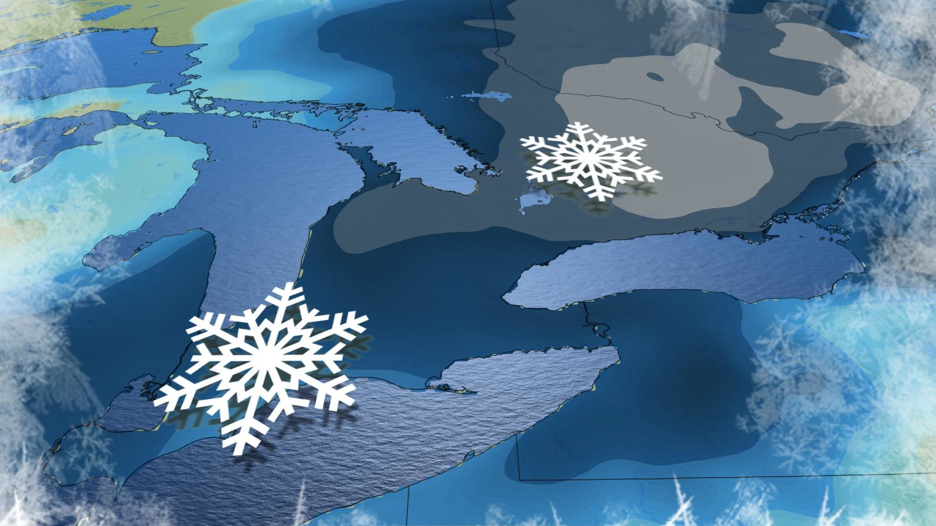
Environment Canada has issued snowfall and winter storm warnings across southern, central and eastern Ontario, ahead of an incoming potent Texas low that threatens upwards of 40 cm in some areas through Thursday morning. Plan ahead for travel Wednesday and only do so if it's necessary. Travellers should consider postponing non-essential travel until after the winter storm. We have the latest timing and details on this significant storm, plus a look at the hazardous lake-effect setup that will develop following the low's exit, below.
SPRING FORECAST: The Weather Network will release its seasonal outlook on Wednesday, February 26. Be sure to check back to see what Spring 2020 has in store!
WEATHER HIGHLIGHTS
Major Texas low to begin impacting southern Ontario Wednesday morning
School bus cancellations possible on Wednesday
Bands of lake-effect snow develop on Thursday persisting into Saturday with the threat for whiteouts at times
Keep track of active weather alerts in your area
WEDNESDAY: TEXAS LOW TO BRING SIGNIFICANT SNOWFALL, COMMUTE TIMES WILL BE AFFECTED
Wednesday's widespread heavy snow is thanks to a major Texas low, which is expected to be at its worst through the evening and overnight hours before easing off to flurries early Thursday.
For the GTA, snow will develop Wednesday morning, likely impacting the commute as roads become slick. Snow will continue through the day, but most of the time it will be light. The snow will become heavier during the late afternoon and evening hours, and continue through the overnight. Travel will be very slow and difficult.
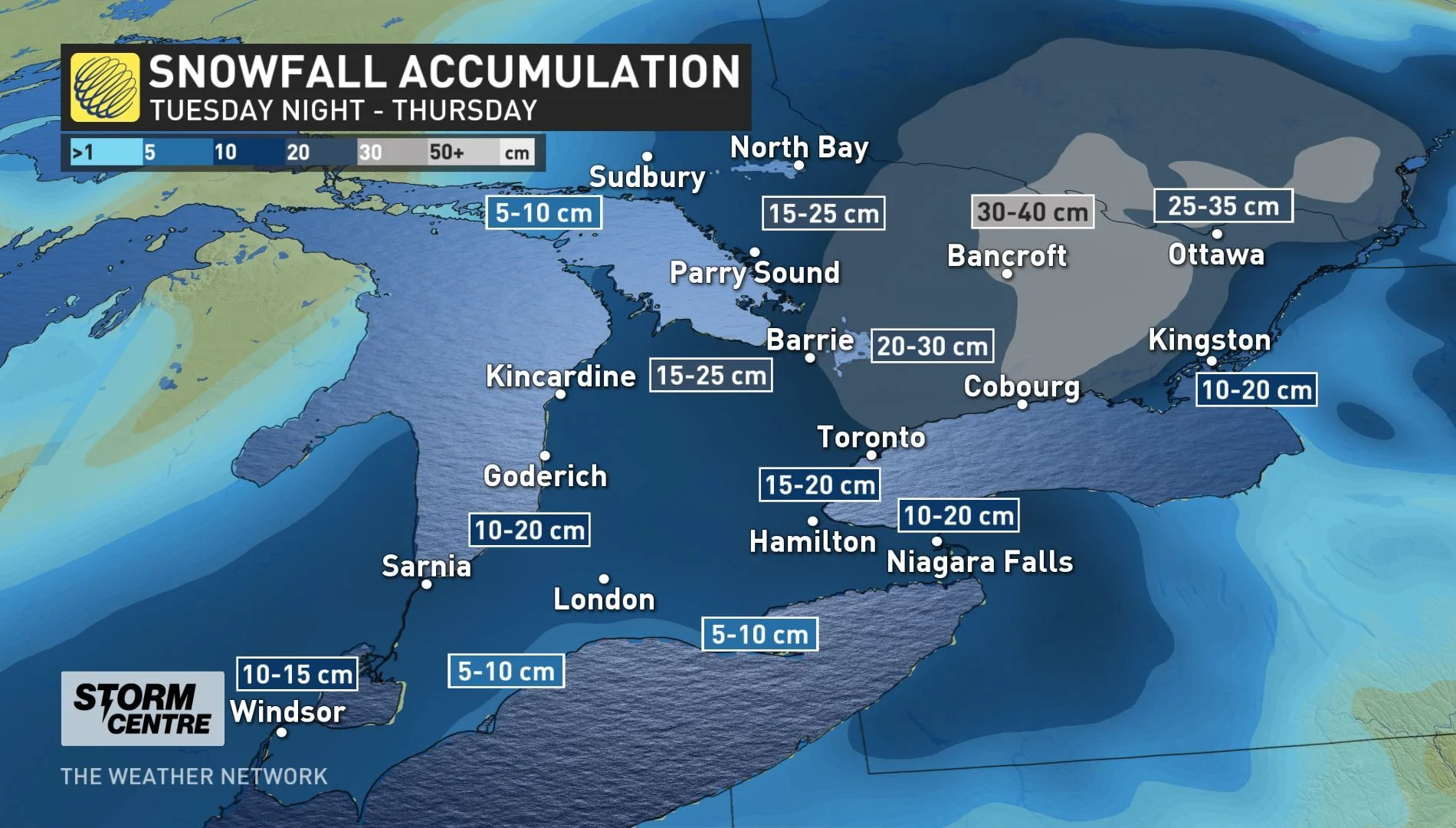
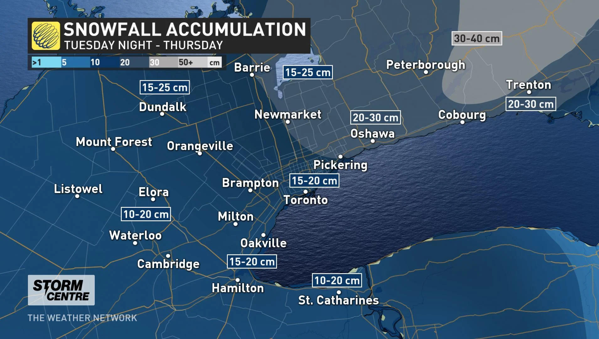
Widespread snow totals will range depending on where you are in southern Ontario. 10-20 cm is forecast across the southwest through Niagara and areas west of the GTA, with lower snowfall amounts expected for areas along northern Lake Erie shorelines as the snow will likely transition to a rain/snow mix for part of the evening and overnight. Totals will reach 15-20 cm across most of the GTA, but 20+ cm is expected east of Toronto.
Snowfall amount will increase for areas to the north and east of the GTA, with the heaviest amounts expected to be across Grey-Bruce County, parts of central and eastern Ontario, including the City of Ottawa, where upwards of 30+cm could fall through Thursday morning.
"Be prepared to adjust your driving with changing road conditions. Visibility may be suddenly reduced at times in heavy snow. There may be a significant impact on rush hour traffic in urban areas," warns Environment Canada in snowfall warnings that cover the GTA and parts of southern and central Ontario.
BRACE FOR 30+ CM OF SNOW IN THE OTTAWA AREA
THURSDAY TO SATURDAY: EXTENDED PERIOD OF SNOW SQUALLS COULD BE ONE OF THE MOST IMPACTFUL OF SEASON
Temperatures will plunge by Thursday as daytime highs will remain below the freezing mark. As the storm winds down early Thursday morning, winds will increase with gusts of 60-80 km/h expected, creating extensive blowing and drifting snow. Narrow bands of lake-effect snow squalls will develop southeast of Lake Huron and Georgian Bay. The threat for whiteout conditions with blowing and drifting snow will make for a dangerous setup over the region.
"It will really feel and look like winter!" says Weather Network meteorologist Dr. Doug Gillham.
These lake-effect bands will extend into parts of the GTA Thursday and Friday with bursts of heavier snow and low visibility at times.
LAKE-EFFECT SNOW WILL ROAR BACK TO LIFE AFTER MAJOR WINTER STORM:
Check back as we continue to monitor the forecast across Ontario.