Temperatures will tumble after major snow departs Quebec

Widespread winter warnings were still in effect across Quebec first thing Thursday morning, as a far-reaching and potent storm system covers much of eastern Canada.
PHOTOS: Blast of heavy, wet snow coats Ontario like wintry cement
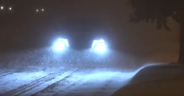
Conditions began to deteriorate quickly Wednesday evening, with impressive snowfall rates of 2-5 cm per hour bumping totals in a hurry. By 5 a.m. on Thursday morning, 26 cm of snow was already reported in Montreal.
"Prepare for quickly changing and deteriorating travel conditions. Visibility may be suddenly reduced at times in heavy snow," said Environment and Climate Change Canada (ECCC) in the snowfall warning for the city. "There may be a significant impact on rush hour traffic in urban areas."
Several schools closed their doors first thing Thursday morning and many flight cancellations were reported as well. Travellers are being advised to check for updates on their flights before leaving for the airport.
SEE ALSO: La Niña fades, so what does that mean for a Canadian spring?
WATCH: Tricky travel in southern Quebec as snowstorm continues to move east
A few more centimetres of snow is left to fall across southern Quebec as the system pulls off towards the east.
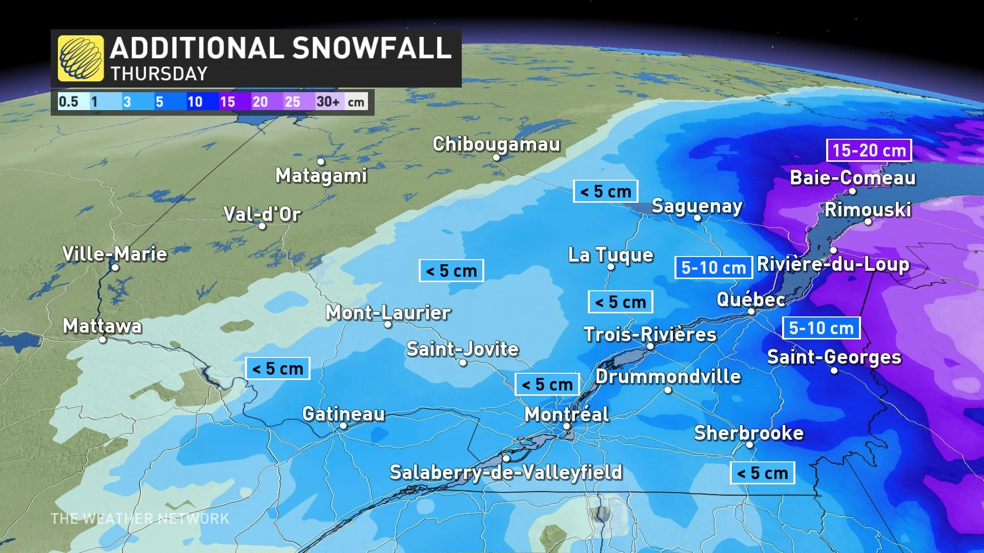
Heavy snow however, is still forecast through Thursday for the Gaspe, mouth of the St. Lawrence and the Lower North Shore of the province, with 20-40+ cm expected locally, combined with gusty winds. Winter storm warnings are still in effect for these regions.
In the wake of the storm, temperatures will fall significantly dropping into the minus double digits Thursday night, with wind chills making things feel even colder.
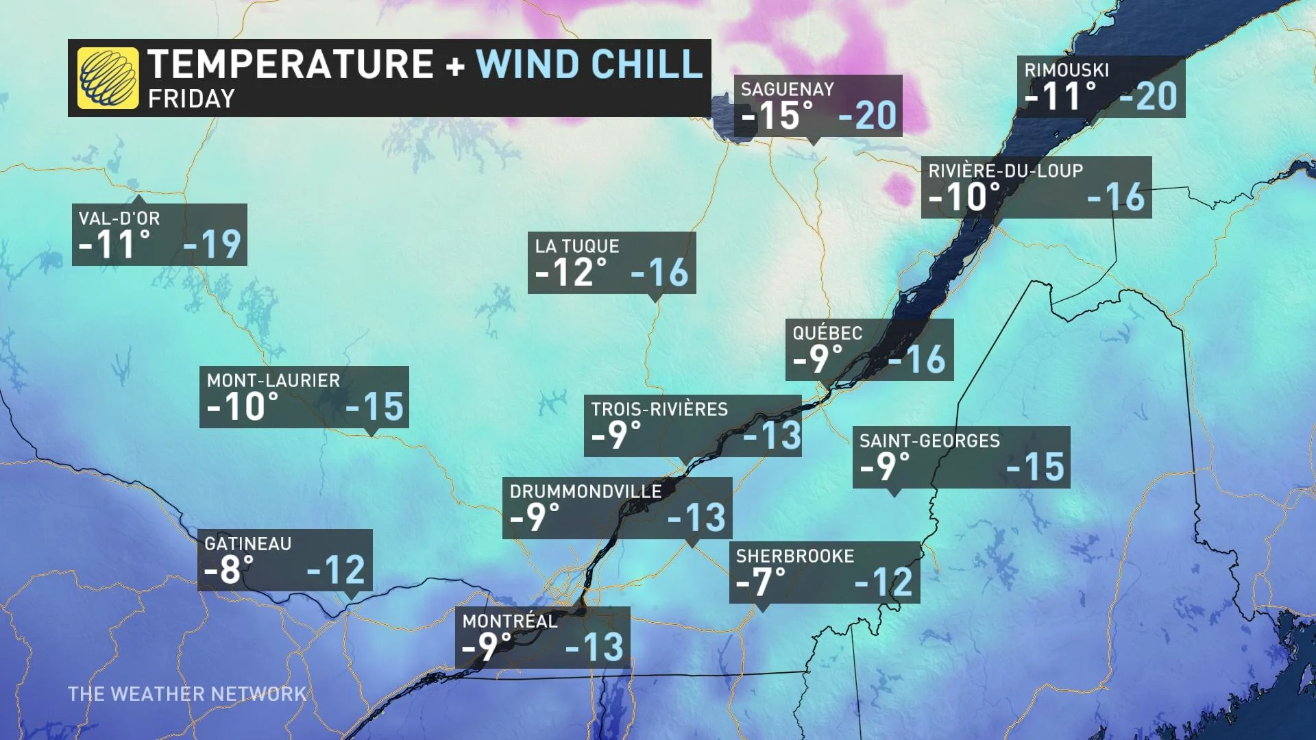
A cold day is expected on Friday, with a brief recovery Saturday before temperatures plunge and stay cold through next week once again.
This won't be it for the snowfall either. A clipper system from the Prairies will spread a light dusting of snow Friday night into Saturday across much of the province, with another system forecast Saturday night through Sunday.
The second system will spread a heavier swath of snow across just the southern regions of the province, however there is still some uncertainty with exact timing and totals will this storm.
Stay tuned to The Weather Network for the latest forecast updates for Quebec.
Thumbnail image courtesy: Nicolas Lessard/MétéoMédia


