More chilly nights ahead for Alberta as a cooler pattern lingers

The ongoing surge of chilly air will even dip into southern Alberta by Monday night.
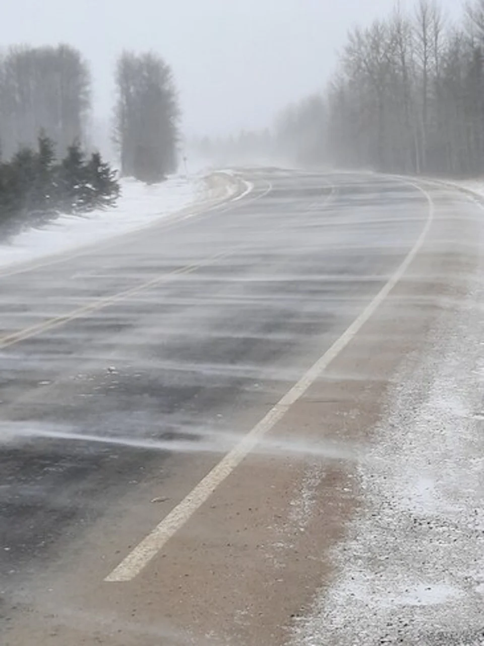
We saw quite the pattern reversal across Western Canada this weekend. A burst of cold air filtered across Alberta, sending temperatures below freezing with heavy snow in the mountains. A little bit of snow even reached the Calgary area. Temperatures will remain below-seasonal through the week, with a few chances for unsettled conditions. More on what to expect to start the week, below.
Visit our Complete Guide to Fall 2021 for an in-depth look at the Fall Forecast, tips to plan for it and much more!
MONDAY: A CHILLY START WITH CALMER CONDITIONS
After a raw Sunday that saw the season’s first snowflakes in spots, Thanksgiving Monday will get off to a chilly start for much of Alberta.
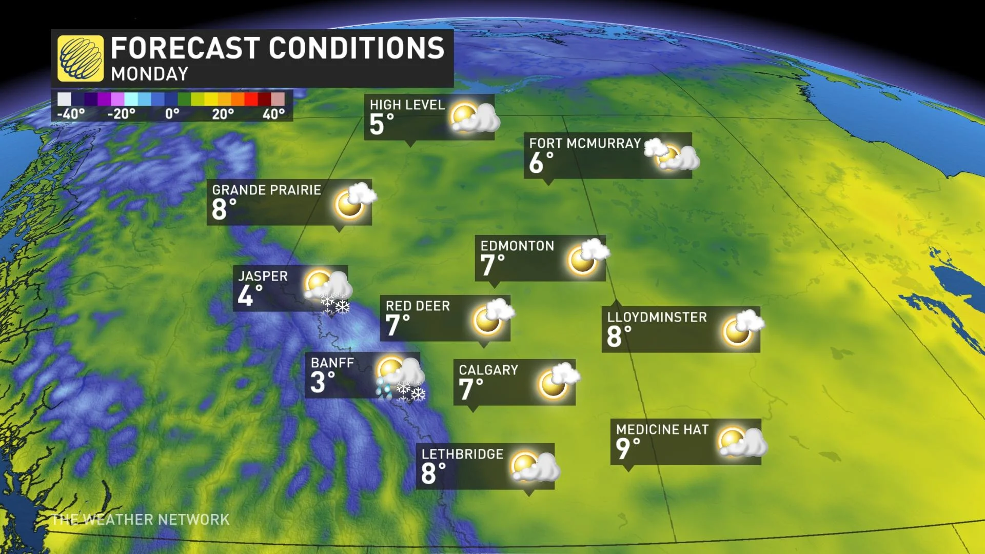
Morning lows will dip below the freezing mark for much of the province.
Temperatures will remain in the upper single digits for most during the day, but we’ll see a repeat of the subfreezing temperatures by Monday night, when the cold air will finally reach communities down near the international border.
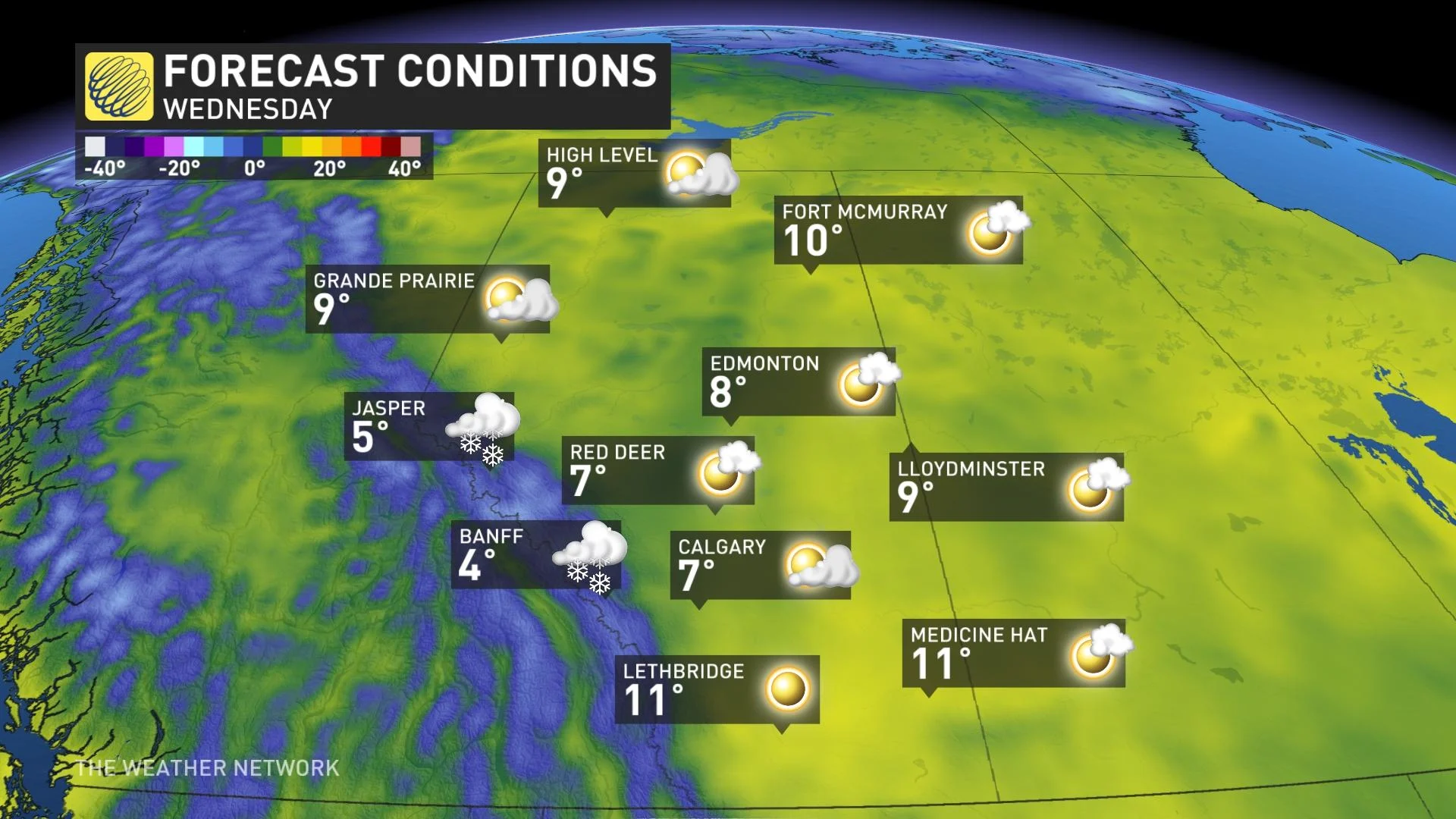
LOOK AHEAD: BELOW-SEASONAL TEMPERATURES LOCKED IN THIS WEEK
Beyond, below-seasonal temperatures settle in for all of this week, with seasonal conditions not returning until perhaps the following week.
Thumbnail courtesy of Melanie McLaughlin, taken in Kinuso, Alta.
Stay tuned to The Weather Network for the latest forecast updates for Alberta.