Ontario: Squalls end, temperatures rise ahead of weekend storm

Wednesday's widespread snow squalls made for difficult travel, with at least one person dead in one of several collisions on Ontario's highways. For Thursday, the last squalls shift mostly to more northerly areas, and freezing temperatures gradually rise into Friday. What's ahead, below.
Visit our Complete Guide to Winter 2019/2020 for an in depth look at the Winter Forecast, tips to plan for it and a sneak peek at the spring season next year
WEATHER HIGHLIGHTS:
Squalls continue for parts of the north Thursday, end in the south
Temperatures recover back to above-seasonal into the weekend
Eyeing a system that will bring precipitation to southern Ontario Saturday
Stay up-to-date on the ALERTS in your area
ONE PERSON KILLED IN MULTI-VEHICLE COLLISION WEDNESDAY
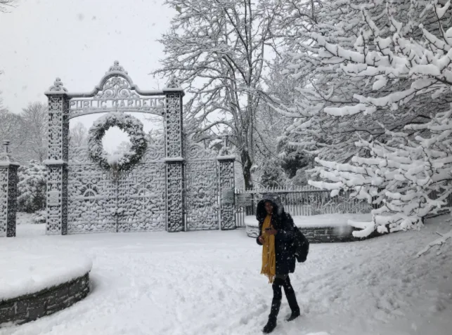
Wednesday's snow squalls made for dangerous travel on some of southern Ontario's highways, with the OPP reporting at least one person dead in a collision.
Westbound lanes of Highway 401 were closed in several locations from Brockville to Napanee as a result of weather-related collisions, including one involving multiple vehicles in the Brockville area. Police confirmed on Twitter that a person who was seriously injured in the pileup was deceased.
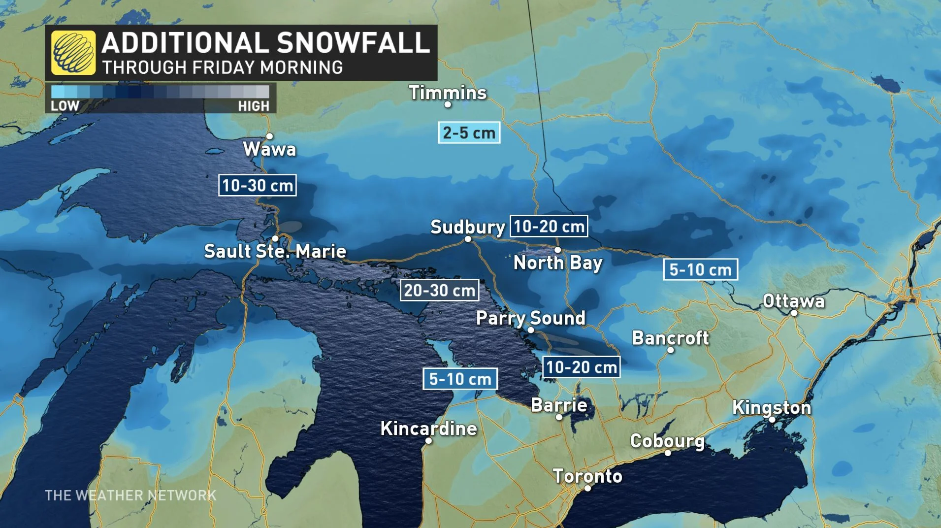
THURSDAY/FRIDAY -- SQUALLS LAST LONGER IN THE NORTH, TEMPERATURES RECOVER
The south will see the last of the lingering squalls in the south as high pressure nudges in. More northerly areas, however, will still have a messy Thursday.
Specifically, areas east of Georgian and Lake Superior will continue to see lake-effect streamers through the day, with some areas in line for as much as 30 cm of additional snow by Friday morning.
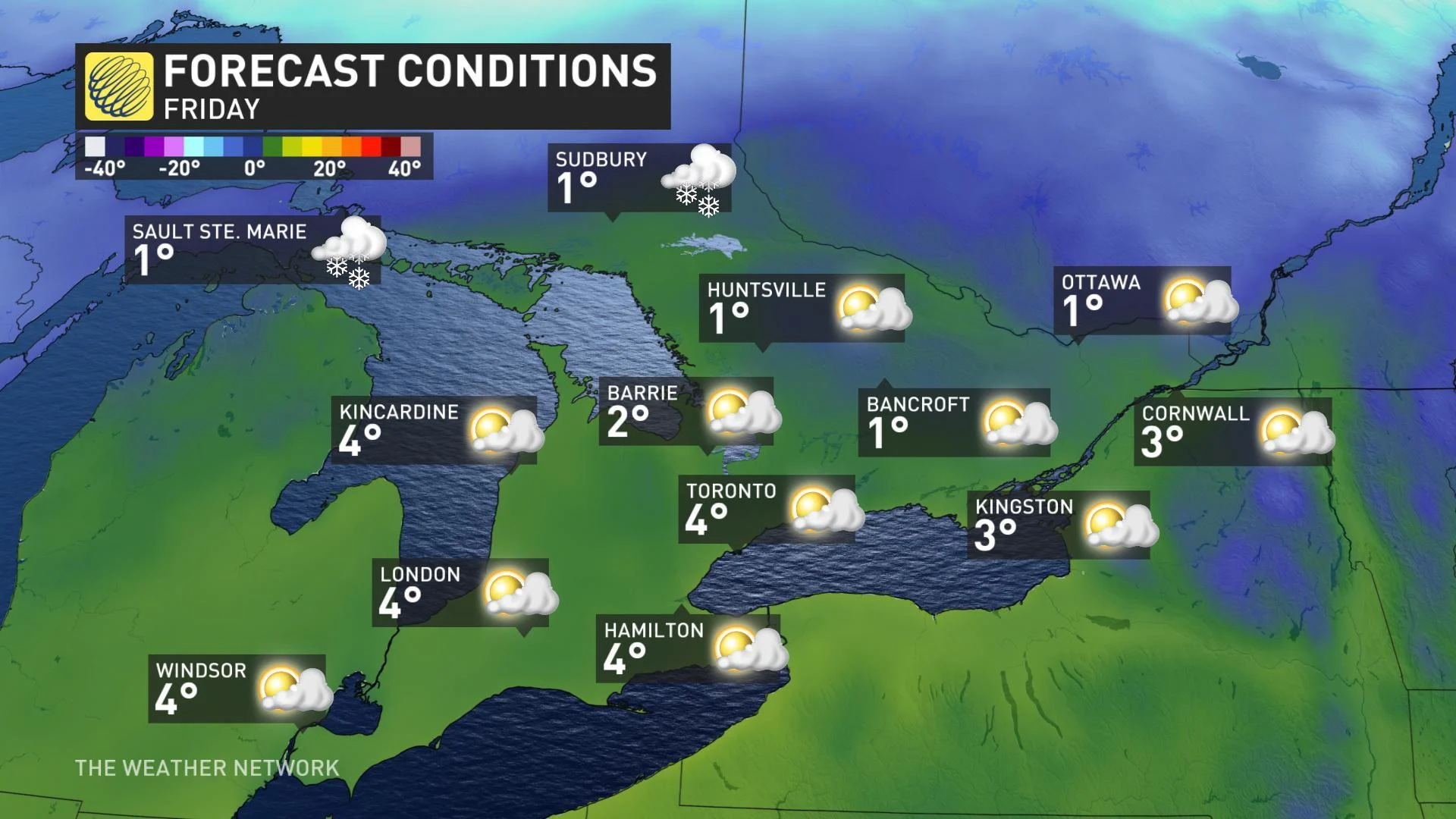
By Friday, however, temperatures will be well on their way to a modest recovery, with most places in Ontario seeing daytime highs a little above zero.
The next chance for stormy weather looks to be the weekend.
"A moisture-laden system tracking along the east coast of the U.S. will bring widespread rain showers to southern Ontario on Saturday. However, the rain could mix with some ice and snow across the higher terrain to the northwest of the GTA during the morning," says Weather Network meteorologist Dr. Doug Gillham.
By late Saturday night, there's the potential for the rain to change to wet snow, especially for the higher terrain, away from Lake Ontario. Watch below for how we expect this system to behave at this time:
CHANGEABLE CONDITIONS LEADING UP TO CHRISTMAS
Forecasters are keeping an eye on another large and moisture-laden system that is expected to track south of the border on Tuesday. While the exact track and impacts are still uncertain, it has the potential to bring significant snow or an icy mix during the day.
The weather pattern leading up to Christmas looks to remain changeable, with no sustained cold weather in sight.
"But there still will be the potential for wintry weather at times," Gillham says, adding that it is still too early to make a call on a white versus green Christmas.


