Backwards set-up not done with East Coast, 30+ cm for some areas

The end is in sight to this uncommon retrograde system, which is bringing downpours and heavy snow for some parts of the East Coast to end off the week.
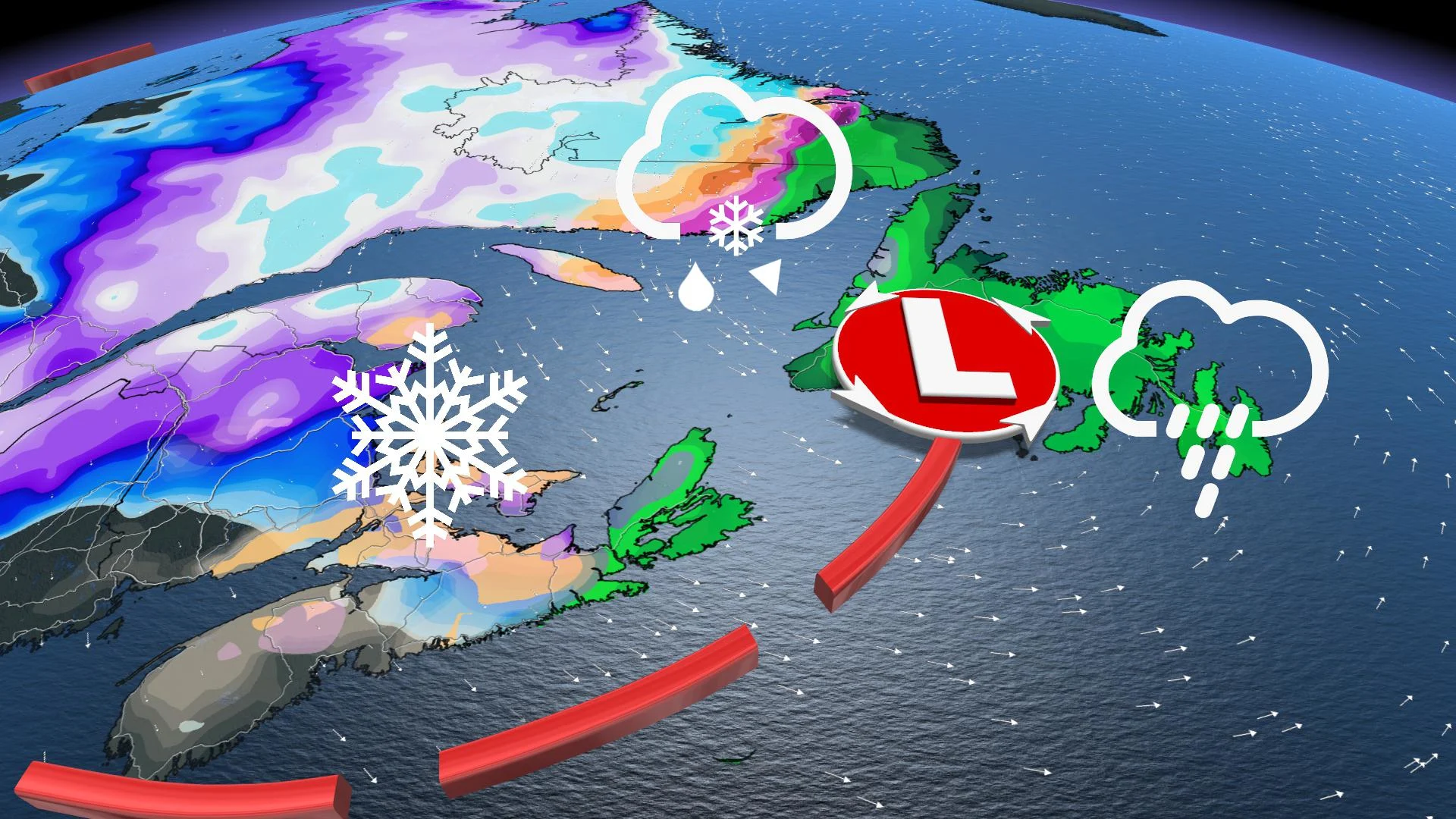
Periods of unsettled conditions will continue to impact Atlantic Canada through Saturday, as a rare weather pattern has systems retrograding into the region. Instead of the more typical motion of west to east, a strong blocking pattern in the North Atlantic has created a "backwards" set-up as storms retrograde from east to west -- the opposite direction of the normal storm track. Because of this set-up, periods of rain, freezing rain and snow will persist into Friday, with some significant snow totals impacting parts of southern Labrador. More on the timing and storm totals, below.
WEATHER HIGHLIGHTS:
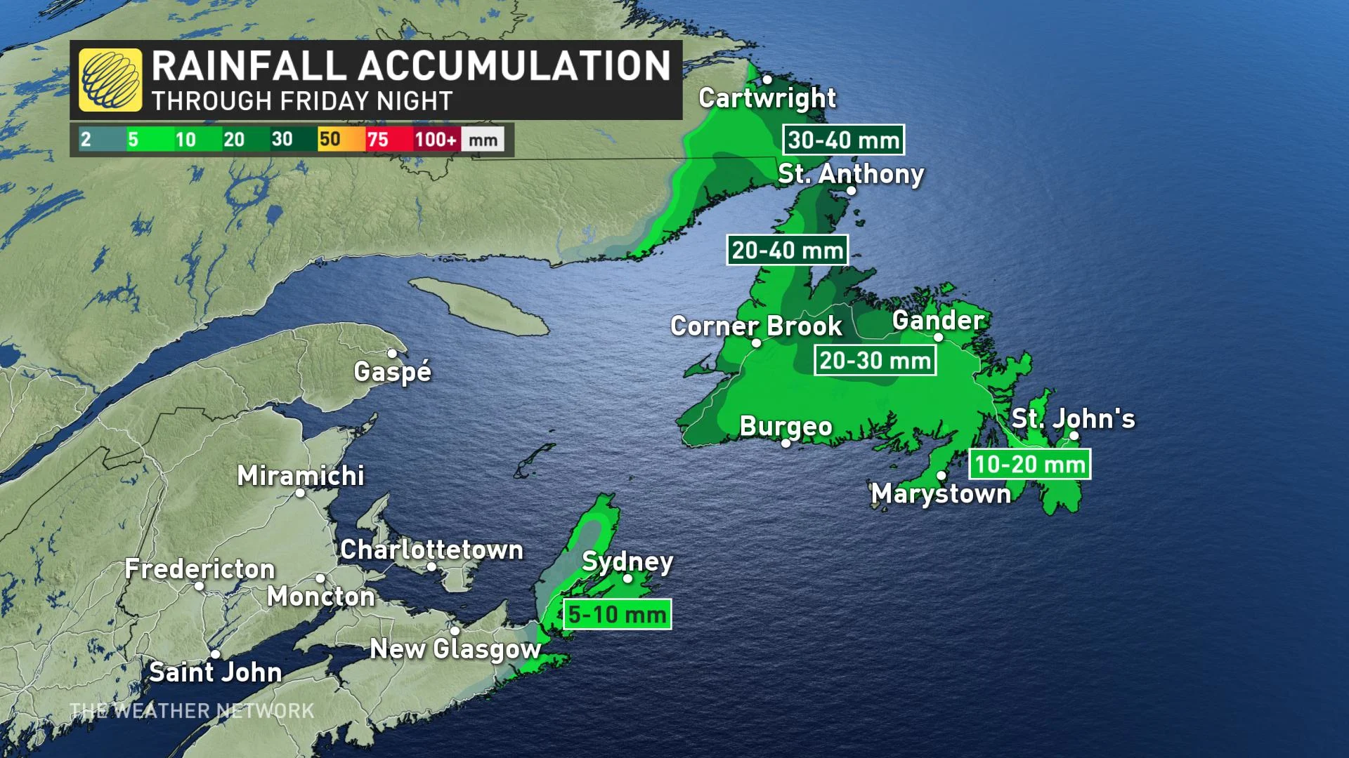
Rain continues into Friday night for Newfoundland
Onshore flow for the Maritimes continues to bring a mix of freezing rain and ice pellets
Heavy snow in southeastern Labrador, with winter storm and snowfall warnings in effect
INTO FRIDAY: RAIN, FREEZING RAIN AND SNOW THANKS TO RETROGRADING LOW PRESSURE
The retrograding cycle of precipitation that has brought unsettled weather to much of Atlantic Canada this week will continue to impact the region with more significant rain, freezing rain and snow through Friday.
This is all thanks to a massive high-pressure system over the North Atlantic, which is preventing storms from making their normal progress out to sea.
As temperatures remain on the mild side of seasonal, the system's impact mostly manifested as rain for parts of the Maritimes Thursday, picking up in intensity as it spreads into Newfoundland on Friday.
"With an onshore flow, there's also the potential for periods of freezing rain and ice pellets to mix in across the Maritimes Thursday, with snow expected for eastern sections of the region," says Weather Network meteorologist Nadine Hinds-Powell.
As temperatures continue to cool Friday, heavier snow is expected on the back side of the system, especially across PEI and also for parts of western and northern Nova Scotia, where 10-15+ cm of snow is possible.
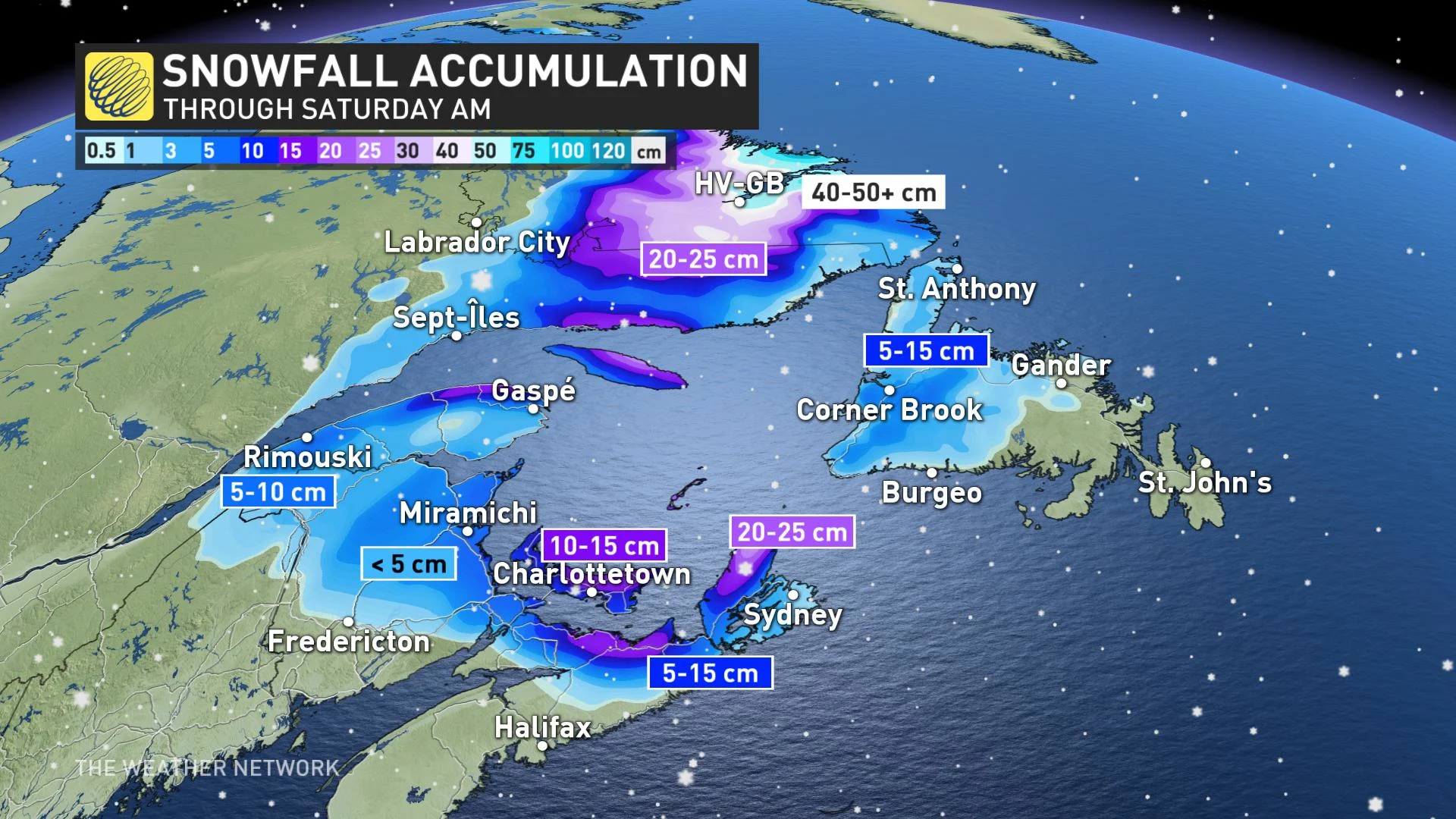
SNOW AND WINTER STORM WARNINGS IN EFFECT FOR LABRADOR
The heaviest snow looks to target southeastern Labrador, with winter storm and snowfall warnings in effect for the region. The snow combined with winds gusting up to 50 km/h may also lead to reduced visibility over exposed areas at times.
"Consider postponing non-essential travel until conditions improve," says Environment Canada in the warning. "Surfaces such as highways, roads, walkways and parking lots may become difficult to navigate due to accumulating snow."
Conditions are expected to gradually improve through Friday evening as the snowfall intensity begins to diminish.
Stay tuned to The Weather Network for the latest updates on the weather in your area.