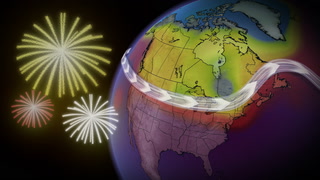
After a shot of June snow for parts of the Prairies, storm risk returns

Accumulating snow lasts into Tuesday morning for the mountains of Alberta, with as does heavy rain for some areas to the east, while severe thunderstorm risk makes its way back to the region later in the day.
Alberta is in the midst of a full seasonal rewind this week: after blazing hot temperatures just days ago, it's cold enough in the province to support high-elevation snow, prompting winter storm warnings. It will be winding down Tuesday morning, while further east, Saskatchewan and Manitoba will be staring down some severe thunderstorm risk later in the day. A closer look, below.
Visit our Complete Guide to Summer 2021 for an in-depth look at the Summer Forecast, tips to plan for it and much more!
TUESDAY: AFTER HIGH-ALTITUDE SNOW AND HEAVY RAIN, STORM RISK RISES
It's not impossible for Alberta in June, but it's rarely welcome: high-altitude snow triggered winter storm warnings for parts of the mountains Monday, and by Tuesday morning, some areas were in line to pick up as much as 20 cm. Further east, heavy rain was set to continue into the morning.
Tuesday, the active weather hotpot shifts eastward to southern Saskatchewan and parts of southwestern Manitoba where thunderstorms, some potentially severe, are forecast for later in the day, lasting through the overnight.

In areas where thunderstorms do occur, the primary threats will be torrential downpours and large hail.
One of the enablers for Monday's snow in the mountains was a spate of colder-than-normal temperatures in Alberta. Tuesday sees those recover slightly, but only by a few degrees, such that most people will still be below 20°C.
Manitoba, meanwhile, will occupy the other extreme, with daytime highs at or above 30°C in the forecast.

WINTER STORM WARNINGS IN EFFECT
As an upper disturbance moves across the region and forces moisture up the foothills, terrain-driven snowfall is impacting the area.
Winter storm warnings were issued for areas of Banff and Jasper National Parks along Highway 93, urging residents to prepare for hazardous winter conditions.
"Consider postponing non-essential travel until conditions improve," says Environment Canada in the warning. "Rapidly accumulating snow could make travel difficult over some locations. Visibility may be suddenly reduced at times in heavy snow."
As much as 30 to 40 cm of snow could fall across the region by Tuesday morning.

The system will also bring heavy rainfall to areas east of the slopes, including for the Rocky Mountain House area. This is where rainfall warnings are in place and flash flooding is possible. Between 80-100 mm of rain is forecast, locally enhanced by thunderstorms.
"Heavy downpours can cause flash floods and water pooling on roads. Don't approach washouts near rivers, creeks and culverts," EC warns.

Both the snow and rain are expected to linger in some areas until Tuesday morning.
MID TO LATE WEEK: STRONG THUNDERSTORM THREAT SPANS THE REGION
The thunderstorm threat will persist through much of this week, with strong to severe storms expected across southern Alberta and southwestern Saskatchewan on Wednesday. That threat will continue across southern Saskatchewan into Thursday.
"A low pressure system will develop over Montana on Wednesday and then track north into Saskatchewan Thursday, slowly track east to central and northern Manitoba late week and into the weekend," says Dr. Doug Gillham, a meteorologist at The Weather Network. "This will bring widespread soaking rain to much of the Prairies with between 25-75+ mm expected for a large part of the region."
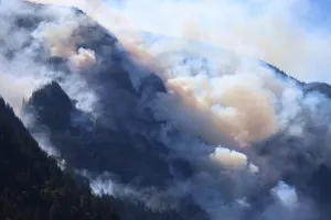
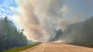
Though not everyone will get as much rain as they need, this soggy set-up will be a positive story for agriculture for much of the region. It will also help to reduce the threat for wildfires.
"June is typically the wettest month of the year, and it looks like this week will deliver some meaningful relief from the drought conditions," Gillham says, adding that a drier pattern is expected to return for southern areas next week.
Stay tuned to The Weather Network for the latest forecast updates across the Prairies.