
Refreshing air spills across Ontario for the first day of fall

The mugginess that marked the final day of summer in Ontario will flip to cooler, drier air in time for the first full day of autumn.
Welcome to fall, Ontario.
Southern Ontario saw off the final full day of summer in style, with muggy heat fueling strong thunderstorms across parts of the province throughout the day. The cold front responsible for the storms will bring a refreshing change by Thursday.
Visit our Complete Guide to Fall 2022 for an in-depth look at the Fall Forecast, tips to plan for it and much more!
A trough swinging across the eastern half of Canada will allow cooler, drier air to plunge across Ontario Wednesday night into Thursday.
Daytime high temperatures across the region will only reach the upper teens on Thursday afternoon, a far cry from feels-like values in the 30s just one day earlier.
This will be the coolest weather we’ve enjoyed in Ontario since the May long weekend.
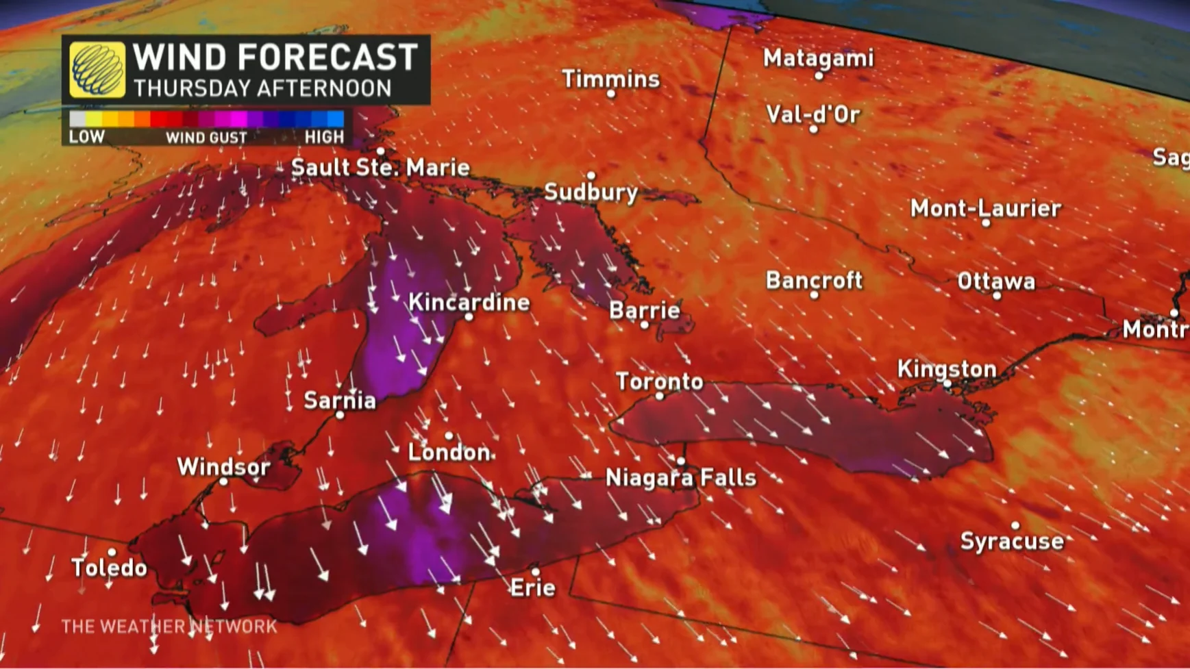
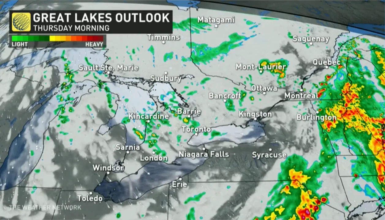
The cooler temperatures will flow into the province on gusty winds. Gusts could approach 60-70 km/h across the Huron shores. Folks near Lake Huron and Georgian Bay could see lake-effect showers through the first half of the day, as well.
Are we finished with summer, though? Probably not.
The final week of September will likely see cooler-than-seasonal temperatures across the province, with temperatures more typical of early October. However, above-seasonal temperatures are expected to return and dominate during the month of October.
WATCH: The polar vortex is waking up, what does this mean for Canada's winter?
Thumbnail courtesy of Unsplash.
Check back for the latest on conditions across Ontario.