Summer 2.0 has reached B.C., here's how hot it'll get

While many will soon see toasty temperatures in B.C., the likelihood of setting new records is fairly low.
Summer 2.0 has set in across British Columbia, and its accompanying warmth looks to stick around for a bit, will likely make up for lost ground.
Early summer was a bit of a bummer for the province, as below-normal temperatures spilled well into July.
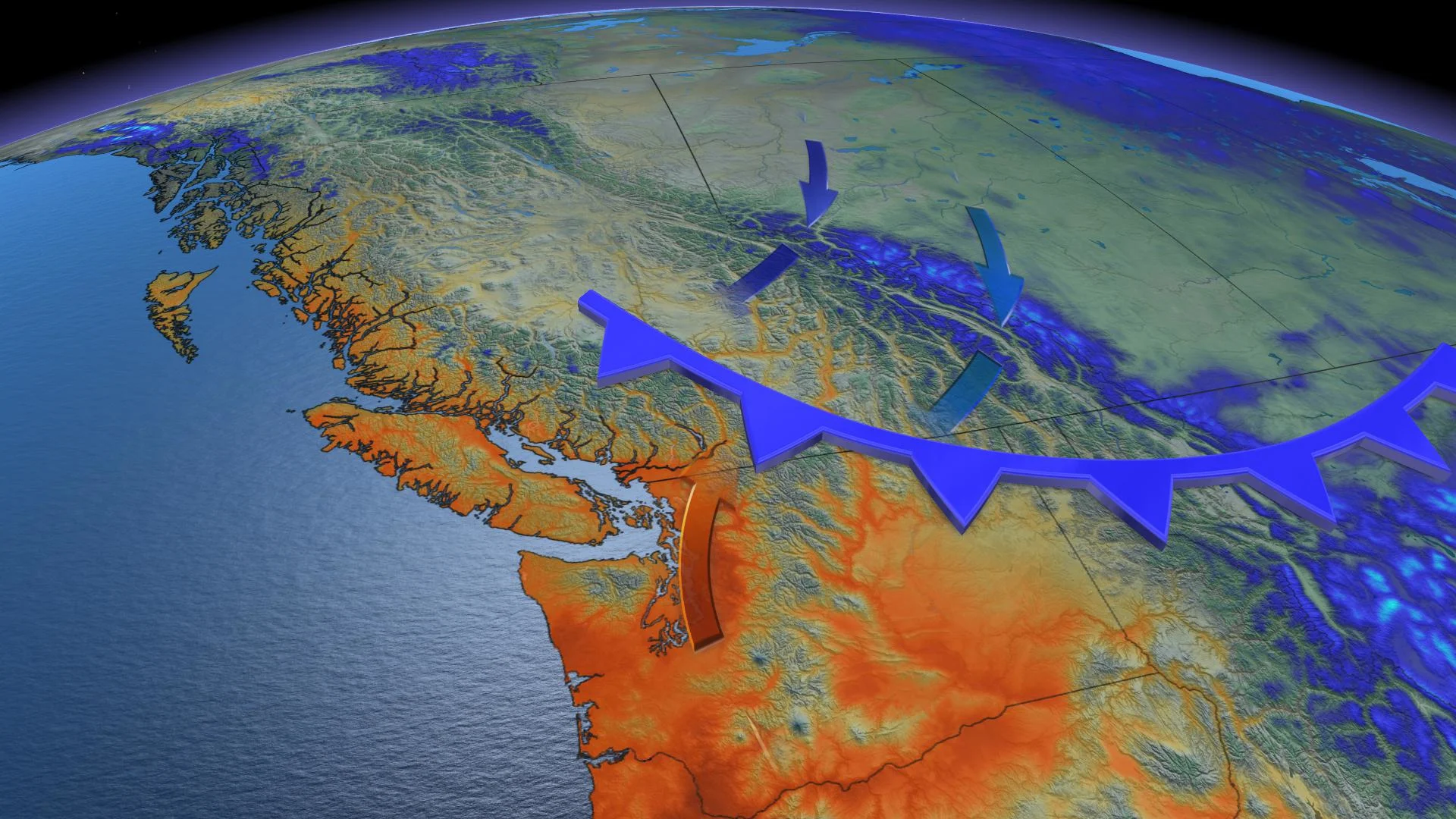
By early next week, a record-breaking ridge that's settled in offshore of the province is forecast to reach peak heights. Current modelling suggests temperatures could be up to 10 degrees above average for some as the atmosphere pushes outside the boundaries of climatology.
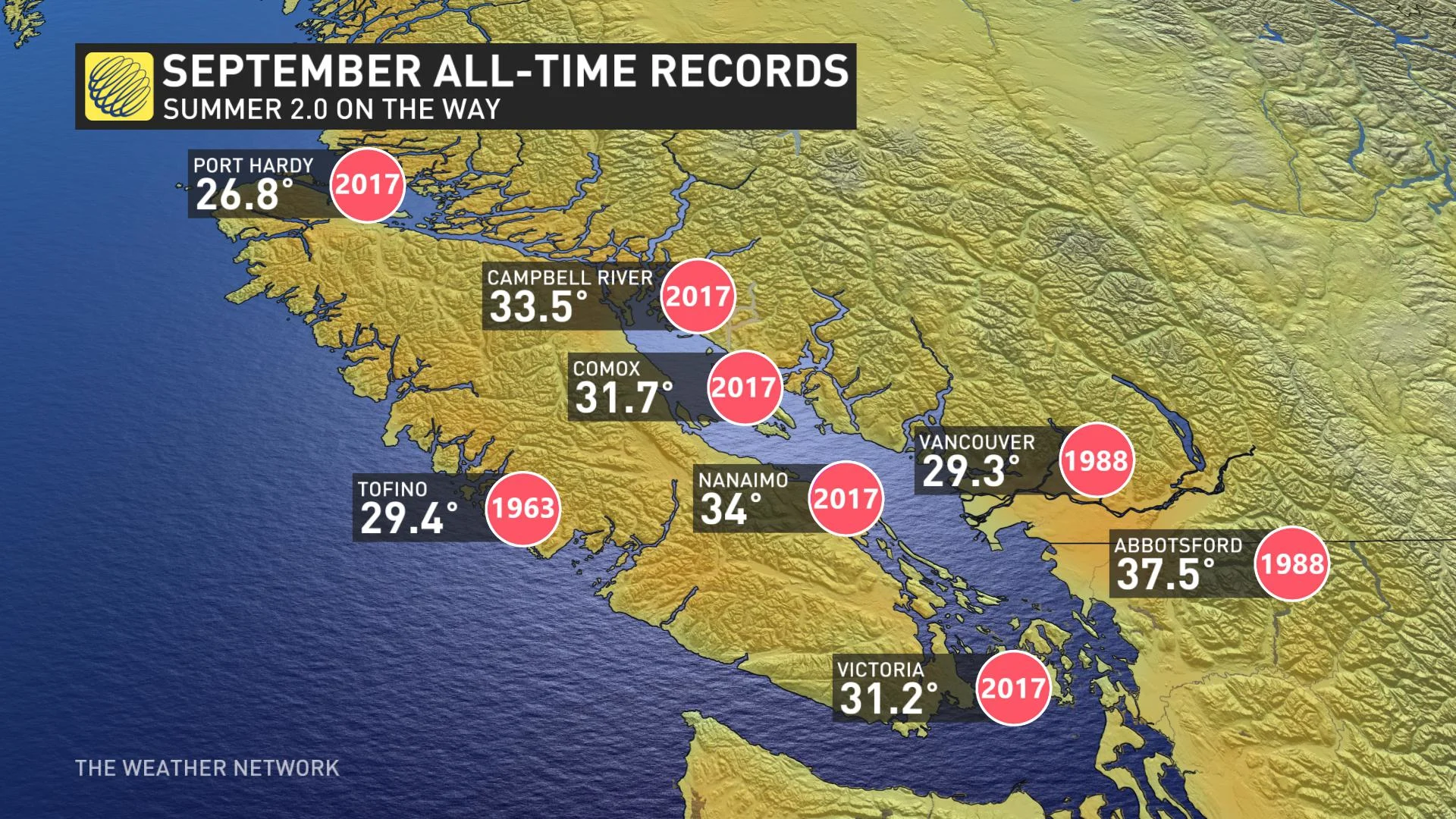
The province’s all-time temperature records for September are tough numbers to beat, as a similar setup in 2017 developed a thermal trough caused by downsloping winds from the higher terrain inland. This pattern is known to bring warm, dry air downsloping towards the ocean; consequently, shutting off the natural air-conditioning – onshore flow and marine air.
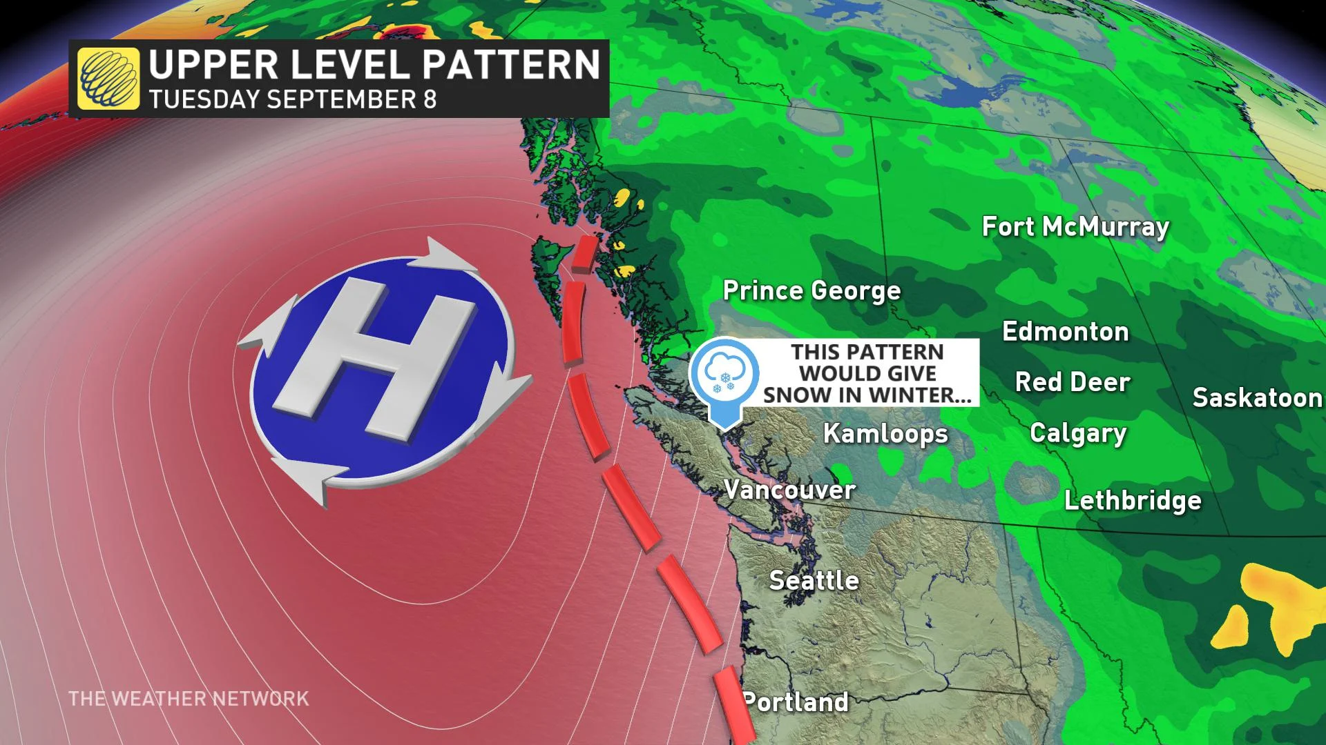
Here’s a fun hypothetical scenario: If this were winter, this same upper air pattern would likely bring low elevation snow down to sea-level. The warm, dry air would be dense, bitter air flowing out of the Fraser River.
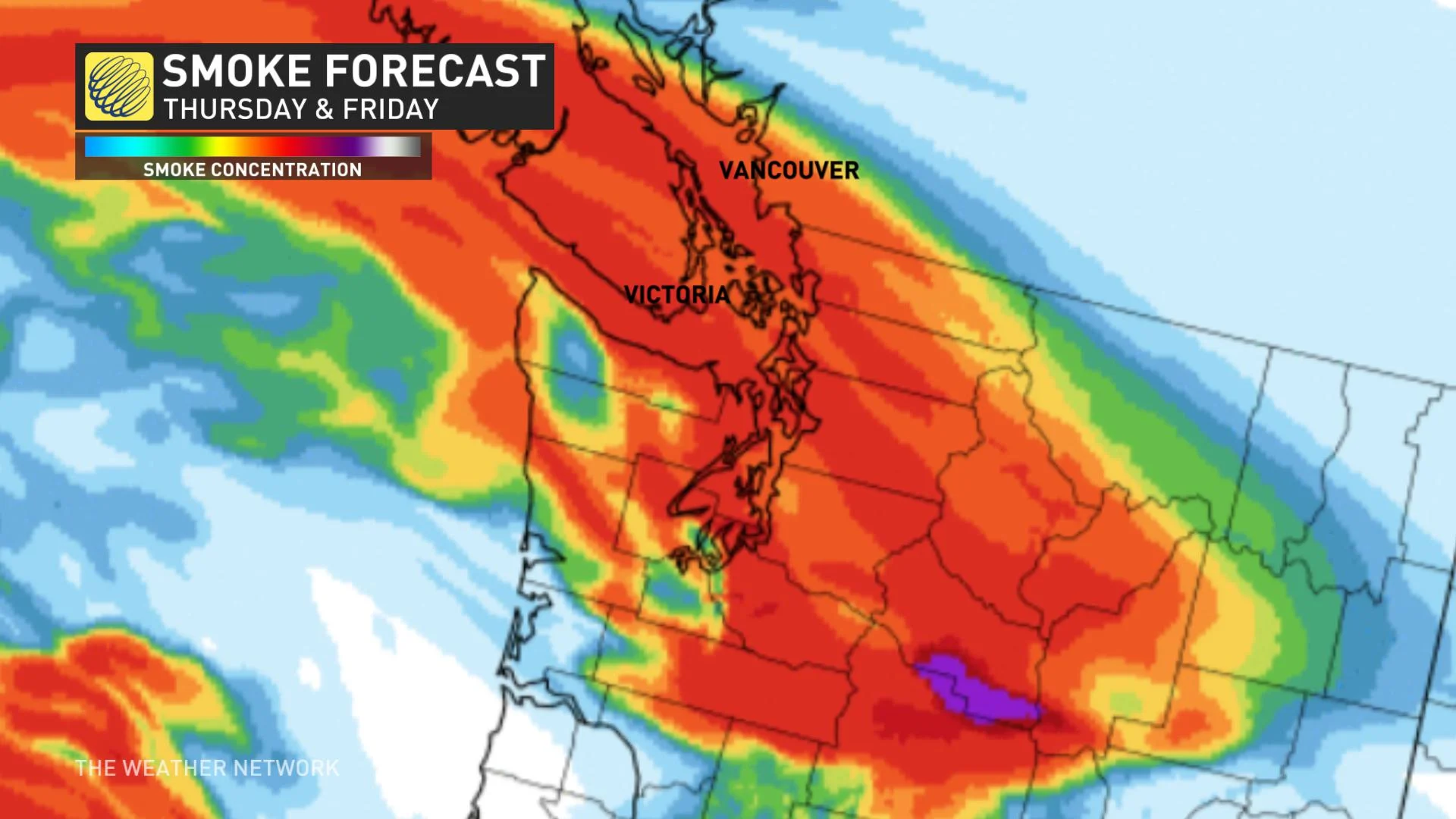
Throughout the summer, the South Coast has dodged the forest fire smoke. The latest smoke models indicate this may change late-Thursday and beyond as the high pressure off the coast of California siphons smoke north.


