March begins with strong winds, rain, and snow in Atlantic Canada

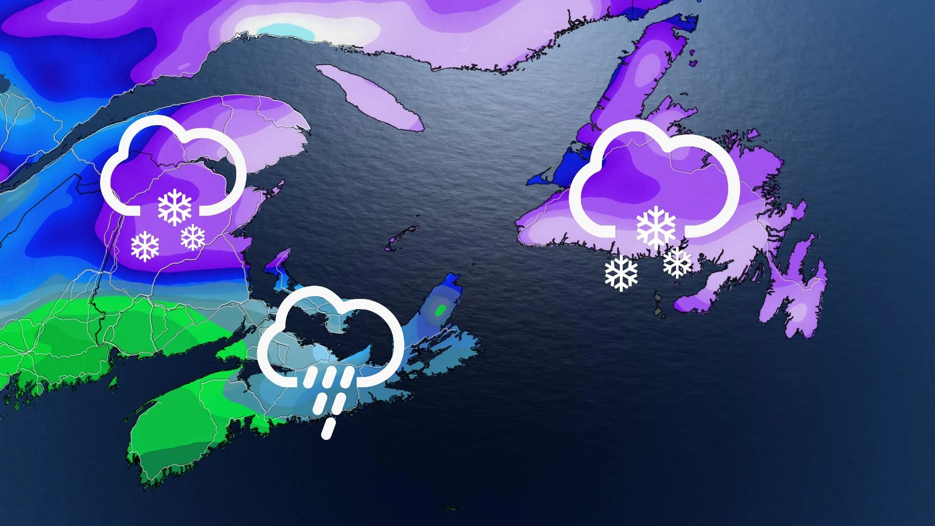
The first day of March will feature powerful winds, snow, and rain in Atlantic Canada. The potent system that is tracking into the region could dump 15-30+ cm of snow to the Gaspé Peninsula and northern New Brunswick while bringing rain to Nova Scotia. Newfoundland will see some of the most extreme impacts from this system, including blizzard conditions and dangerous wind gusts up to 140 km/h. Details and timing, below.
WEATHER HIGHLIGHTS:
Low pressure system begins impacting Maritimes late Monday morning
Heaviest snowfall in northern New Brunswick, eastern Nova Scotia, Gaspé Peninsula
More wintry weather mid-week
MONDAY: SYSTEM BRINGS SNOW, RAIN, STRONG WINDS
The week will begin with active weather in Atlantic Canada due to a low pressure system reaching the Maritimes by the early afternoon hours. Rain is expected for the Bay of Fundy shores and most of Nova Scotia, but some areas will see precipitation begin as a brief mix of rain and snow before showers develop.
Snow that could be heavy at times will develop in New Brunswick, just north of Fredericton during the day. The rain/snow line looks to be setting up and running through Fredericton and Moncton and there will be heavy, wet snow at times for these areas.
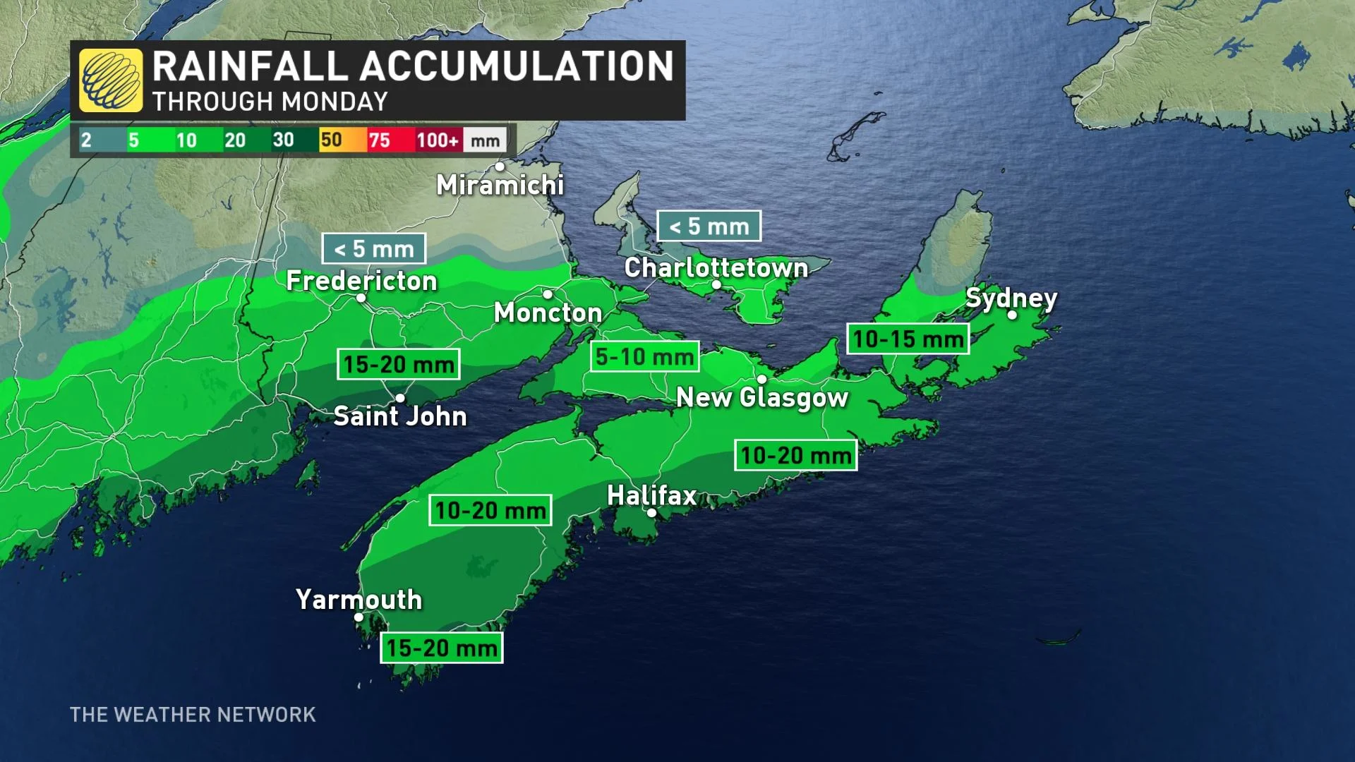
The highest snowfall amounts are anticipated for Cape Breton Highlands, northern New Brunswick, and the Gaspé Peninsula. Roughly 15-30+ cm of snow could fall in these regions through Tuesday. Portions of western P.E.I. may pick up hefty snowfall amounts if the rain/snow line sinks further south at times.
The snowfall will reach Newfoundland during overnight hours on Monday and will continue through early Tuesday morning. There will be a switch to a rain/snow mix at times for southern areas including Burin and the Avalon.
Many regions in Atlantic Canada will experience gusty conditions and the winds will be strongest in the eastern portions of the Maritimes on Monday evening. Strong winds are expected in Newfoundland through Tuesday and blizzard-like conditions are possible for a number of regions.
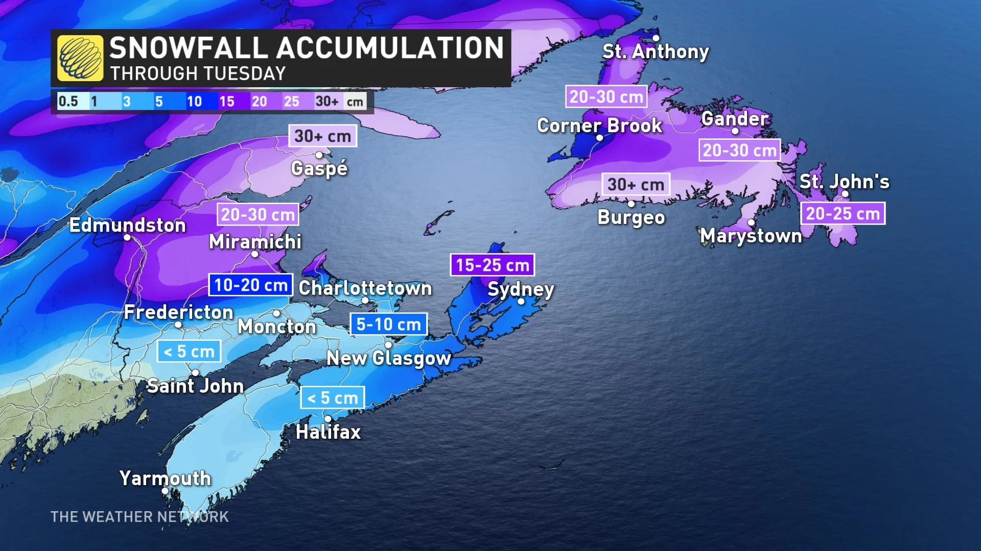
Environment Canada issued blizzard warnings for Burgeo - Ramea and Channel-Port aux Basques and vicinity on Sunday afternoon. Environment Canada states that “travel is expected to be hazardous due to reduced visibility. Visibility will be suddenly reduced to near zero at times in heavy snow and blowing snow.” The blizzard conditions are expected to diminish by Tuesday morning.
The Wreckhouse region will experience powerful winds that could gust up to 140 km/h on Monday evening into Tuesday morning. “Be prepared to adjust your driving with changing road conditions due to high winds. Drivers may lose control of their vehicles; tall vehicles are at risk of being overturned,” Environment Canada warns.
Many areas across the Maritimes will be brushed by light snow throughout Tuesday as this system departs the region.
LOOK AHEAD: ACTIVE STORM TRACK BRINGS ANOTHER WINTRY SYSTEM
Beyond Monday's system, a relatively strong clipper will slowly strengthen as it tracks into the region Wednesday night and Thursday. It is expected to bring 5-10 cm of snow to parts of the central Maritimes including Moncton and Charlottetown, and 5-15 cm for much of Newfoundland, but the snow could change to rain for the Avalon. Rain is anticipated for southern Nova Scotia.
Another messy system is likely for Saturday night and Sunday. It is too early to have confidence in the storm track, but a more northerly track is currently expected, which would bring rain for southern and possibly central Maritimes, but there is the potential for significant snow for Newfoundland.
Be sure to check back for the latest updates on the active weather pattern persisting across Atlantic Canada.