High winds, snow squalls threaten southern Ontario on Saturday

Hold on to your Santa hats: A potent low-pressure system racing through Eastern Canada will make for a very windy Saturday across southern Ontario.
Southern Ontario is staring down its second high-wind event of the week on Saturday as a powerful cold front sweeps through the province.
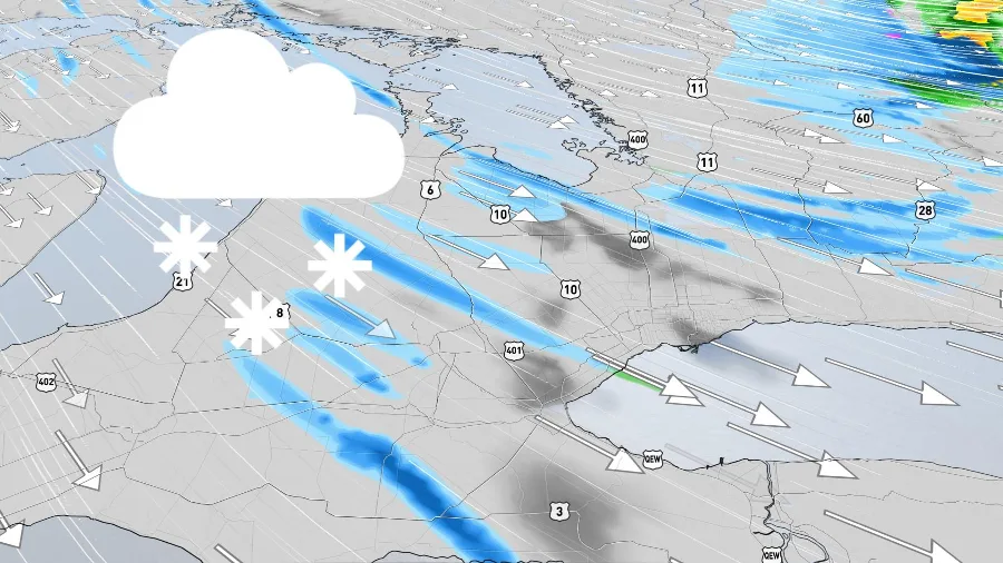
Blustery winds following behind a strong cold front will usher in much colder temperatures, in addition to the risk for snow squalls across the typical snowbelt communities near Lake Huron and Georgian Bay.
Visit our Complete Guide to Winter 2022/23 for an in-depth look at the Winter Forecast, tips to plan for it, and much more!
It’s going to start off on a comfortable note before things get hairy.
Southwesterly winds blowing ahead of the cold front will spread mild temperatures across southern Ontario overnight Friday into Saturday. Widespread rain will build in this slug of milder air, with a few spots possibly even seeing some heavy rain.
Things will take a turn in a hurry as that cold front marches in from the west. Winds will quickly shift toward the northwest and allow colder air to spill over southern Ontario. Gusts could climb as high as 90 km/h for some, potentially leading to wind damage and spotty power outages for some areas.
WATCH: Timing out Saturday's winds across southern Ontario
High winds during the holiday season are especially fraught given the number of outdoor events and holiday decorations dotting the landscape.
Factor the threat for gusty winds into any parades or outdoor gatherings you may have planned. It’s also a good idea to secure or temporarily take down any holiday decorations (especially the inflatables!) before the winds crank up.
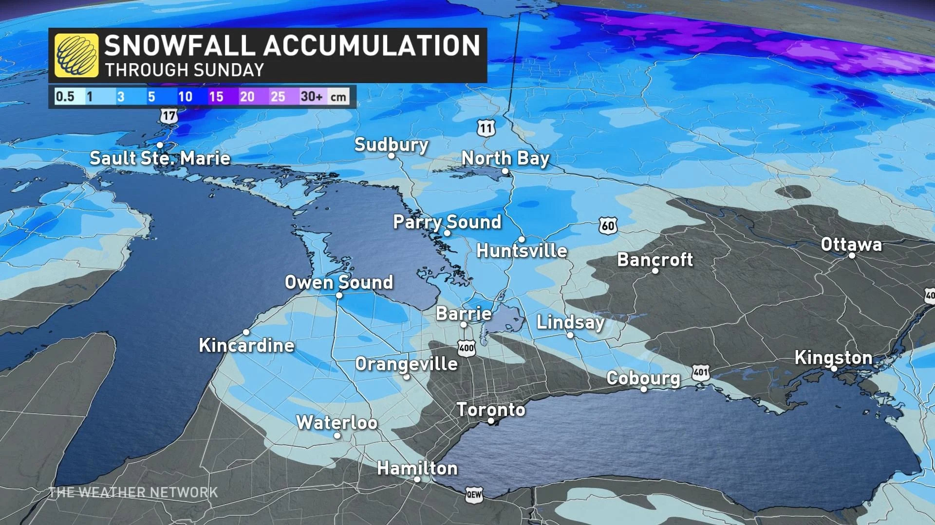
The combination of cold air and blustery conditions will lead to lake-effect snow squalls blowing off of Lake Huron and Georgian Bay.
Heavy snow and gusty winds are a recipe for reduced visibility, potentially making for dangerous travel at times. Visibility can drop rapidly from clear to near-whiteout during a snow squall.
DON'T MISS: Worried about a power outage? How to prep ahead of time
A look ahead to Sunday
Snow squalls may linger for some communities into Sunday morning before finally tapering off.
Once the winds and snow subside, we’re left with a bitter chill to finish out the first weekend of December.
"Sunday morning will be 10-15 degrees cooler waking up in comparison to Saturday morning," says Kelly Sonnenburg, a meteorologist with The Weather Network.
Residents should watch out for slick roads and the possibility of black ice Sunday morning as the temperatures tumble.
Stay tuned to The Weather Network for the latest forecast updates in southern Ontario.