
Ontario storm threat diminishes, cooler pattern setting up

After a stormy night, Wednesday featured some more thunderstorm risk, though an initially severe chance gradually diminished through the afternoon. Once again, areas west of the GTA were quite warm, but the province as a whole is set for a cooler pattern thereafter. For a look at how we finish off April, and start the month of May, below.
WEDNESDAY NIGHT: STORM RISK DIMINISHED
A good chunk of southern Ontario experienced showers and the occasional rumble of thunder Wednesday morning, lasting into the early afternoon in some areas.
Forecasters were looking at some slightly elevated thunderstorm risk for a second round as clouds cleared and daytime heating sent temperatures on the rise, though that risk diminished as the afternoon wore on.
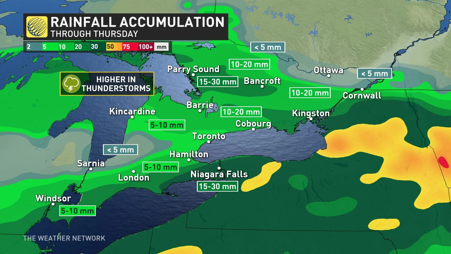
Some showers will linger into the overnight and early morning in some areas and in all, widespread 5-10 mm is anticipated across the south, with as high as 15-30 mm for a swath of cottage country extending into southeastern sections.
As well, winds will be strong Wednesday, in thunderstorms and after the passage of the cold front in the evening. Gusts of 50-70 km/h are expected, though could be stronger in thunderstorms.
The front will move out in the evening, but that won't be the end of the unsettled weather, with more showers and cooler temperatures expected for Thursday.
THURSDAY INTO FRIDAY: WIDE TEMPERATURE DIVIDE CLOSES, COOL START INTO MAY
Once that front moves out, more showers and a cooler pattern are ahead, beginning Thursday, when temperatures will take a noticeable dive in the southwest, with cooler daytime highs continuing across the south into the weekend and as we start the month of May.
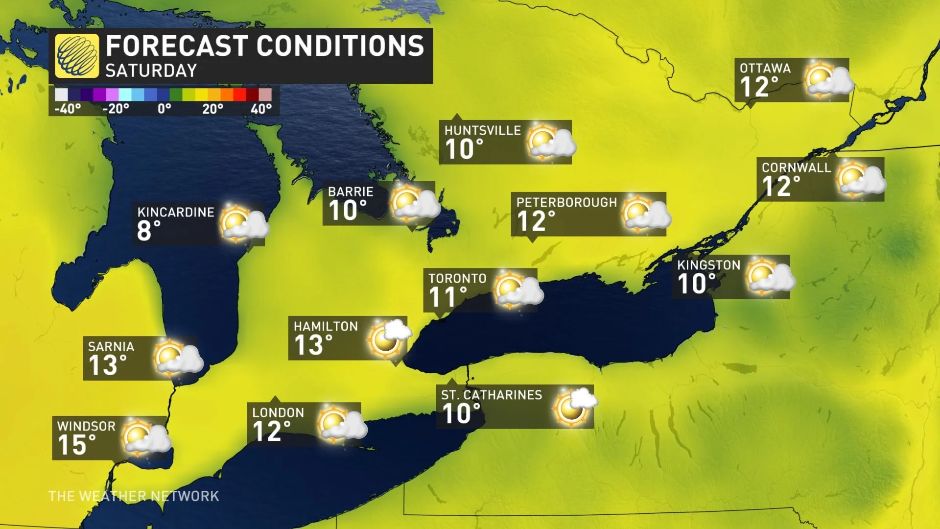
As well, a system tracking south of the border will bring in another bout of showers to southern Ontario, especially in southwestern sections and the GTA. Friday will see more chilly temperatures and showers as the month comes to a close. Conditions will be fair for Saturday.
A tricky forecast for Sunday with a warm front anticipated to push into the region, depending on how far north it can advance.
"A few days of warmer weather are possible next week, but it looks like this region will struggle to see consistent warmth through early May," says Dr. Doug Gillham, a meteorologist at The Weather Network.
Be sure to check back for updates on the spring temperature rollercoaster across southern Ontario as we head into May.


