
Strong storm risk for Ontario, heat holds on for one more day

Welcome relief from the intense heat and humidity is in sight for Ontario, but not without storm risk. Some storms will already be ongoing through the morning hours in the southwest, but it's eastern Ontario where the most severe potential will be located. A deeper look at that storm risk, and what's beyond, below.
WEATHER HIGHLIGHTS
Slight break in humidex Tuesday, but still hot, especially in the east
Cold front to trigger storms through the afternoon, strongest in the east
Break from humidity for the rest of the week, feeling seasonal
Keep on top of severe weather ALERTS in your area
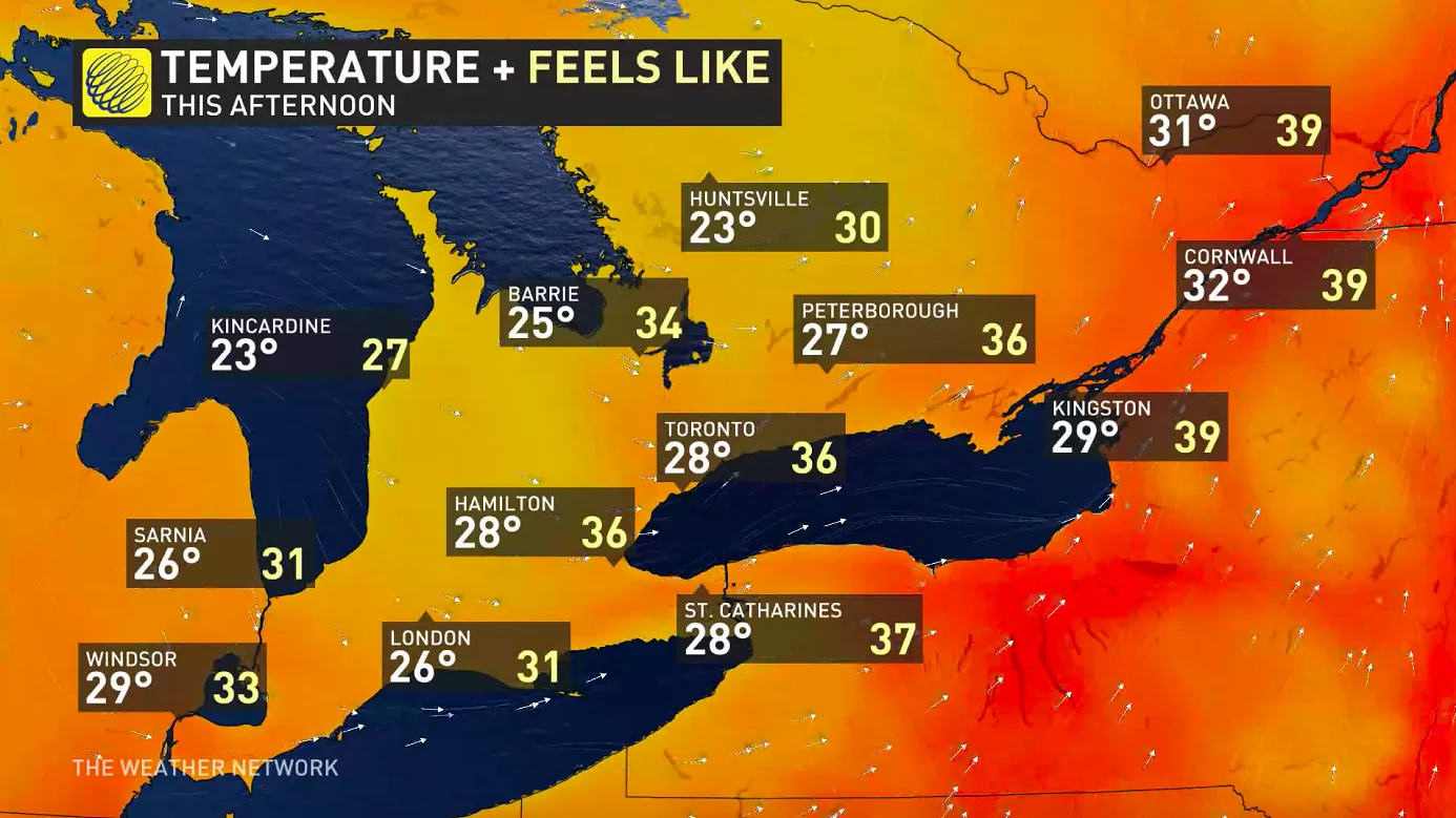
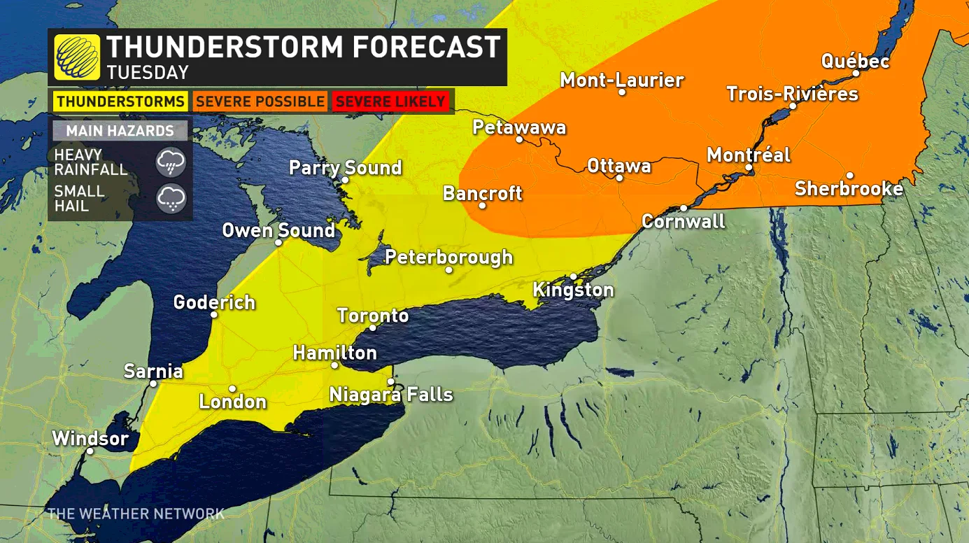
TUESDAY: SEVERE STORM RISK IN EASTERN ONTARIO
Heat warnings have dropped for many parts of the province, lingering only in the east, where daytime highs in the low 30s will feel seven or eight degrees higher with the intense humidity.
The rest of the province has already started to see a break from this latest heat episode, thanks to a cold front that began moving through overnight. Parts of the southwest will feel no warmer than the low 30s, and the GTA's humidex will be limited to the mid-30s -- a slight, but notable relief from the past few days, where it's been feeling closer to 40.
That cold front will be behind the storms many will be seeing Tuesday, and indeed, parts of the Bruce Peninsula were already hearing a few rumbles in the early morning hours.
There's a chance of at least non-severe storms over most of the province by the afternoon, though most people in the GTA won't see one, and it's eastern Ontario where the main focus will be. Storms that fire up there in the afternoon will feature heavy local downpours, and perhaps small hail as well.
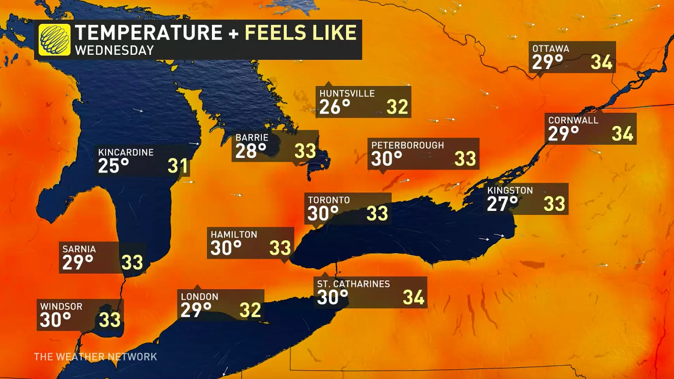
WEDNESDAY AND BEYOND: SEASONAL TEMPERATURES SETTLE IN
That cold front will have swept the last of the humidity out of the province overnight, and though daytime highs will still be at or near 30°C across the board Wednesday, it'll only feel three or four degrees hotter with the humidex -- hot, certainly, but markedly down from Monday's peak.
Daytime highs gradually drop into the mid-20s through the week, though still feeling like the low 30s, and possibly up to the mid-30s again on the weekend. Beyond, the early part of next week may finally see a break from above-30 humidex values, but it's best to check back as this week progresses.
Keep an eye on the forecast as we continue to monitor Ontario's weather outlook.


