Showers and thunderstorms dampen summer vacation kick off in Ontario, Quebec

Vacation alert: Some disappointing weather news for those ready to kick off some summer vacation time next week.
Though the sun will break through from time to time, the days to come will be gloomy and wet for most of Quebec and Ontario. Friday's rounds of showers were a herald for more of the same across both provinces this weekend, with thunderstorm risk, some of it severe, creeping into the forecast. Beyond, the week to come, a popular one for vacationers, will also feature showers. More details on these rounds of rain and storms that persist into the start of July and when to expect the consistent summer heat to build back in, below.
Visit our Complete Guide to Summer 2021 for an in-depth look at the Summer Forecast, tips to plan for it and much more!
THIS WEEKEND: HIGH HUMIDITY, PERSISTENT RAIN THREAT
The leadup to the weekend was warm and sunny, but those clear skies had already clouded over by Friday, which was marked by what will prove to be the first of many rounds of showers.
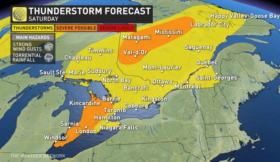
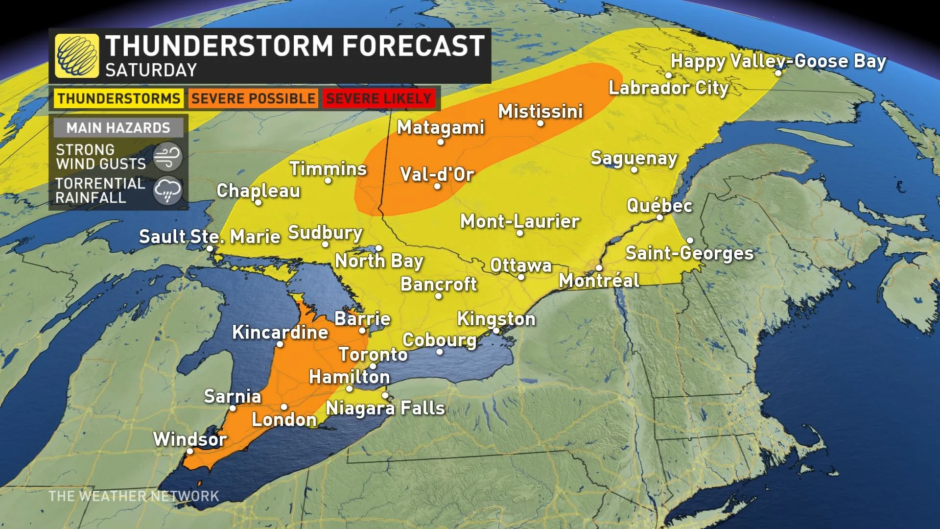
Up ahead, a potent system that will track into the Great Lakes region and then into western Quebec this weekend will bring periods of rain and thunderstorms, some of which could turn severe – with the first round already moving in Friday evening and Friday night.
There will continue to be a threat for showers and thunderstorms during Saturday, along with very humid conditions, but there will be periods of dry weather as well when you will be able to get outside to enjoy the warm temperatures, especially across the south.
Another round of widespread rain and thunderstorms is expected for Saturday night, especially for areas north of Toronto, Ottawa and Montreal. This includes Muskoka, Haliburton and Algonquin Park.
The heat and humidity will build through Sunday, with a humidex near 40 expected.
There will be the threat for passing thunderstorms throughout the day across both provinces.
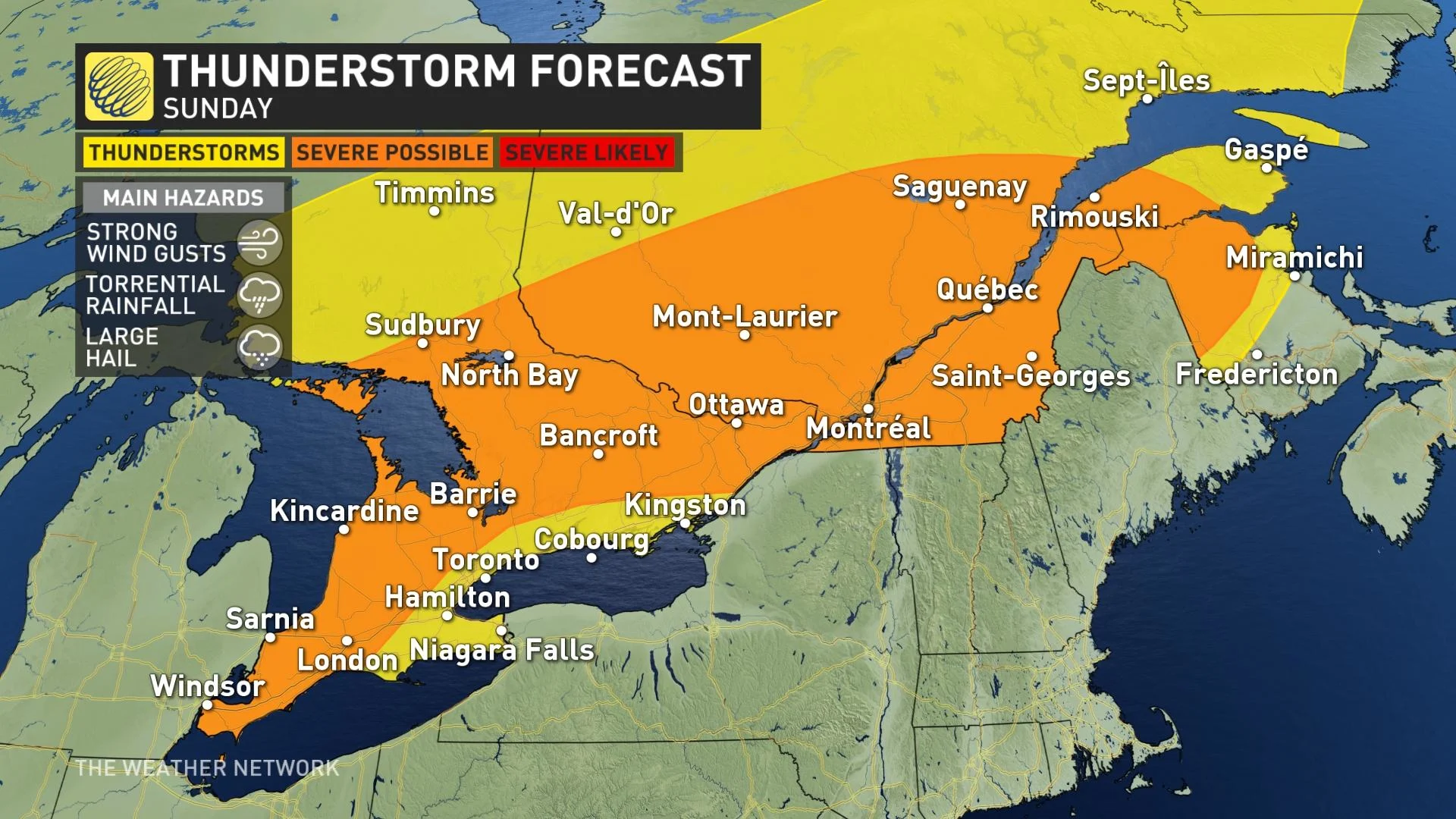
Compared to Saturday, the risk of Sunday's storms turning severe is more widespread, with only the areas nearest Lake Ontario, including the GTA and Niagara Region, holding the lowest risk.
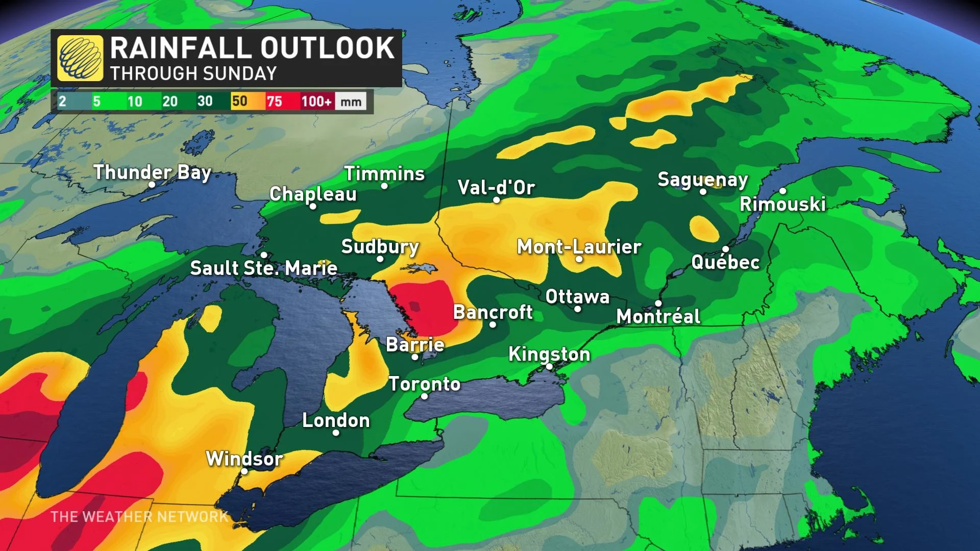
In all, between showers and locally higher downpours in thunderstorms, most of southern Ontario is in for a fair soaking throughout the weekend.
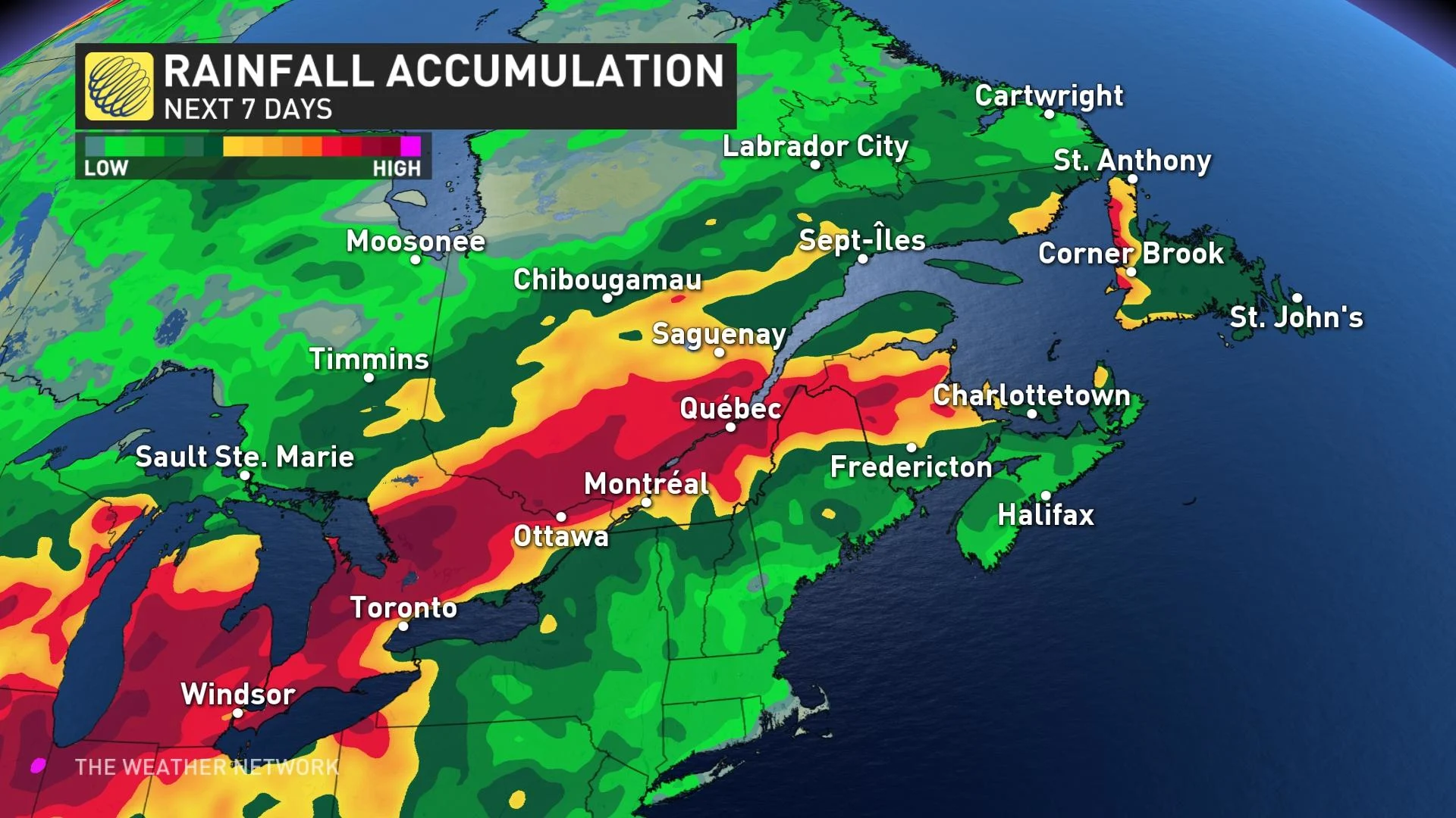
VACATION ALERT: STALLED BOUNDARY LEADS TO SWATH OF HEAVY RAINFALL THROUGH NEXT WEEK
Warm summer weather is likely next week, but that will come with an ongoing threat for more unsettled weather, as an active storm track develops along the stalled boundary. Despite a bit of a lull in the stormy pattern for the early part of the week, more widespread showers and thunderstorms return by mid-week, possibly impacting vacation plans and the Canada Day holiday.
There will be a daily threat for rain and thunderstorms, with many places seeing more than a month's worth of rain fall over the week. Much of cottage country, Haliburton and Algonquin Park, and into western Quebec, could see as much as 80-150 mm of rain throughout the next few days.
"Of course this is disappointing news for those on vacation, however, there will also be periods of dry weather with sunshine and warm temperatures," says Dr. Doug Gillham, a meteorologist at The Weather Network. "So, it will not be as miserable as it may look if you just quickly glance at the weather icons in your forecast for the week."
Despite the vacation disappointments, this will have a positive impact on agriculture, as these drought-busting rains will wipe out the June deficits. It will also help to temporarily alleviate the forest fire concerns.
A period of very warm and drier weather looks to return across the region for the week after Canada Day.
Be sure to check for the latest updates on the weather in your area.