
Severe storm risk in Ontario as the week begins before humidity builds

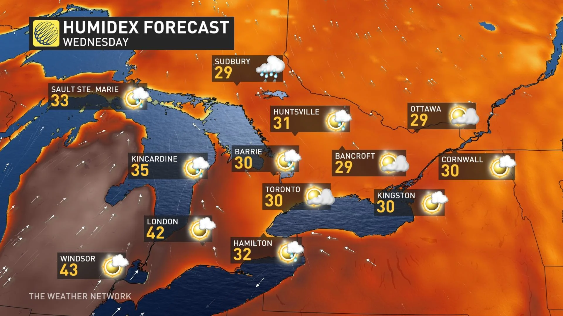
Humidity will climb during the week and some places in Ontario could see humidex values in the 40s.
While Monday will be a pleasant day for the region, southwestern Ontario could be on the tail end of a mesoscale convective system (MCS), which is a cluster of organized thunderstorms, during the overnight hours as it tracks through the U.S. Midwest.
Visit our Complete Guide to Summer 2022 for an in-depth look at the Summer Forecast, tips to plan for it and much more!
The MCS is a conditional threat that depends on the timing of a disturbance as it rounds the ridge of high pressure responsible for extreme heat across much of the continental U.S.
“The main threats include damaging winds, torrential rain, and small hail if the convective system swipes southern Ontario,” explains Tyler Hamilton, a meteorologist at The Weather Network.
Some questions remain about how far north the instability and warm front will push, which dictate the track of the system.
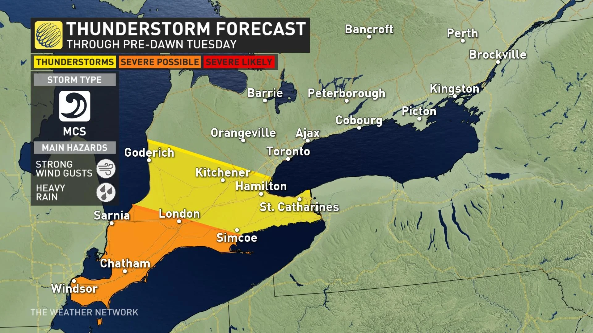
If the MCS does impact the region, there could be rain and severe storms in areas near the U.S. border and along the western Lake Erie shores into the pre-dawn hours Tuesday morning.
Additionally, a building heat wave south of the border will begin to influence our weather this week.
Several days of above-seasonal temperatures are likely next week across southern Ontario and Quebec, with daytime highs in the upper 20s to near 30 possible in some areas. The humidity will build and parts of southwestern Ontario could see humidex values spill into the 40s.
DON’T MISS: Father's Day creeping up on you? Consider these five gifts
Easterly winds off Lake Ontario would likely keep the Greater Toronto Area cooler mid-week.
The warmth could also fuel thunderstorms at times next week.
We’re also watching the timing of a cold front toward the end of next week that’ll help push back the heat and bring down temperatures heading into next weekend.
Thumbnail courtesy of Hayley Lounsbury, taken in Port Stanley, Ont.
Stay tuned to The Weather Network for all the latest on conditions across Ontario.