B.C.: Storm track guarantees soggy end to January

So far, Vancouver has chalked up only one day in January without measurable precipitation, and if the active storm track has anything to say about it, that one day will stand alone at the end of the month. Rounds of rain and snow continue this week, with bursts of strong wind accompanying the stronger systems. We take a look at what the rest of the month has in store below.
WEATHER HIGHLIGHTS:
Pattern of rain and snow continues for rest of month
Gusty winds through straits at times as systems move onshore
Relatively high freezing levels mean decent alpine snow through mid-late week
Stay aware of ALERTS in your area
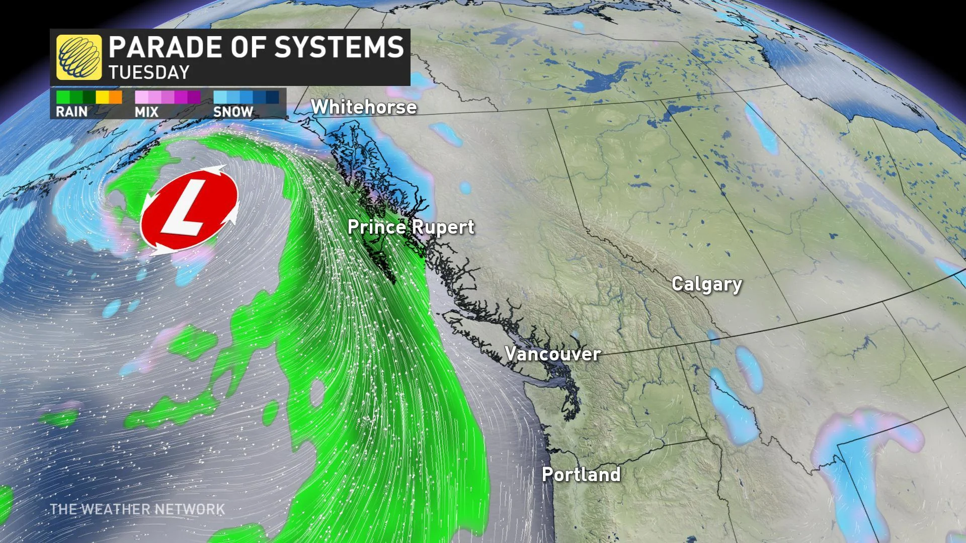
MONDAY/TUESDAY: BRIEF DRY BREAK, HEAVIER RAIN FOR THE COAST
After another soggy weekend that brought rounds of rain and powerful winds, the first part of Monday holds the promise of the longest dry spell of the week for much of the Lower Mainland and southern Vancouver Island. Even so, this pattern means that dry spell will be measured in terms of hours rather than days -- the next round of moisture is poised to move into the coast later Monday afternoon and evening and through Tuesday morning.
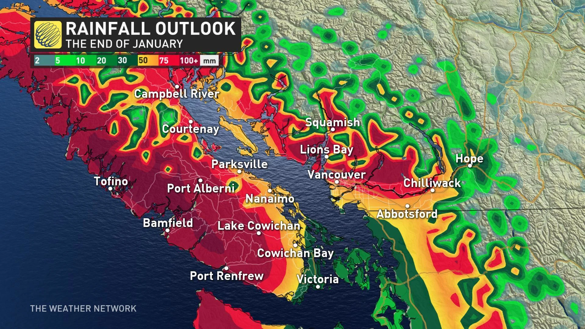
MIDWEEK THROUGH THE END OF JANUARY: SOGGY WRAP-UP TO THE MONTH
With little change in the pattern expected for the rest of the week, more of the same is ahead to close out January.
As much as 100+ mm of rain is on the way for the western side of Vancouver Island, with lesser amounts on the rain-shadowed east side. A similar pattern is expected over the mainland, with 50+ mm anticipated for much of Vancouver, and significantly higher amounts into mountains.
Forecasters are also watching a potent system for later in the week as it taps into subtropical moisture and brings heavy rain and mild temperatures to the South Coast on Friday and Saturday.
Stay with us here at The Weather Network for your latest forecast updates.