
Ontario storm risk rises as intense humidity and heat surge in

The heat is on the rise in southern Ontario, with some areas feeling closer to 40 than to 30 into the early part of the coming week. That humidity is a prime ingredient in storms, and there will be scattered risk for the next little while, with a touch of severe potential for Sunday. A closer look, below.
WEATHER HIGHLIGHTS:
Some chance of severe storms in the southwest Sunday
Storm risk shifts to the north and Nickel Belt Monday, unsettled through Tuesday
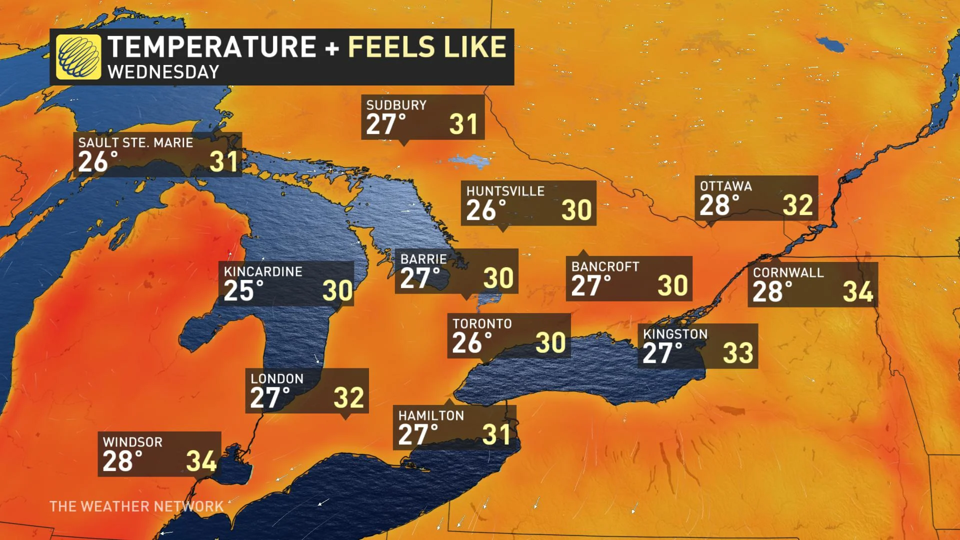
Intense humidity eases beginning Wednesday
Keep an eye on weather ALERTS in your area
SUNDAY: STRONG STORMS POSSIBLE, HEAT INCREASES
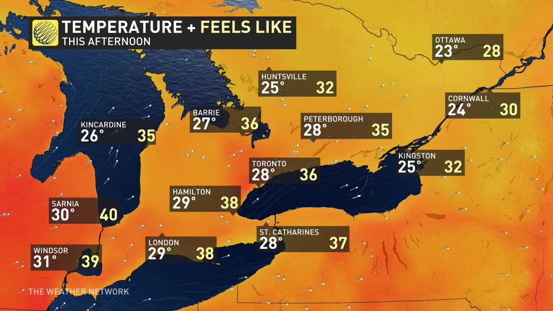
Sunday looks to continue this latest round of heat wave conditions for southern Ontario, with heat warnings in effect for southwestern Ontario and the entire Greater Toronto Area. Temperatures become more bearable the further easy one goes.
People who plan any outside activities in the afternoon should prepare to stay hydrated and stick to the shade if they can, with daytime highs in the low 30s feeling near 40 with the oppressive humidity.
That heat and humidity, as always, are prime ingredients for storms with the right trigger, and the province can expect a couple of rounds through the day, depending on location.
Round one will feature popup storms through the morning into early afternoon for the southwest, and it is there where there is the most severe potential, with the main risks being strong wind gusts and heavy local downpours.
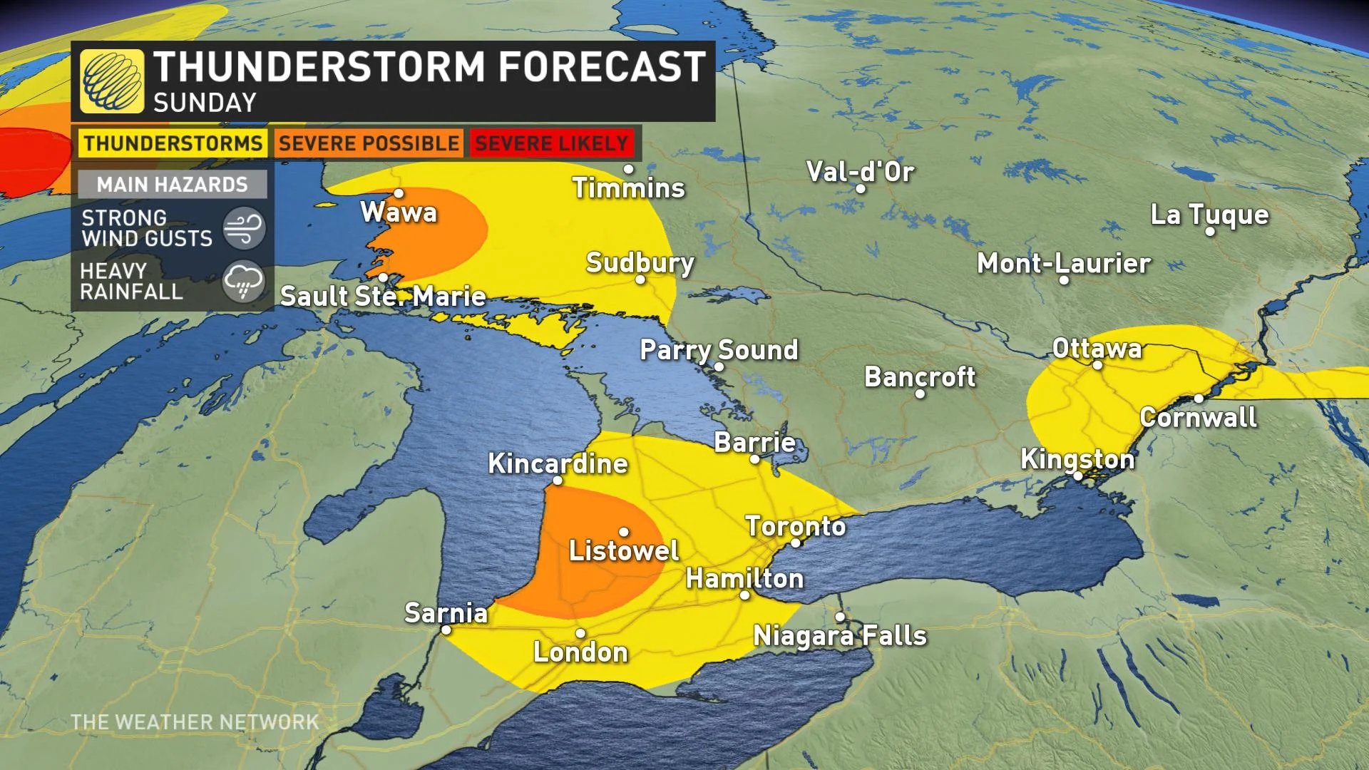
For the afternoon and early evening, eastern Ontario may see a few storms here and there, though with less humidity to work with, they should remain non-severe. The southwest may also see a few popup stragglers over the same time period.
NEXT WEEK: STORMS LINGER, HEAT PEAKS, PROLONGED WARMTH BEYOND
More storm risk looks to start off the workweek, though presently, the risk zone looks to shift mostly to northern Ontario and the Nickel Belt, though some of the south, particularly cottage country eastward, along with the shores of Lake Huron and Georgian Bay, may see an isolated storm or two through the afternoon.
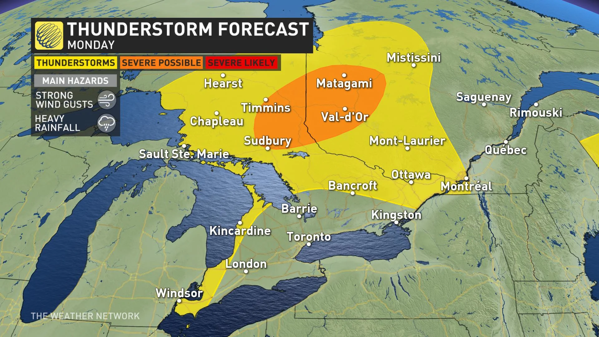
In fact, the early half of the week will remain relatively unsettled, with much of the south of the province likely to see a shower or two. Not a prolonged deluge by any means, but enough to hopefully offset the arid effects of the accompanying hot temperatures on crops and yards.
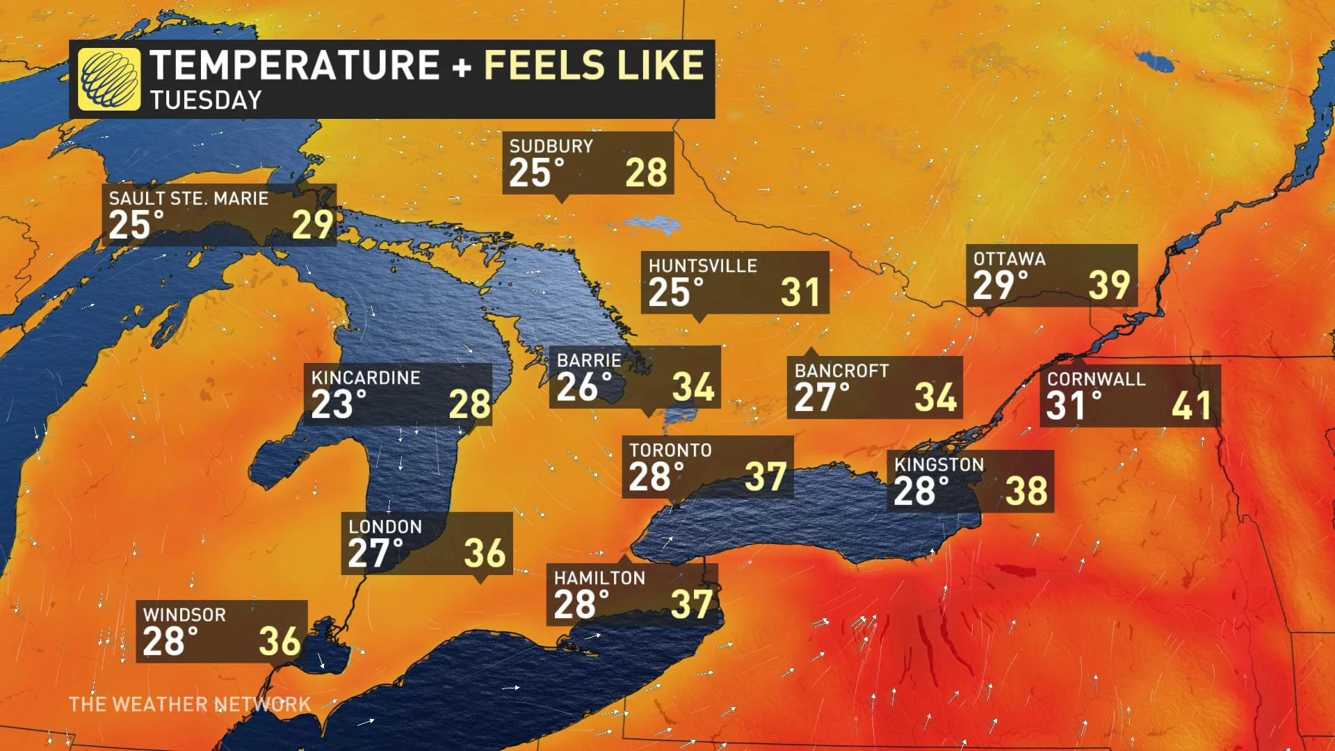
As for those temperatures, they look to remain intense. By Tuesday, widespread daytime highs at or near 30°C will feel more like the mid-to-high 30s, though by then it will be eastern areas that will be on the higher end of that range.
Beyond, however, people across the south can finally look forward to relief, or at least, as much as can be expected at peak summer.
By Wednesday, much of the humidity will have cleared out, such that daytime highs won't have come down much from the high 20s, but will feel at or just a smidgeon above 30 for most places.
Temperatures and humidity look to be a little higher by the following weekend, but nowhere near as uncomfortably torrid as this weekend and the earlier part of the week.
Check back as we continue to monitor the forecast.