A storm that died in the Bering Sea could draw Hurricane Fiona towards Canada

Remnant energy from Typhoon Merbok has the potential to pull Hurricane Fiona closer towards Canada this week
Have you heard of 'the butterfly effect?’ If not, it boils down to this: a small, seemingly unimportant event can have far-reaching future consequences. This is how one ex-typhoon that churned 10,000 km away will impact Canada this week.
MUST SEE: Canada, a perfect storm is about to change your September
Last week, a destructive low pressure system in the Bering Sea was fuelled by the remnants of Typhoon Merbok, which sent a ripple effect across the jet stream.
Forecasters initially thought the storm's only influence would be temperatures by carving out warm and cool pockets across Canada. However, it is now increasingly likely that Typhoon Merbok will indirectly alter Hurricane Fiona in the Atlantic Ocean some two weeks later and 10,000 km apart.
Here is a look at how the powerful storm developed in the North Pacific:
September 9th, 2022: The Japanese Meteorological Agency began tracking a weak tropical depression meandering in unusually warm waters in the North Pacific Ocean.
September 14th, 2022: Typhoon Merbok took a peculiar track due north, intensifying as it continued towards the Bering Sea, on course to become the strongest storm since 2011 for Alaska due to supercharged sea surface temperatures.

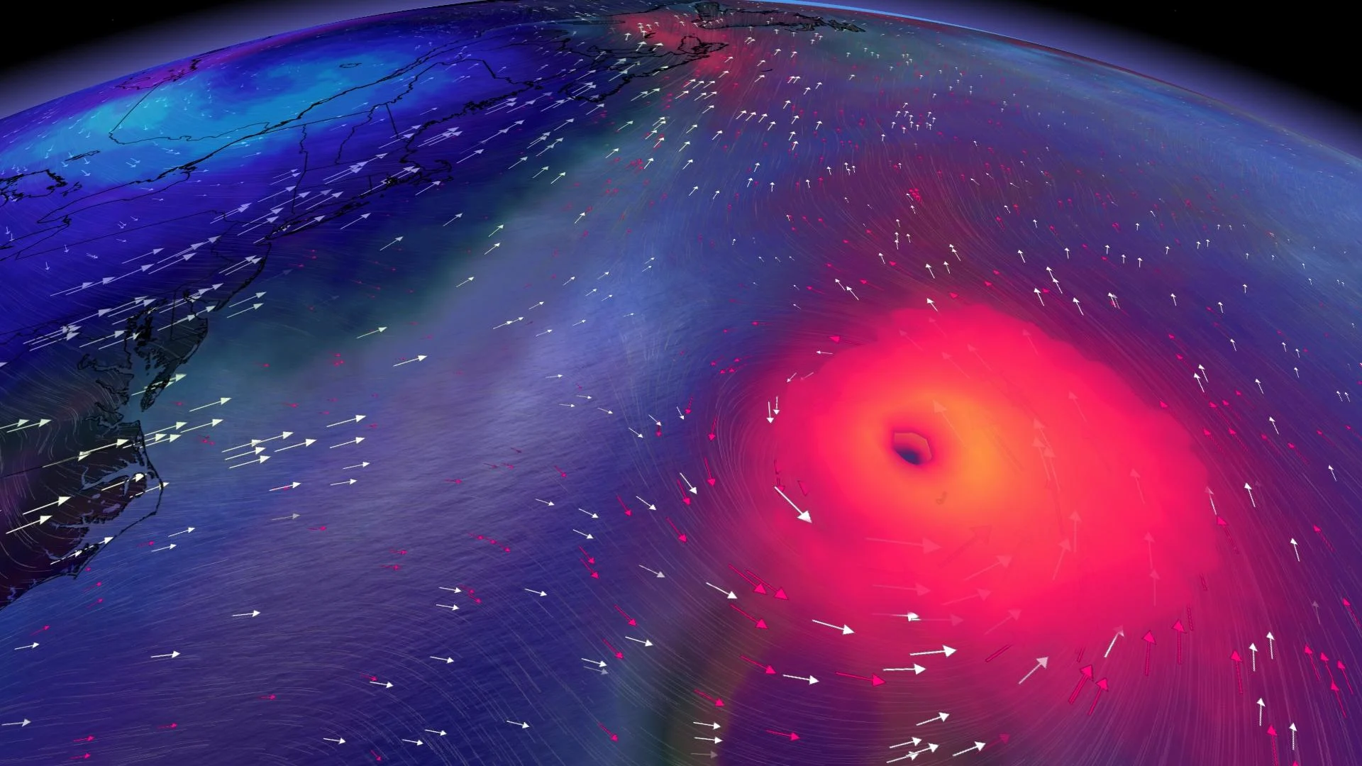
September 17th, 2022: Tremendous storm surge, catastrophic flooding, large waves, and power outages battered Alaska as ex-Merbok deepened to a formidable mid-latitude cyclone with widespread damage reports in Nome, Alaska.
The remnant typhoon energy aloft dipped across a ridge in the eastern Pacific Ocean and then carved a trough that will move across the Prairies early this week. This means that cold air is drawn down from the Arctic and could result in snow on the peaks of the Rockies. The cool air will continue to steamroll east, triggering a fall-like cooldown across eastern Canada.
By Thursday, the core of the trough will travel over Ontario and Quebec, with Hurricane Fiona a couple of thousand kilometres towards the southeast. This presents an immense problem that comes down to timing.
RELATED: Hurricane Fiona makes landfall on Puerto Rico, knocking out power to island
A delicate but high-stakes dance will take place with the upper trough attempting to capture and pull the hurricane towards Atlantic Canada late week.
If the trough picks up speed, the impacts across Atlantic Canada will be negligible. We would watch as Hurricane Fiona recurves harmlessly out to sea, steered northeast by the trough.

If the trough takes its time traversing the continent, it would hang back and slingshot Hurricane Fiona closer towards Atlantic Canada.
All this is thanks to a typhoon that developed on September 9th, two weeks before this critical weather maneuver. No Merbok? That would have likely meant no appreciable trough.
This forecast is sensitive to subtle changes, so please check back frequently for important updates.