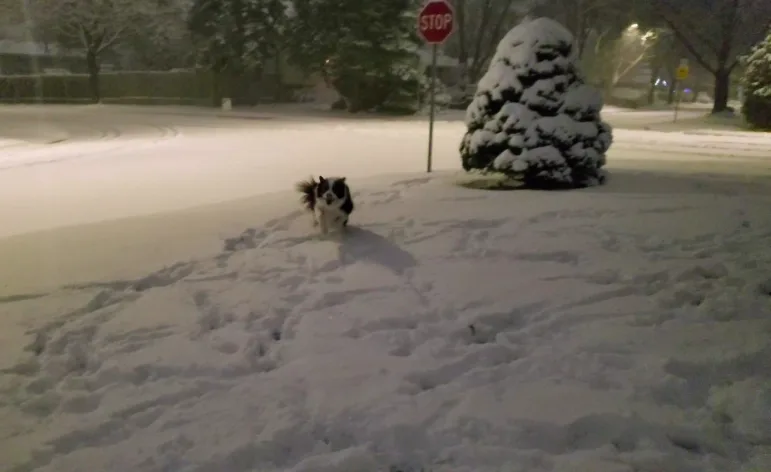
10-20 cm of snow blankets the GTA, heavy rain falls in eastern Ontario

Many in southwestern Ontario and the GTA are waking up to a white Christmas, while folks in eastern regions of the province are seeing heavy rainfall. Snow squalls are forecast to develop through Friday evening and continue through Saturday. The greatest impact is expected for Grey-Bruce and Simcoe County, but there is the potential for western GTA to see a bit of the squall if it can gain some strength from Lake Superior. Details and timing, below.
WEATHER HIGHLIGHTS:
Snowfall for Toronto and southwestern Ontario early Friday
Heavy rain for Ottawa, Kingston, and other areas in eastern Ontario
Snow and rain ease Friday afternoon, but a lake-effect snowfall just around the corner through Sunday
FRIDAY: SNOW, RAIN, AND ICE
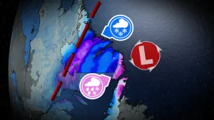
Parts of eastern Ontario will face 30-60 mm through Friday. Rainfall and freezing rain warnings are in effect for the aforementioned region.
“Heavy downpours can cause flash floods and water pooling on roads. Watch for possible washouts near rivers, creeks and culverts. Keep children and pets away from creeks and river banks,” Environment Canada warns.
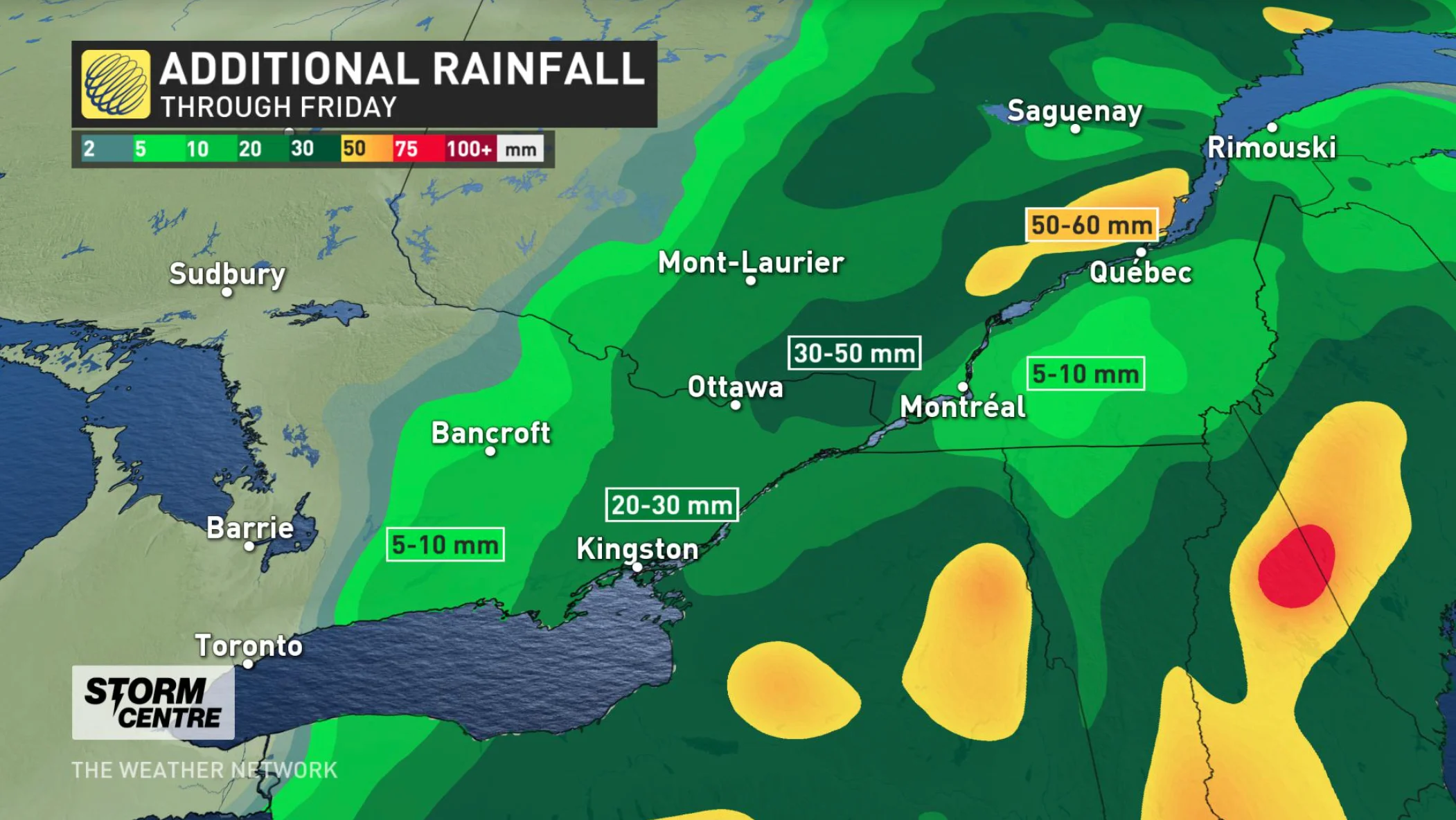
Environment Canada issued a winter weather travel advisory for the GTA and other parts of southern Ontario due to the poor winter road conditions, black ice, and accumulation snow. The road conditions are expected to be hazardous through Friday evening.
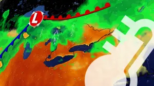
"There will be a very tight gradient in snow totals on the eastern side of the cold air boundary, and the exact position of this gradient is still uncertain, especially for areas east of the GTA," The Weather Network meteorologist Michael Carter says.
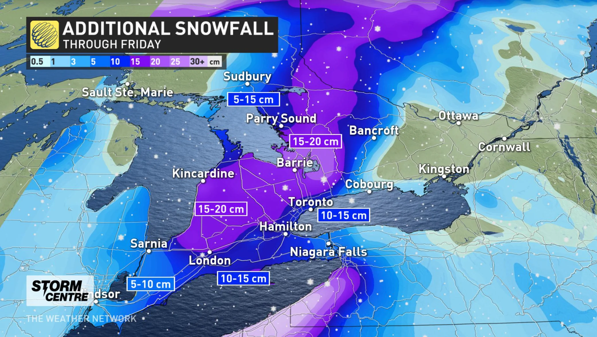
There still may be some of the messier overnight weather for the GTA. The freezing rain and ice pellets turn into snow overnight, but the transition line will continue into the pre-dawn hours Friday morning.
Even after the system snow comes to an end, Christmas Day will be blustery and cold under the influence of Arctic air, with lingering flurries and bursts of lake-effect snow expected for the usual snow belt areas and GTA.
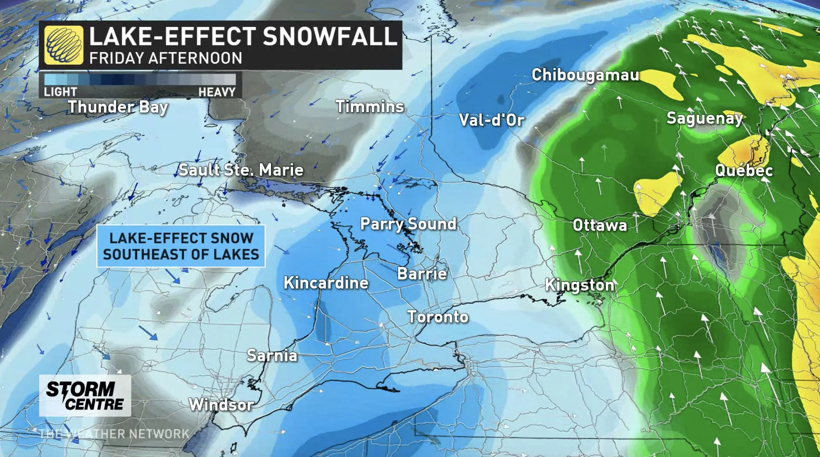
Temperatures will remain chilly on Boxing Day, with bands of lake-effect snow continuing through the day for areas southeast of Georgian Bay and Lake Huron. The GTA could see some flurries into the afternoon.
Sunday will see the fair and seasonal conditions return, but forecasters are watching the potential for widespread snow early next week across southern Ontario and into southern Quebec.
LOOK AHEAD: POTENTIAL FOR MORE MESSY MIX OF RAIN AND SNOW
Beyond the weekend, a significant system will track into southern Ontario from the upper Great Lakes with primarily rain and a mix of rain and snow for central and eastern areas. The exact storm track is still uncertain, but significant snow could extend further south to areas just north of the GTA, and into Ottawa and Quebec City.
A messy storm is expected to track into the upper Great Lakes for New Year’s Eve and Day with a second low developing and moving into the northeastern U.S. It is too early to know the exact track and impacts, but at this point, it looks like southern Ontario will see some snow, ice and rain – but rain looks to be the dominant precipitation type at this time.
WATCH BELOW: MUST-HAVE WINTER CAR EMERGENCY ITEMS
Thumbnail credit: Matt Grinter