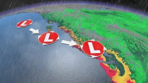
Flood risk rising in B.C. as province may see wettest June in a decade

The threat of flooding is keeping several communities in B.C. on high alert, with rain continuing through Sunday. Flood watches and high streamflow advisories remain in place. As well, a general non-severe thunderstorm risk is present Sunday for parts of the South Coast and northern B.C. with an upper trough hovered over the province. Some areas could still see 20-40 mm of rain before it tapers off by Tuesday. Less than a week into the month, it could end up being the wettest June for B.C. in a decade. More on what to expect on Sunday and beyond, below.
Visit our Complete Guide to Summer 2022 for an in-depth look at the Summer Forecast, tips to plan for it and much more!
SUNDAY/MONDAY: HIGH ALERT FOR FLOOD THREAT AS RAIN CONTINUES
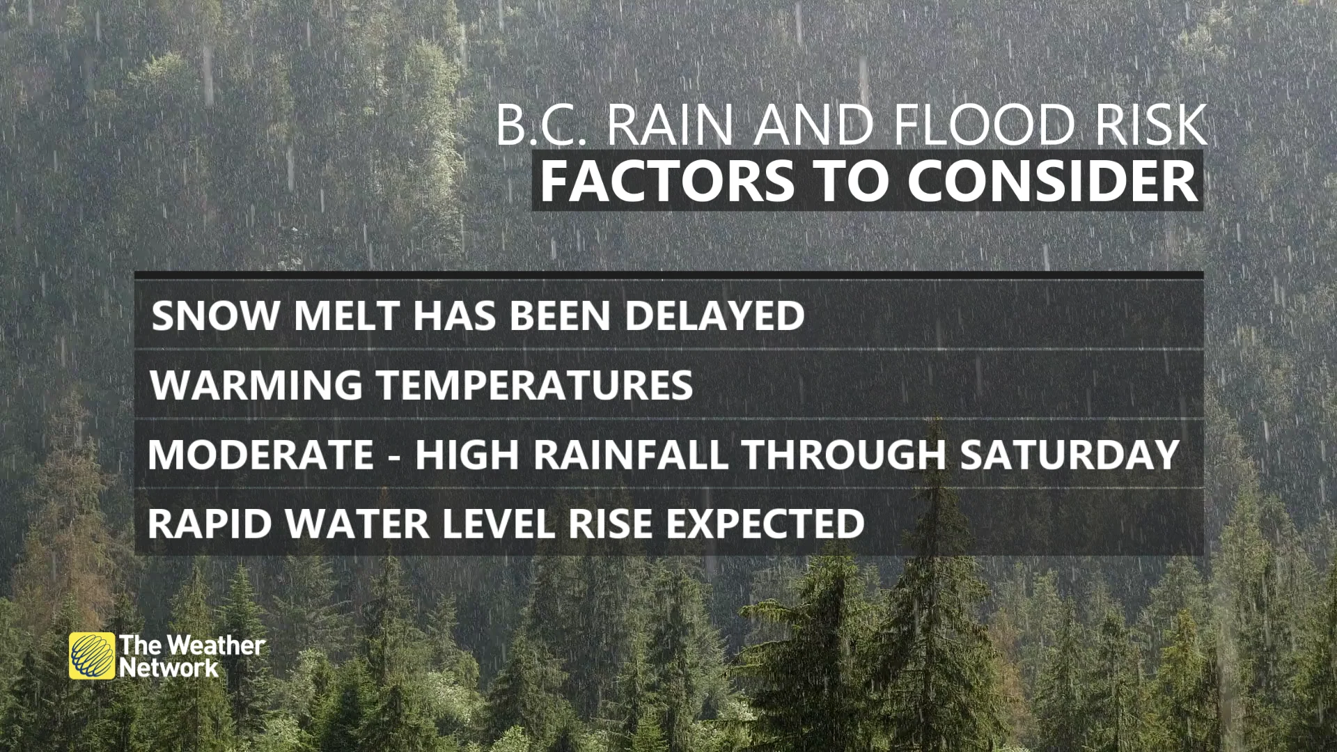
The current wide-reaching flood threat across B.C. involves several factors, including a long spell of heavy rain, a deeper-than-average snowpack for June, and warmer temperatures that’ll steadily melt that excess of snow.
A low-pressure system that moved into B.C. from the south is allowing a stream of atmospheric moisture to wash over the province.
Heaviest rain continues early Sunday morning, especially for the Lower Mainland, then becoming more isolated by Sunday afternoon.
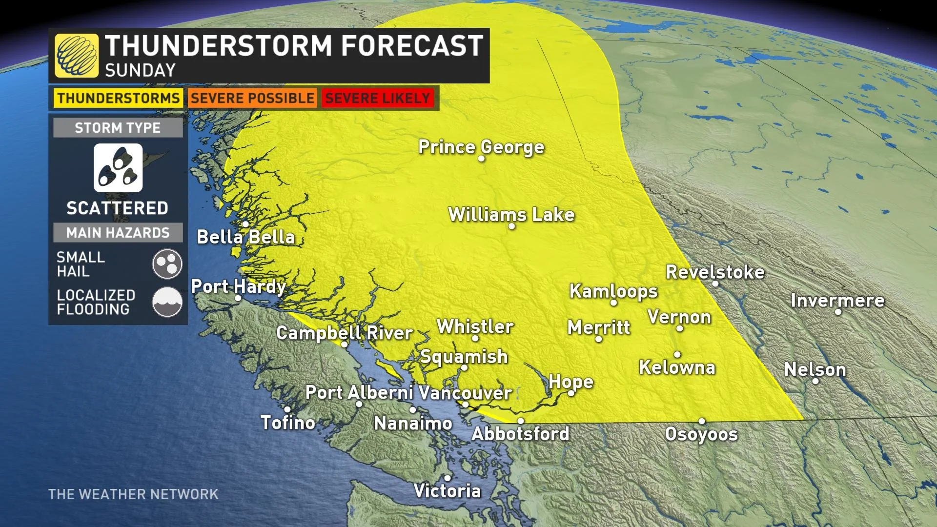
Widespread instability will flow across B.C. with the upper trough in place, leading to a far-reaching risk for thunderstorms Sunday that will stretch from the Lower Mainland to deep into northern B.C. Scattered thunderstorms are possible, with the strongest storms potentially producing small hail and localized flooding from heavy rainfall.
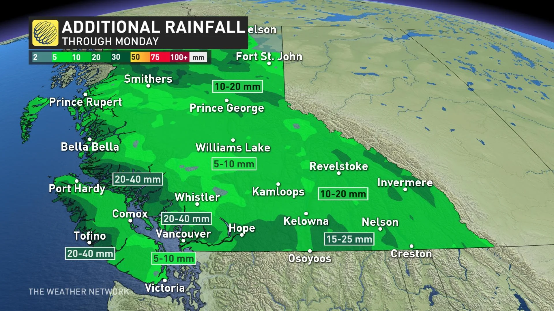
Generally 20-40 mm of rainfall left to go for the Metro Vancouver area, which will wrap up through the day Monday. An additional 20-40 mm is also anticipated for western Vancouver Island and the North Coast.
However, the greatest concern for flooding is farther inland toward the Okanagan, where flood watches are currently in effect for areas including the communities of Kelowna, Penticton, Vernon, and surrounding areas. There are also high streamflow advisories in place for some.
The combination of rain, warmer temperatures, and rapid snowmelt will quickly push local waterways out of their banks.
Scattered showers will linger on Monday, eventually tapering off by Tuesday.
POTENTIALLY WETTEST JUNE IN A DECADE
Some parallels are beginning to develop across British Columbia, especially in 2012. That year featured a weakening La Niña, but this year's moderate La Niña is guiding the province towards the wettest June in a decade. June 2012 featured more than 60 mm of rainfall in Nanaimo, 44 mm in Victoria, and 77 mm of rain in Vancouver and the Comox Valley.
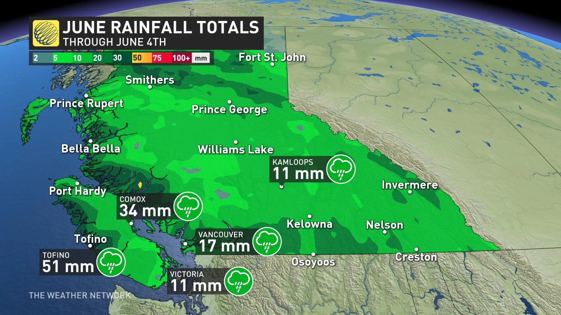
In just the first four days of June, we're off to a soaking wet start across the South Coast. It's a possibility several stations will surpass 100 mm of precipitation throughout this month, making this the wettest June since 2012.
WATCH: BRITISH COLUMBIA’S 2022 SUMMER FORECAST
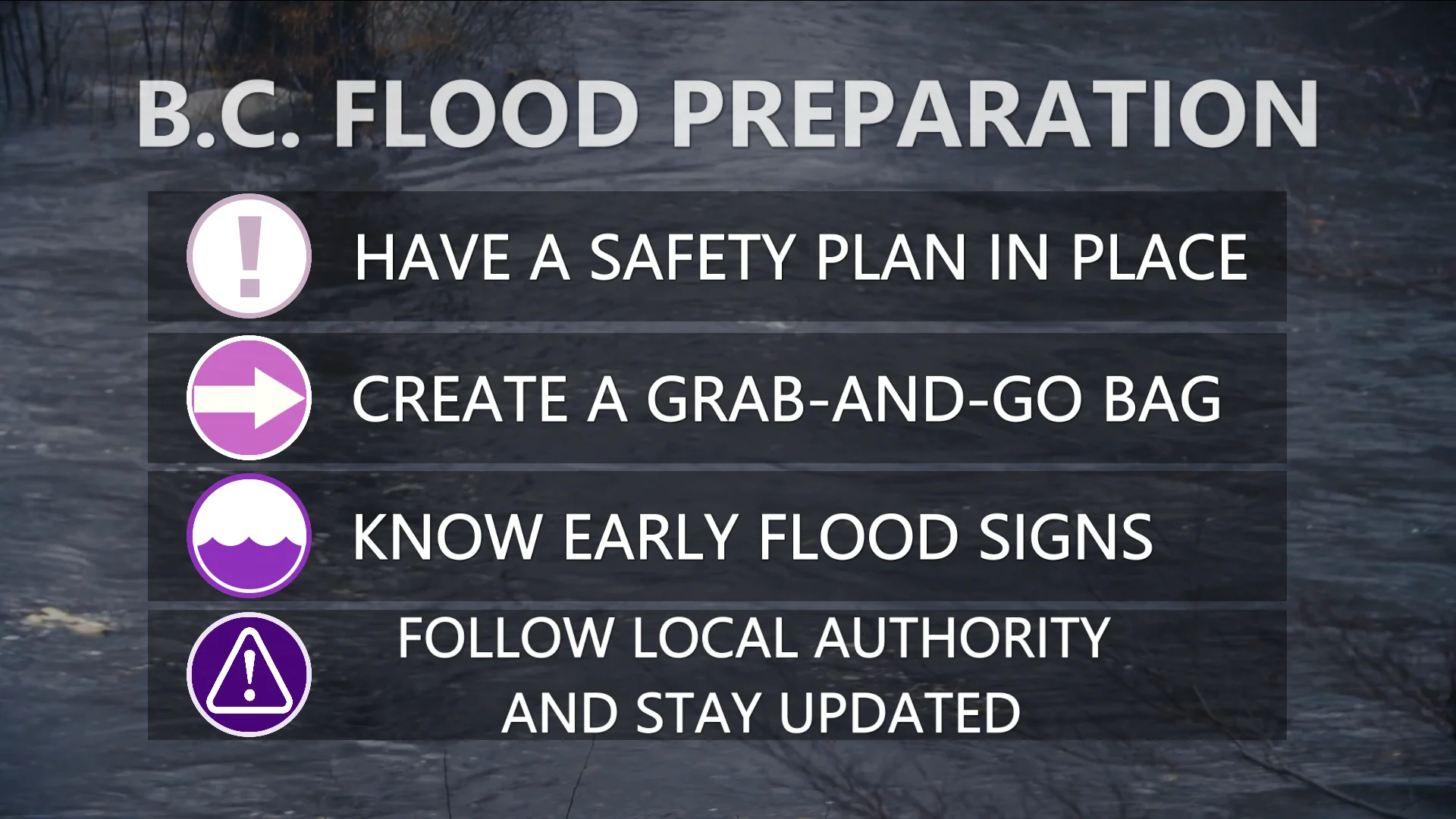
“The public is advised to stay clear of the fast-flowing rivers and potentially unstable riverbanks during the high-streamflow period,” the B.C. River Forecast Centre said in its flood watch for the Okanagan.
Officials have already issued an evacuation alert for several streets in Grand Forks, B.C., in anticipation of flooding along the Kettle River this weekend.
Remain mindful of the risk for flooding across B.C. over the next couple of days. Never drive across a flooded roadway. It’s impossible to judge the depth of the water until it’s too late, and it only takes a small amount of water for a vehicle to lose traction.
Beyond, a couple days of drier weather is anticipated early to mid-next week, but then forecasters are watching a couple more systems late next week. Temperatures will finally bump back up to seasonal on Tuesday, or even slightly above, with plenty of sunshine.
It's been so cool that Comox is on track to break its record for the longest wait for the season’s first 20°C on record. The latest such reading on record occurred on June 12, 2010.
Stay tuned to The Weather Network for the latest updates on the flood threat across B.C.