Another bout of lake-effect snow prompts winter travel advisories in Ontario

Final round of lake-effect snow threatens more difficult travel across southern Ontario Thursday, ahead of a gorgeous weekend warm-up that you'll want to take full advantage of.
Winter arrived in a hurry this week with rounds of lake-effect snow, graupel, showers and cool temperatures spreading across much of southern Ontario. It even prompted the first winter weather travel advisories of the season for areas north and west of the Greater Toronto Area, with some of those advisories re-issued Thursday morning. The setup is part of a flip-flopping pattern that will unfold through November before eventually turning consistently colder as we head into December. Another round of lake-effect snow is making for dangerous travel once again on Thursday, ahead of a gorgeous late fall weekend that will feature warmer temperatures and abundant sunshine. Now's the time to take advantage and wrap up any yard work before winter arrives with more of a force during the second half of the month and especially December. See the pattern ahead, below.
RELATED: When should you switch to winter tires? Provincial breakdown, here
THURSDAY: LAST ROUND OF LAKE-EFFECT SNOW AND TROUBLESOME TRAVEL
A deep trough brought the coldest air of the season to southern Ontario Tuesday, at a time when Great Lakes water temperatures are the warmest in more than 25 years for this time of year.
The resulting instability, combined with a northwesterly wind, saw lake-effect snow squalls and difficult travel persist into Wednesday for the usual snowbelt areas.
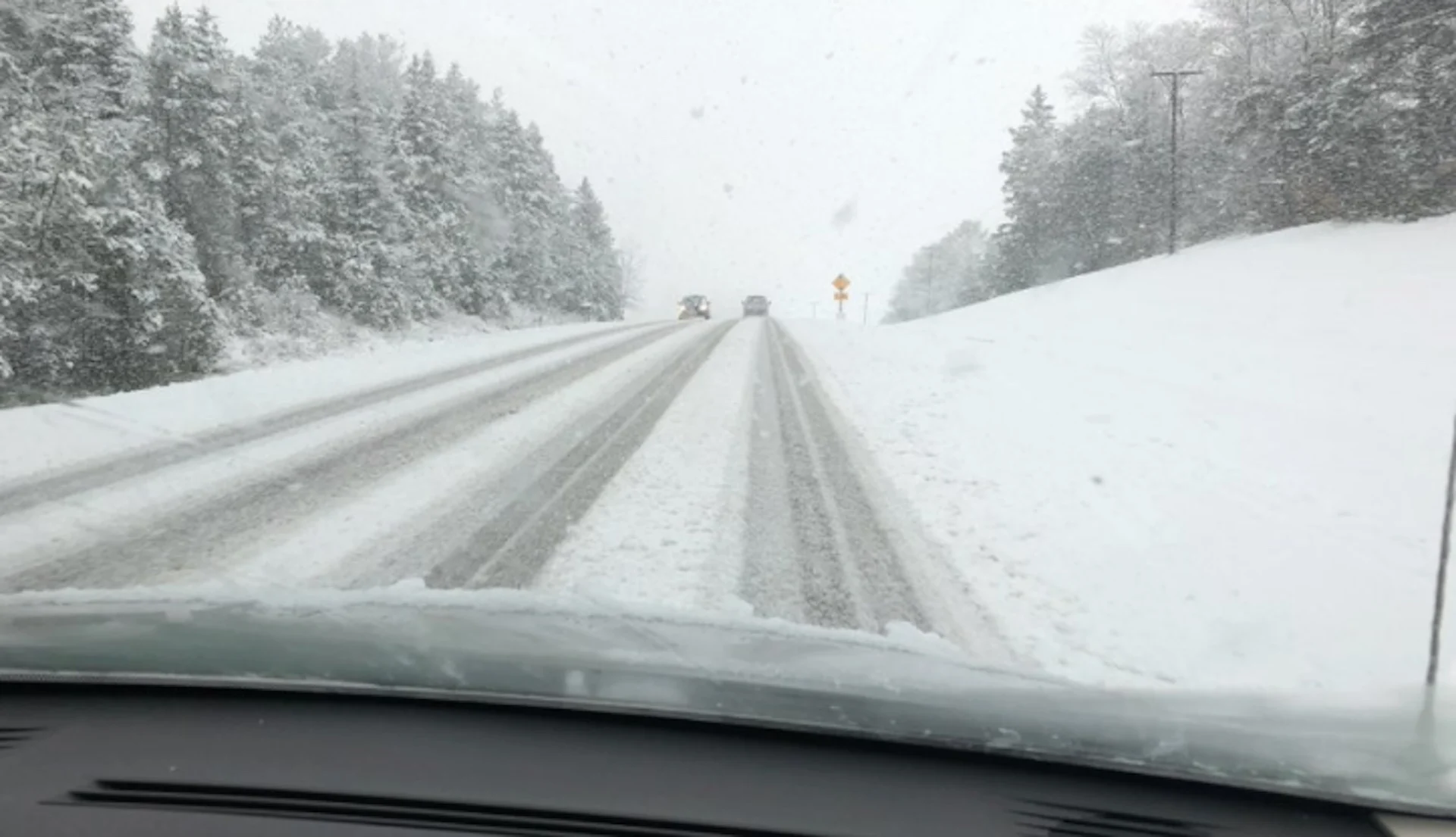
The lake-effect snow showers are bringing yet another round of some troublesome and dangerous travel through the first parts of Thursday, as true fall-like conditions settle in across the region.
Bursts of heavy snow and low visibility are possible, particularly for areas east of Lake Huron. A few centimetres of accumulation aren't out of the question either, especially for areas that see heavy snowfall rates. Winter weather travel advisories were re-issued for parts of the region Thursday morning.
"Motorists should expect hazardous winter driving conditions and adjust travel plans accordingly. Be prepared to adjust your driving with changing road conditions," says Environment and Climate Change Canada in the advisory.
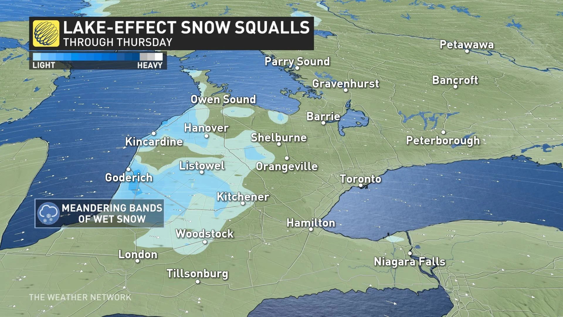
The lake-effect precipitation will diminish later in the day on Thursday.
MUST SEE: Falling into winter, Canada: November pattern reversals lie ahead
WEEKEND: GORGEOUS LATE FALL WEATHER AHEAD!
A much drier pattern will return for the weekend, combined with abundant sunshine and more seasonal temperatures. Daytime highs will even trend a few degrees above seasonal into next week, with double digit highs expected, and the potential for a day or two that reaches well into the mid-teens.
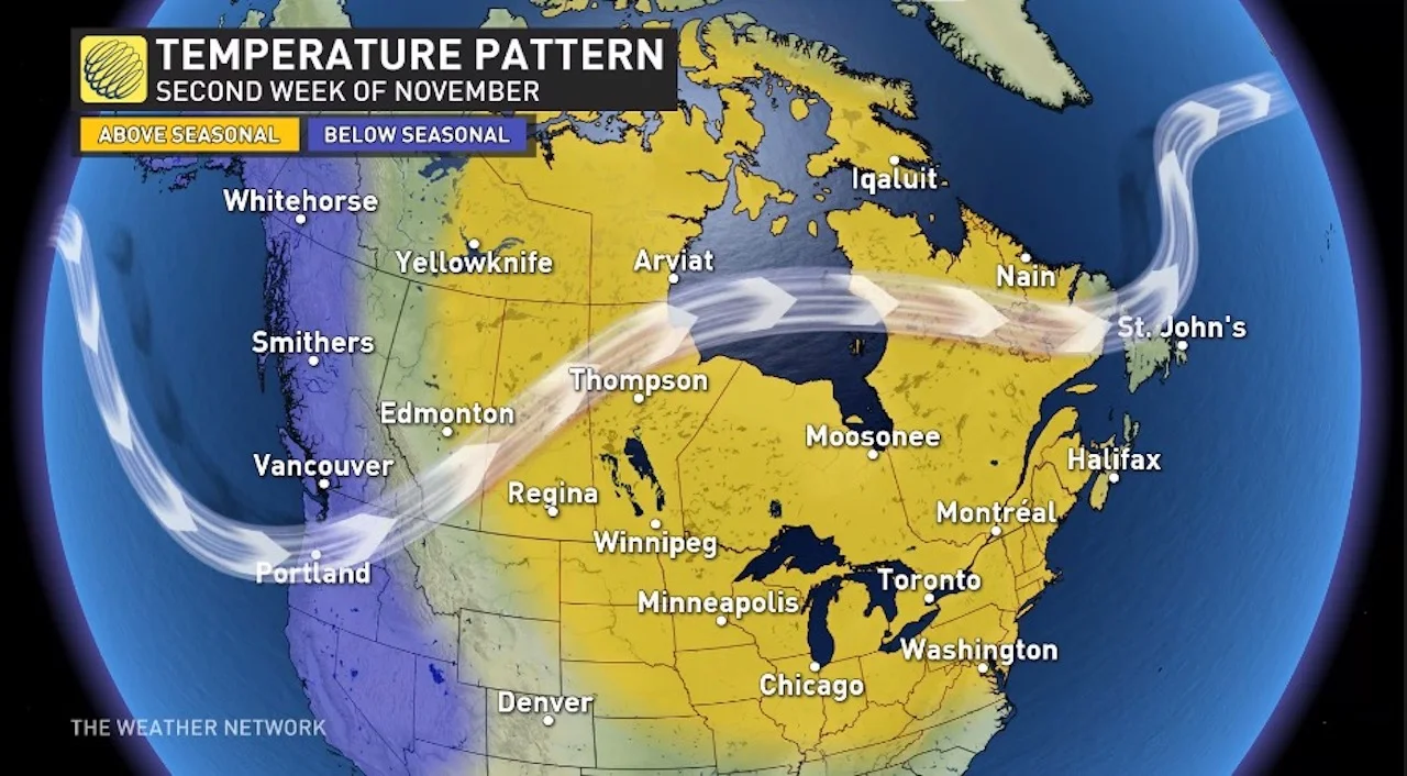
"One should take advantage of this time to wrap up yard work before winter arrives," says Dr. Doug Gillham, a meteorologist at The Weather Network. "We'll see temperatures turn much colder during the second half of November and especially December."
Stay tuned to The Weather Network as we monitor the forecast in Ontario this week.
Thumbnail image courtesy: Mike/Twitter