Spring takes a pause on the Prairies as temperature drop brings snow

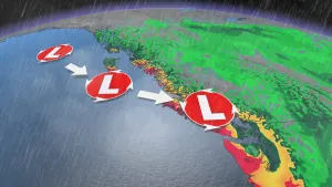
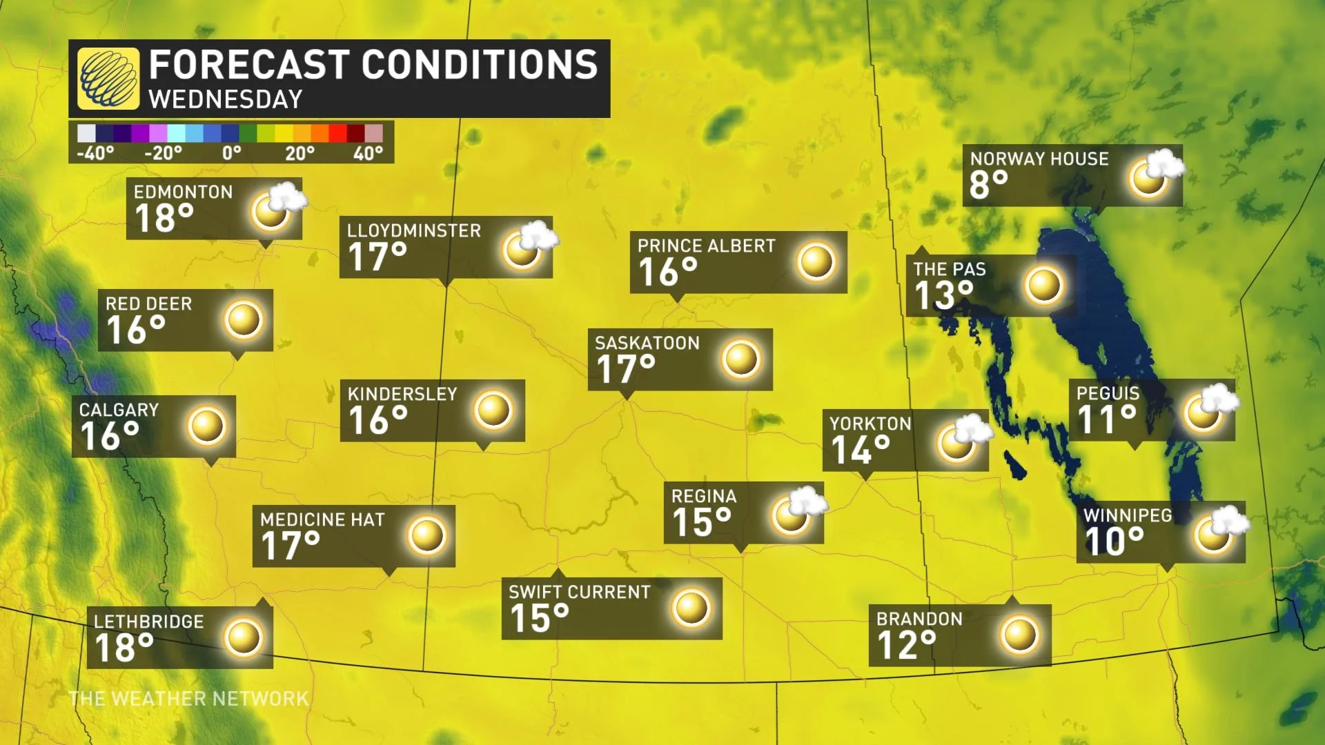
The astounding late spring-like warmth seen across the Prairies last weekend was quickly dashed by a cold front, which brought bursts of snow. The same setup is taking place this week. Temperatures will rise Wednesday to nearly identical values, but another potent system will wipe them out as it slumps southward Thursday. Albertans can expect a similar sharp drop in temperatures in a 24-hour period, in addition to the burst of heavy snowfall and gusty northerly winds. A closer look, below.
THURSDAY: TEMPERATURES DROP, SNOW PUSHES IN
Calgary and Edmonton will approach 20°C on Wednesday as daytime highs, but the late-spring warmth will quickly disappear, thanks to a cold front swinging through Thursday. As the system sinks further south, with the much cooler air, bursts of snow will develop.
Flurries will set up across Edmonton Thursday morning. A band of snow is then expected to push into Red Deer, Calgary and eventually further south by the afternoon hours.
MUST SEE: Pacific typhoon upends April pattern across Canada
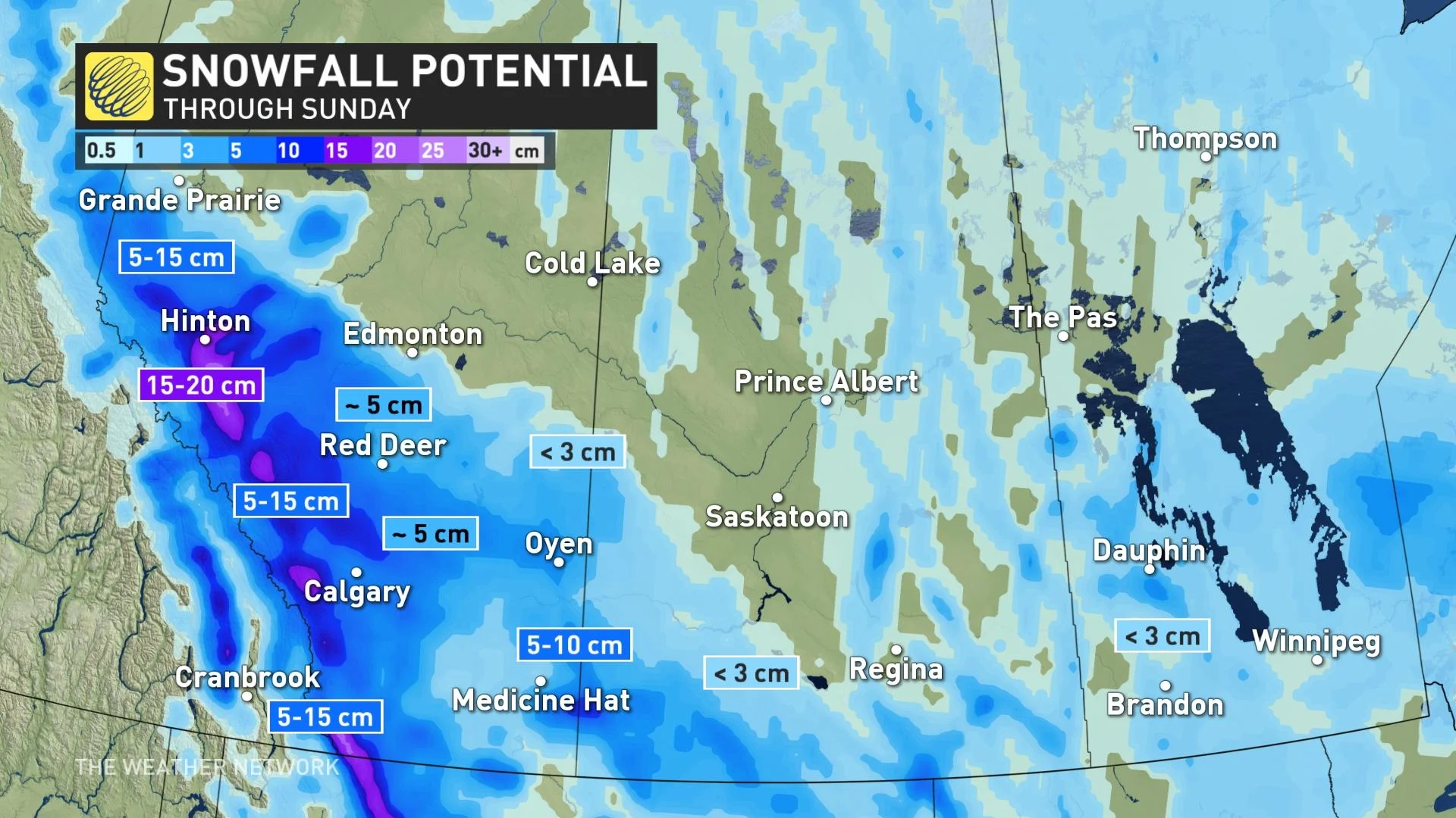
Snowfall amounts will be highly terrain-driven with upslope enhancement -- giving way to locally heavy accumulations along the Rockies and southern foothills. 15-20 cm is possible in these regions. Areas along Highway 2, however, are likely to get closer to 5 cm, but areas just a few kilometres west could get amounts in the 5-10 cm range. Snowfall warnings are in place for areas along Alberta's foothills.
After the passage of the system, winds will increase and switch to a north-northwest direction. The Prairies can expect 50-60 km/h, possibly hitting 70 km/h in southern Manitoba, delivering a chilly air mass to the region.
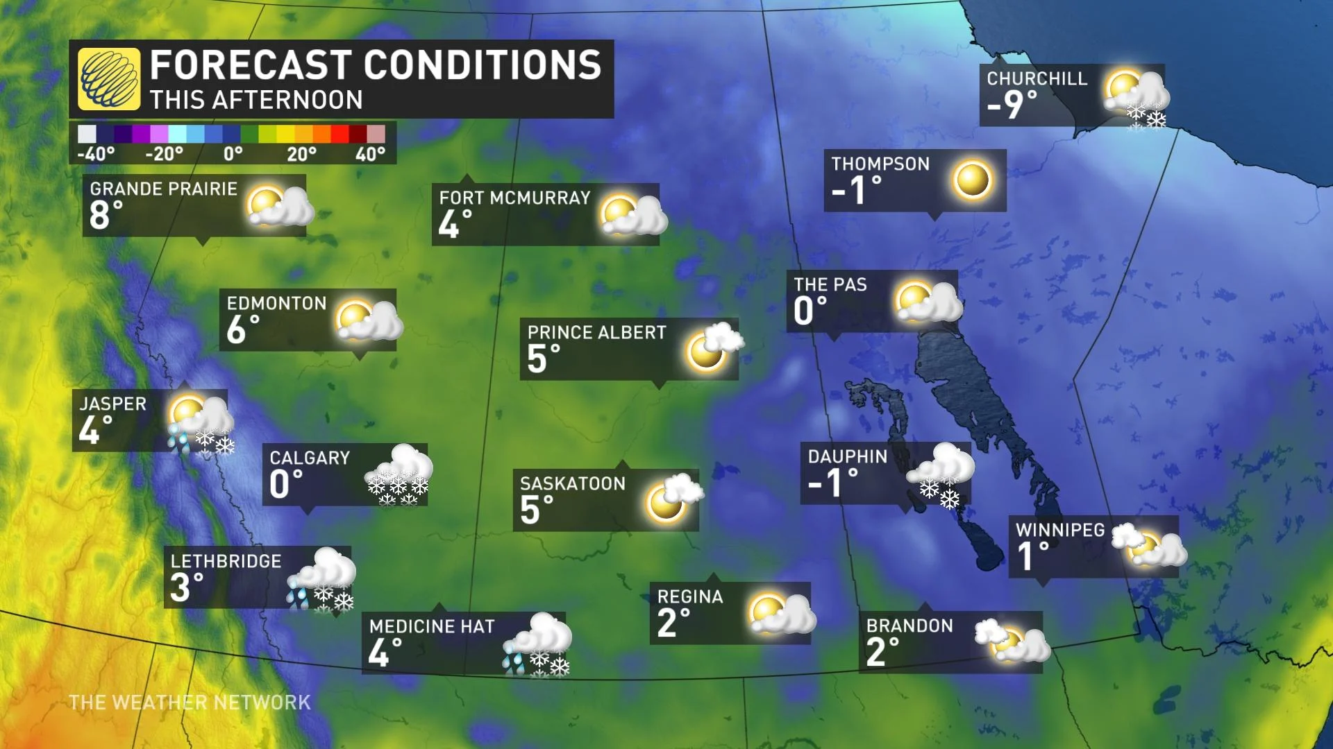
Temperatures take a considerable nosedive Thursday, compared to Wednesday, possibly dropping by as much as 20 degrees in Calgary once more -- only reaching the freezing mark. There will be quite a contrast in temperatures across the Prairies, as Winnipeg will be approaching the 20-degree mark.
Overnight lows will drop into the minus single digits, accompanied by wind chills, but a gradual warmup is looming. Temperatures recover and climb to several degrees above seasonal by mid-week with plenty of sunshine.
BEYOND: CHILLY CONDITIONS SPREAD EAST, REINFORCING SHOT OF ARCTIC AIR
Colder weather will spread east for Friday with temperatures only reaching 1°C for Winnipeg. A reinforcing shot of Arctic air will push in on the weekend with significant snow possible for southern Alberta.
The cool pattern will dominate the first half of next week with more snow possible for parts of the region.
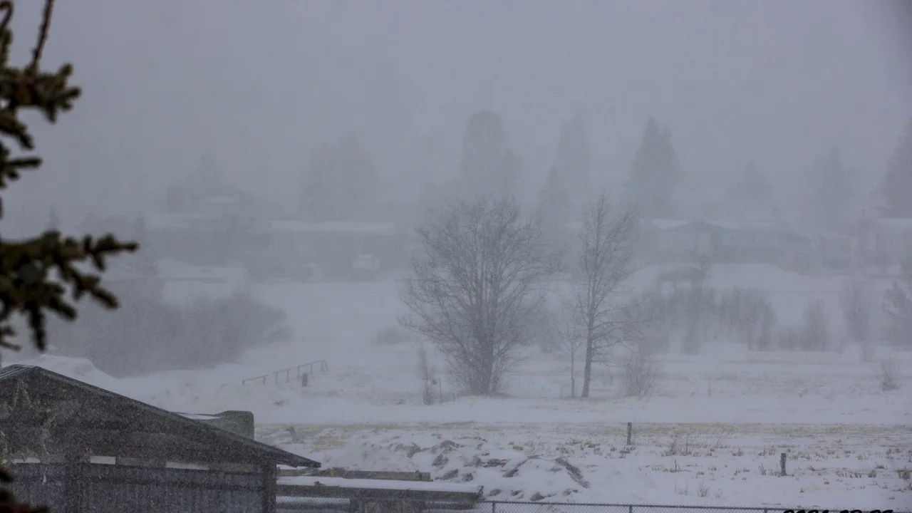
Thumbnail courtesy of David Fitzpatrick, taken in Swan Hills, Alta.
Be sure to check back for updates on this Prairie pattern change.