Alberta: From snow and flurries to thunderstorms

The snow was notable at the higher elevations, but will be a thing of the past Saturday.
2019's temperamental spring will take another swipe at Alberta into this weekend. Wet snow will be all but ended just before Saturday morning, followed quickly on by rain and a few rumbles of thunder before temperatures rebound into next week. Alberta's weekend outlook, below.
Summer revealed! Visit our Complete Guide to Summer 2019 for an in-depth look at the Summer Forecast, tips to plan for it and much more
WEATHER HIGHLIGHTS:
Snow at elevation/along foothills ending early Saturday morning
Isolated showers/thunderstorms on Saturday
Rebounding temperatures into next week
Latest watches and warnings in your area [HERE]
AFTER SNOW, RETURN TO THUNDERSTORMS THIS WEEKEND
The low that's been funnelling colder air south down the Rockies will finally start to pull away across the central Prairies on Saturday, and while that's good news for temperatures, it does mean the end (at least, temporarily) of much-needed rainfall for parts of the province.
With that said, forecasters are watching for the potential for a few showers and thunderstorms along the foothills on Saturday as a weaker disturbance tracks south through the province.
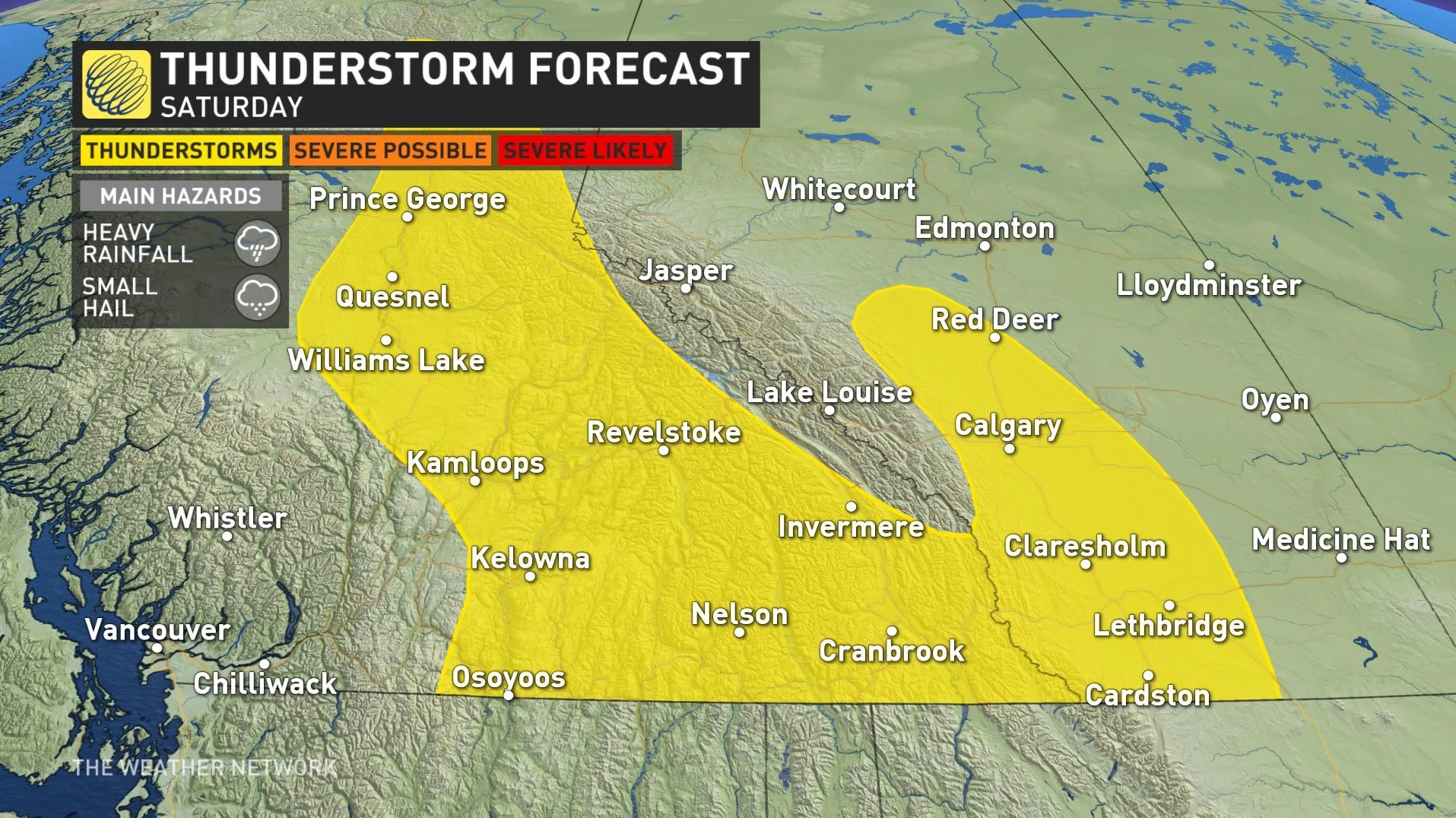
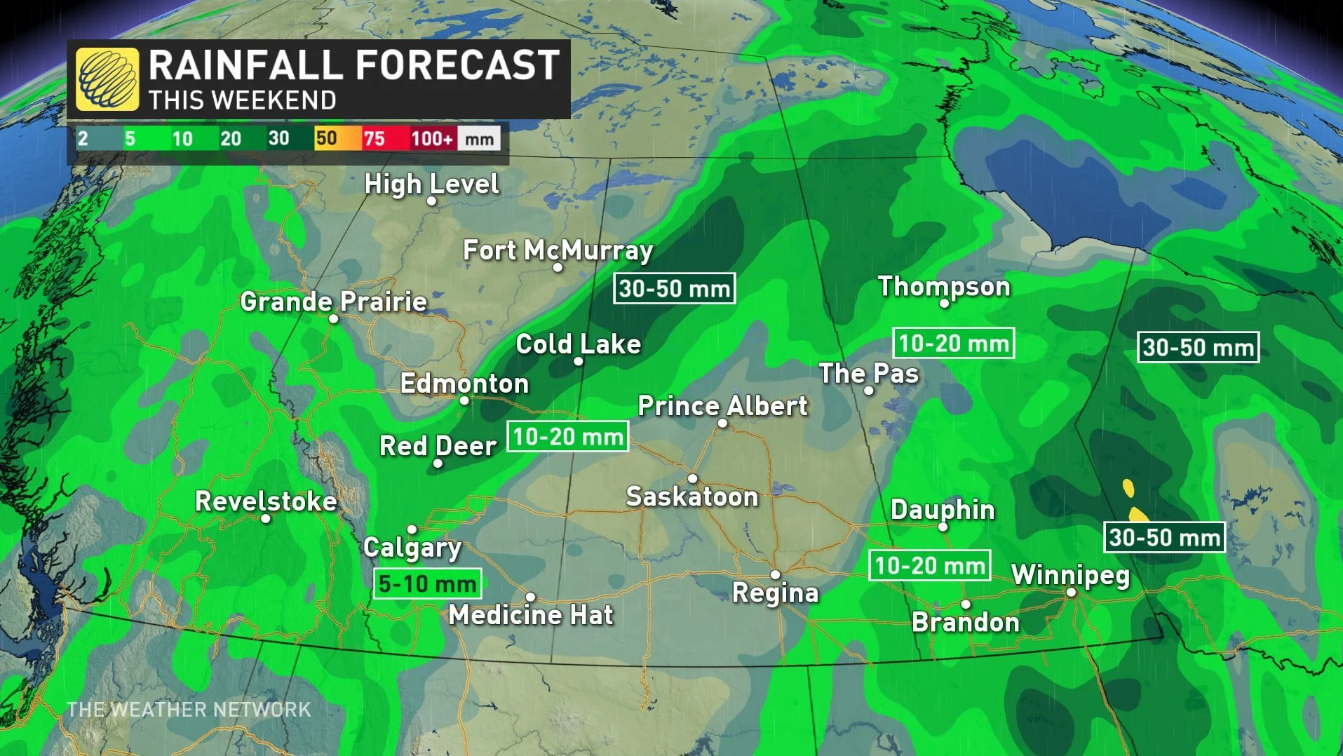
These will likely be isolated and non-severe in nature, and for most places, any showers that do manifest will be relatively weak and isolated, though Calgary, Red Deer and Edmonton up to Cold Lake are likelier to see amounts on the higher side.
Those rebounding temperatures will continue into the new work-week, as afternoon highs climb back to seasonal by Monday, and into the low-20s for most through the remainder of the week.