Ontario: Blast of wet snow followed by double-digit weekend temps

Period of wet snow to end the work week in southern Ontario, but with double-digit daytime highs taking over parts of the weekend.
This first week of March will end much more wintry than it began as periods of wet snow spread across southern Ontario on Friday. The snowy interruption however, will be short-lived as temperatures take a massive rebound into double digit territory by Sunday.
WEATHER HIGHLIGHTS
Clipper brings shot of snow west snow through most of Friday
Daytime highs make a massive rebound for Sunday and Monday, 10°+C possible
Unsettled weather returns next week
Keep track of active weather alerts in your area
Visit our Complete Guide to Spring 2020 for an in-depth look at the Spring Forecast, tips to plan for it and much more
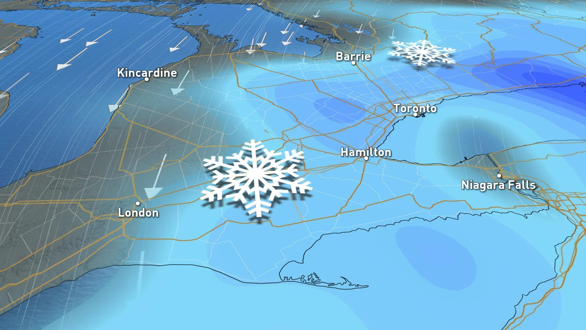
FRIDAY: SNOW MOVES ACROSS THE SOUTHWEST, INCLUDING THE GTA
The snow, or at last a rain/snow mix, will have already started overnight for parts of the extreme southwest and areas near Lake Huron, though by Friday morning it will mostly be manifesting as a wet snow, thanks to temperatures closer to zero.
Much of the snow will have spread across the southwest and GTA by the morning, and forecasters say it will come and go in on-and-off bursts for most of the day, lasting longest in eastern areas.
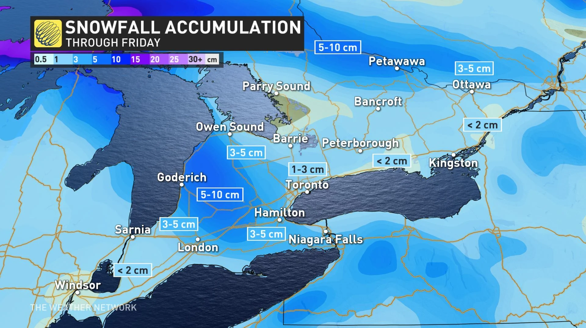
A widespread 1-3 cm of snow is forecast for most places, with 2-5 cm possible above the escarpment to the west and south of the Hamilton area, and as much as 5-10 cm for the Dundalk Highlands. Most of the snow that does fall however, will be wet and will melt on contact with the pavement.
SATURDAY AND SUNDAY: MARCH SUN GOES TO WORK WITH SOARING TEMPERATURES
Sunshine and near seasonal temperatures are expected to return for Saturday and Sunday, with many places in line to see some double digit daytime highs for the latter half of the weekend.
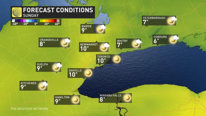
Those warmer conditions will last into Monday, with much of next week marked with more above seasonal weather, though with the threat for more wet snow or rain on Wednesday night and Thursday.
"A warming trend is expected as we head into next weekend and at this point, it looks like the following week, which is March Break for many, will be a rather mild week across southern Ontario," says Weather Network meteorologist Dr. Doug Gillham.
Check back as we continue to monitor the forecast across Ontario.