Ontario's first crack at the 20-degree mark as temperatures soar

Spring-like warmth spans much of Ontario through Thursday, but at the cost of some unsettled conditions and waves of moisture pushing through.
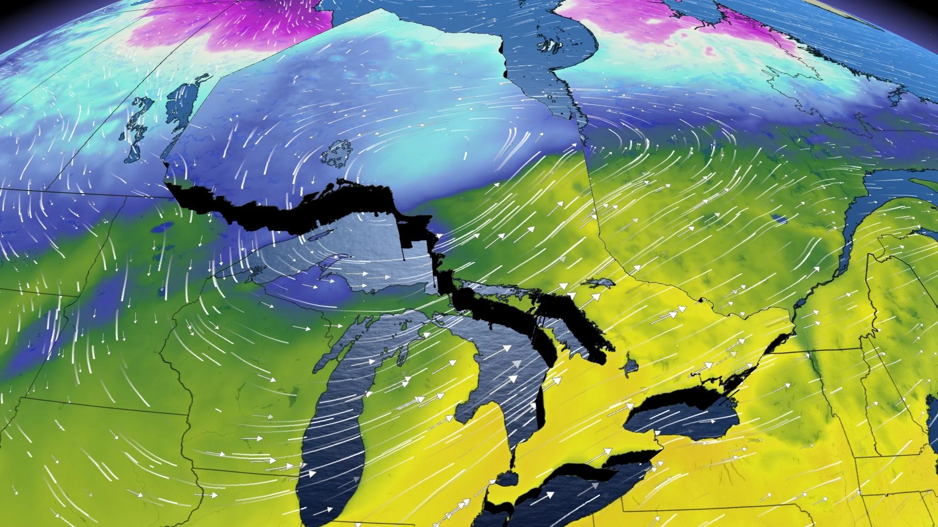
A ridge of high pressure has parked itself over southern Ontario, allowing the region to get preview of spring this week, with a southerly flow that has progressively sent temperatures rising. Through Thursday, there is a chance the next three days could be the warmest three-day stretch the province has seen in several months. Not only that, parts of the region have a fair shot of hitting 20°C for the first time this year.
There is a downside, however, as the flirtations with spring will be quite short-lived, and there will be a round of rain pushing through Thursday, putting a bit of a damper on the warmth before it disappears. The same system that will end the mild stretch will bring a messy wintry mix in northern sections, where some areas could see 20-30 cm of snow.
Parting shots from winter are typically expected right into April, and sometimes even May. Slightly below seasonal temperatures will return for the weekend, with eyes on a potential messy system for early next week.
Visit our Complete Guide to Spring 2021 for an in-depth look at the Spring Forecast, tips to plan for it and much more!
THROUGH THURSDAY: TEMPERATURE CLIMB CONTINUES, SOME AREAS COULD SEE 20 DEGREES
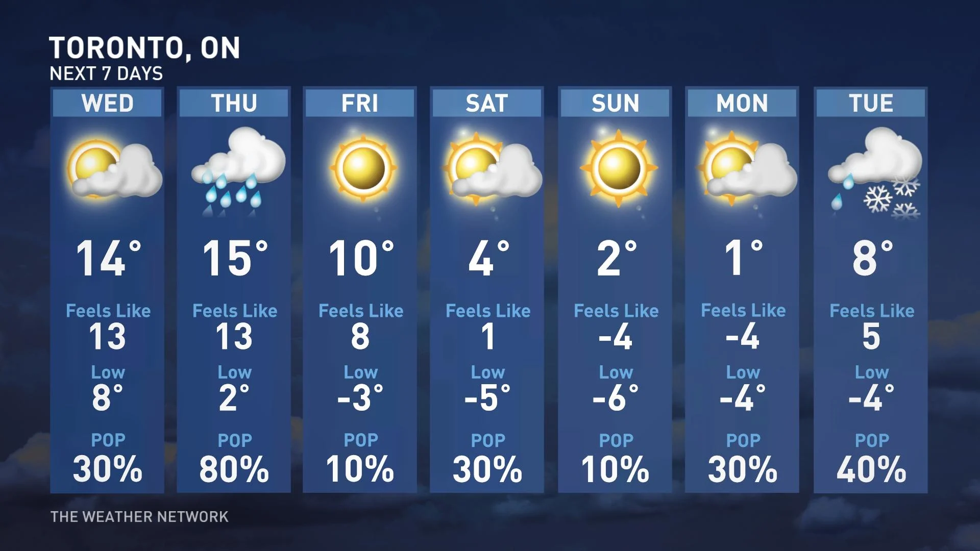
The mid-teen temperatures will become much more far-reaching by Wednesday afternoon, possibly extending into parts of cottage country and eastern sections of the province. The values will be more common for mid-April, so enjoy the outdoors if you can, as the warmth will be accompanied by plenty of sunshine. Parts of the southwest will creep closest to the 20-degree mark Wednesday afternoon.
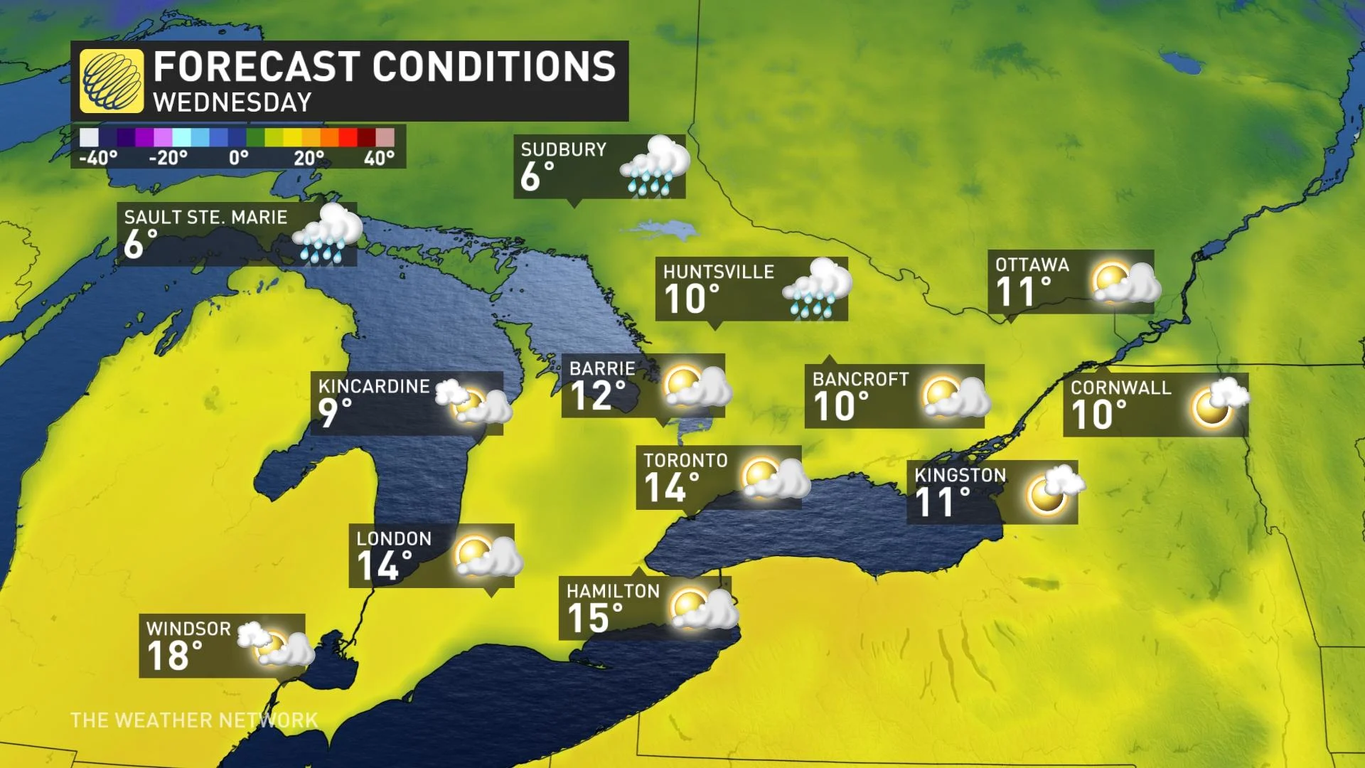
The next threat for rain will arrive Thursday afternoon, along with some gusty winds, but it won't be a washout. Temperatures will be more typical of early May for southern Ontario on Thursday, reaching the upper teens. A few additional spots could even reach 20°C for the first time this year, with most of the day rain-free.
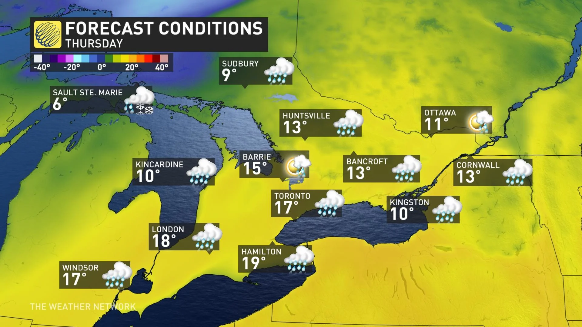
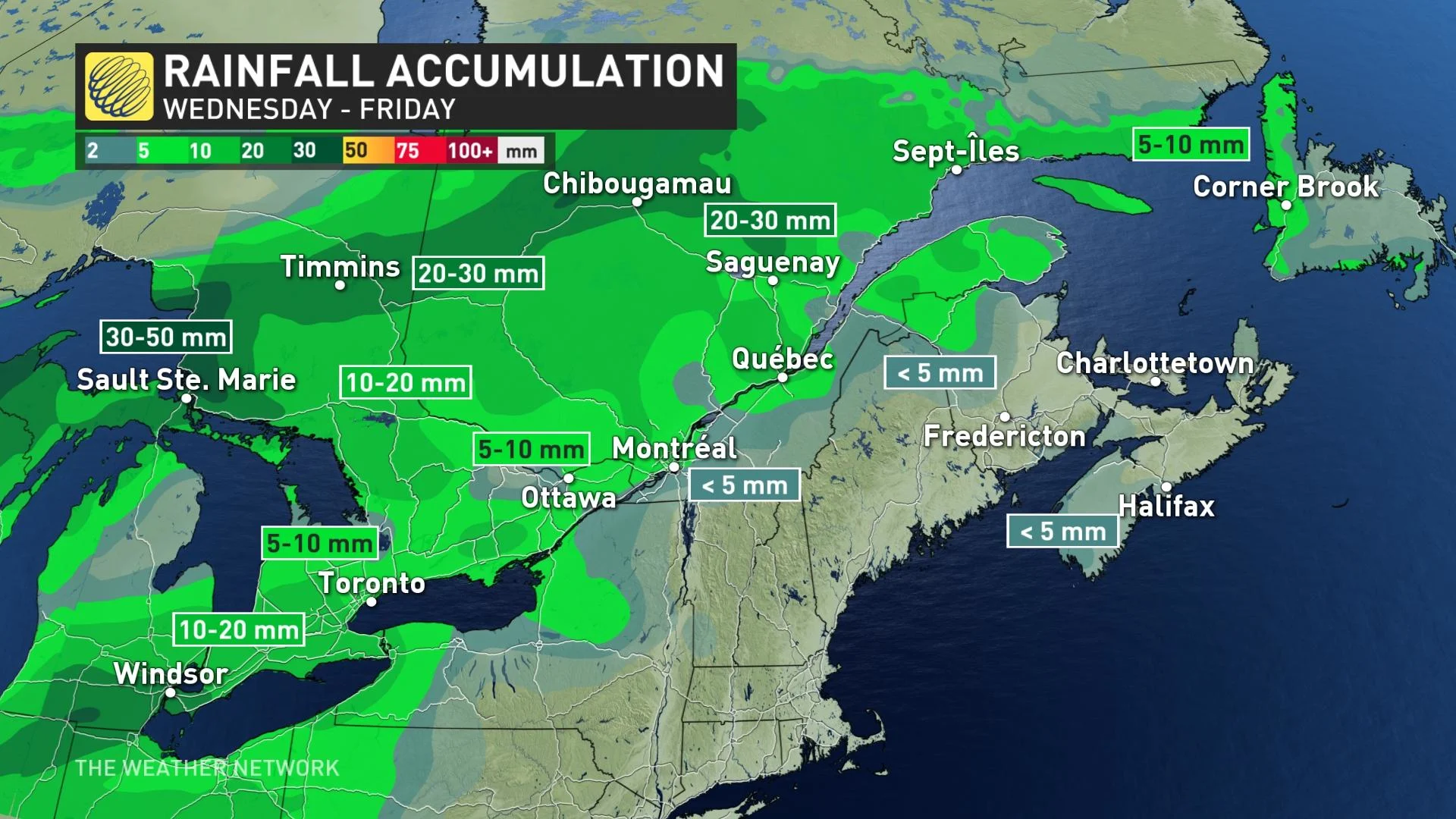
Rainfall amounts will be on the low end in southern Ontario with 5-10 mm for most, but southwestern areas could see 10-20 mm.
END OF SOUTH'S WARMTH PASSES THROUGH THE NORTH
The weather-maker that will be responsible for ending the spring-like warmth by Friday will be a potent low that will be bringing snow, rain and possibly ice pellets and freezing rain to northeastern areas Wednesday night into Thursday.
Areas between Nipigon and Kapuskasing, and in the far northern section of Ontario, may see 20-30 cm of snow through Thursday. Amounts decrease as you head towards Wawa. Some brief mixing with ice pellets will be possible particularly for areas near Lake Superior Wednesday night.
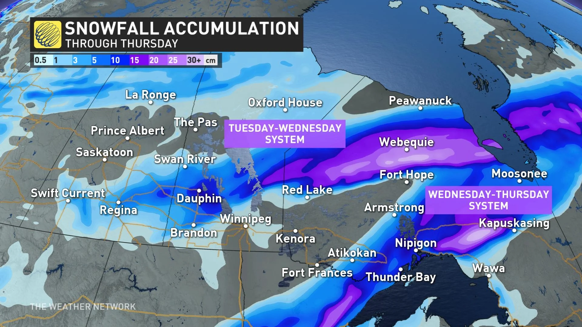
Snowfall warnings and special weather statements are in place, as winter travel conditions can be expected and motorists are advised to prepare for poor visibilities on the road.
INCOMING RAIN PROMPTS FLOOD THREAT FOR GRAND RIVER
The Grand River Conservation Authority (GRCA) issued a combined flood warning/watch watershed due to the anticipated runoff and potential for ice movement. A watch is in place for the entire watershed, while a warning is in place for parts of the waterway. Conditions will continue to be monitored closely and updates will be issued as necessary.
Temperatures of up to 15°C are forecast along with approximately 10-15 mm of rainfall across the Grand River watershed this week resulting in significant snowmelt and increased runoff into local waterways.
Ice on local waterways is extremely unstable and will break up and shift during this event, increasing the risk of flooding in areas prone to ice jams.
"Flows in local waterways throughout the Grand River watershed are expected to begin increasing on Wednesday and remain elevated into early next week. Runoff from this event will result in flooding in low lying areas typically prone to spring flooding," the group said in the statement.
LATE WEEK: DAYTIME HIGHS TUMBLE BACK TO TYPICAL MARCH VALUES
The short spring fling will feel glorious while it lasts, but temperatures will begin to tumble as early as Friday, with cooler, but still above seasonal temperatures. Mostly sunny conditions with slightly below seasonal temperatures are expected for the weekend.
MARCH OUTLOOK: Expect this month to be 'truly Canadian'
Temperatures will be chilly start to next week. Forecasters are watching the potential for a messy system on Tuesday for southern Ontario, with the possibility of snow and ice changing to rain. Changeable temperatures during the week, but colder than this week.
Despite the flip-flopping temperatures however, the season overall still looks to tip to the milder side, with no real threat for extended periods of colder weather that has taken over the season during the past few years.
Be sure to check back for the weather across Ontario as we march into spring.