First weekend of spring to bring rain, snow to parts of Ontario and Quebec

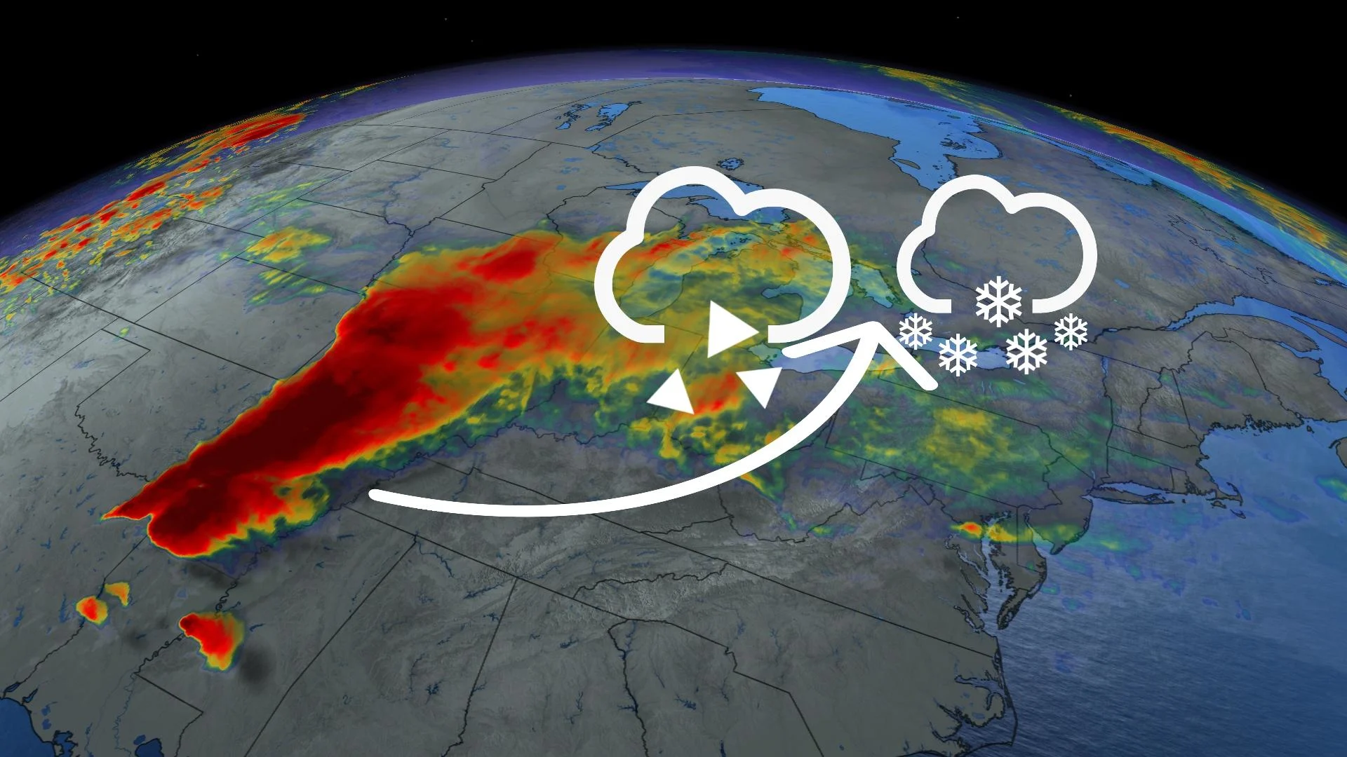
After only a brief pause, active spring weather returns to Ontario and Quebec this weekend in the form of a messy Texas low that will deliver rain, ice, snow, and gusty winds to parts of the provinces.
ALSO READ: Damage, injuries after Los Angeles area’s strongest tornado in 40 years
Southern Ontario
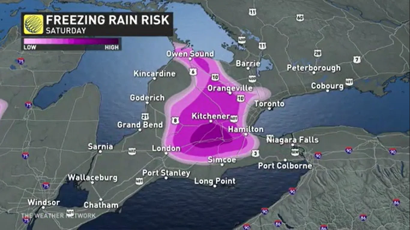
Precipitation begins in the pre-dawn hours of Saturday in the southwest region of Ontario, reaching the Greater Toronto Area (GTA) by morning. A mass of cold air in place over the region will bring a threat of freezing rain, especially to higher elevated locations along the Niagara Escarpment, leading to slick roads and difficult travel Saturday morning.
As temperatures rise above freezing throughout the morning, the icy precipitation will quickly transition to rain Saturday afternoon.
Warmer areas to the south will see more heavy rain throughout Saturday morning and afternoon, with up to 30 mm of rainfall possible for parts of the Niagara Peninsula.
A sharp pressure gradient with this low means that accompanying this messy precipitation will accompany strong, blustery winds with gusts of 60-80+ km/h. Areas around Lake Erie will see the strongest winds of up to 90km/h.
The strong winds, combined with freezing rain, will enhance the risk of localized power outages in parts of southern Ontario.
While temperatures begin to drop in the early evening, there may be brief periods of light flurries across the GTA, but with minimal accumulation. However, some evening snow will make roads slightly slick after a day of ice and rain.
Eastern Ontario and Quebec
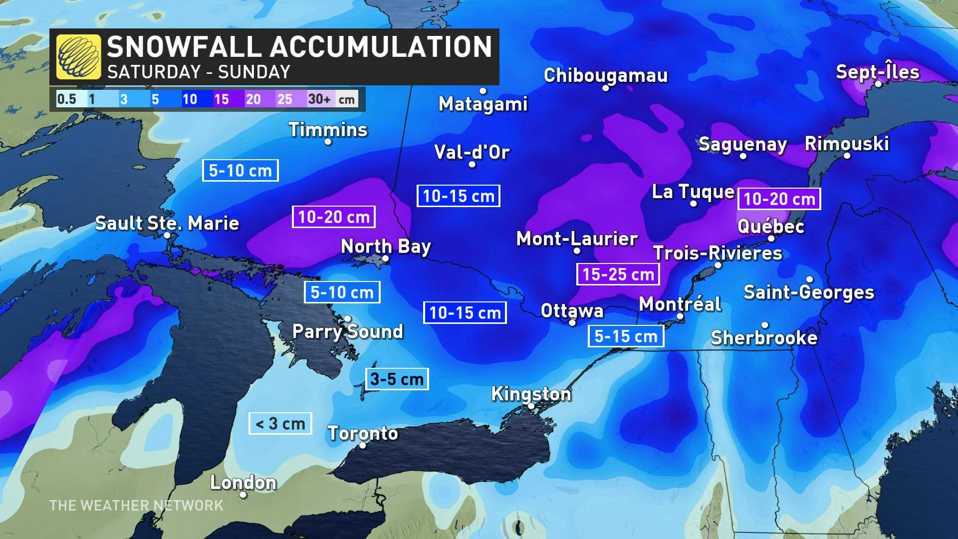
Moisture pushing northeast late Saturday morning and ambient temperatures begin to fall, a swath of snow will develop from Sault Ste. Marie across the Nickel Belt and into the Ottawa Valley, eventually spreading into Quebec throughout the day. It certainly won’t feel like spring for these regions as 10-20 cm of snow may accumulate for the hardest hit areas.
By Saturday evening, the snow will transition to light rain for these areas, making for slushy roads.
DON'T MISS: TICK SEASON: 5 little-known facts pet owners should know
Environment and Climate Change Canada has issued special weather statements across eastern and southern Ontario, as well as for parts of southern Quebec for this system’s risks and impacts.
Luckily, this system is fairly quick-moving and will clear out of southern Ontario throughout Saturday evening, pulling in brisk temperatures behind it.
Quebec will see snow continue into Sunday before the system departs to the east towards the Atlantic.
Ontario’s famous ‘flip-flopping’ between winter and spring weather is expected to continue into April before the spring weather finally settles in for the season.
WATCH NOW: Get in your spring skiing while you can! Who's still open across Canada
Keep checking back to The Weather Network for more forecast and weather information for Ontario and Quebec.


