Shorts to coats: a wild forecast for Canada’s unofficial start to summer

The unofficial kick-off to summer will be a cool yet dry one for much of western Canada this weekend, while the heat will spend the weekend shifting from the Great Lakes to Atlantic Canada, bringing showers and storms in its wake.
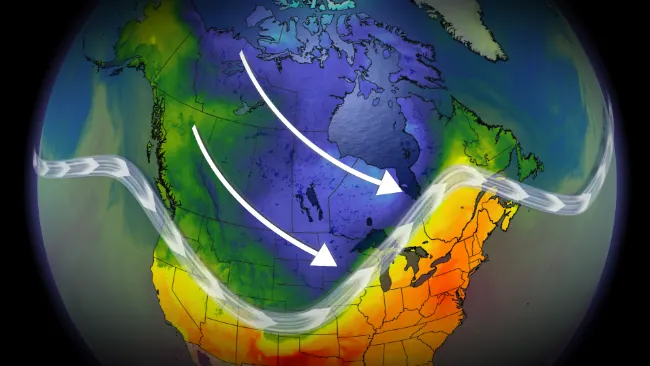
Welcome to the start of the May long weekend, typically known as the unofficial kick-off to summer in Canada. The forecast this weekend emphasizes the “unofficial” nature of this symbolic weekend, as the weather will feel more like early spring than a taste of summer.
MUST SEE: Three things you'll want to keep in mind this long weekend
While a broad trough engulfing the country brings below-seasonal temperatures to most areas, the long weekend won’t be a complete write off for some communities. Summer-like warmth and humidity will greet some areas, with daytime highs pushing 30°C at times.
Here's a closer look at the specific weather details as you get ready to plan for the weekend ahead.
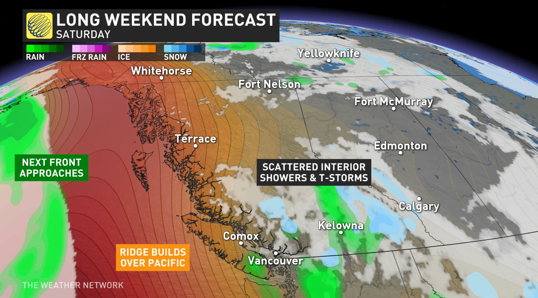
BRITISH COLUMBIA:
Temperatures will continue to trend on the cooler side of seasonal for the long weekend across British Columbia, especially through the interior regions of the province. While we won’t see any major systems to start the weekend, some instability may contribute to spotty showers or thunderstorms, especially through the interior.
The chance for wet weather will return on Sunday and Monday as a Pacific front approaches the central and north coast.
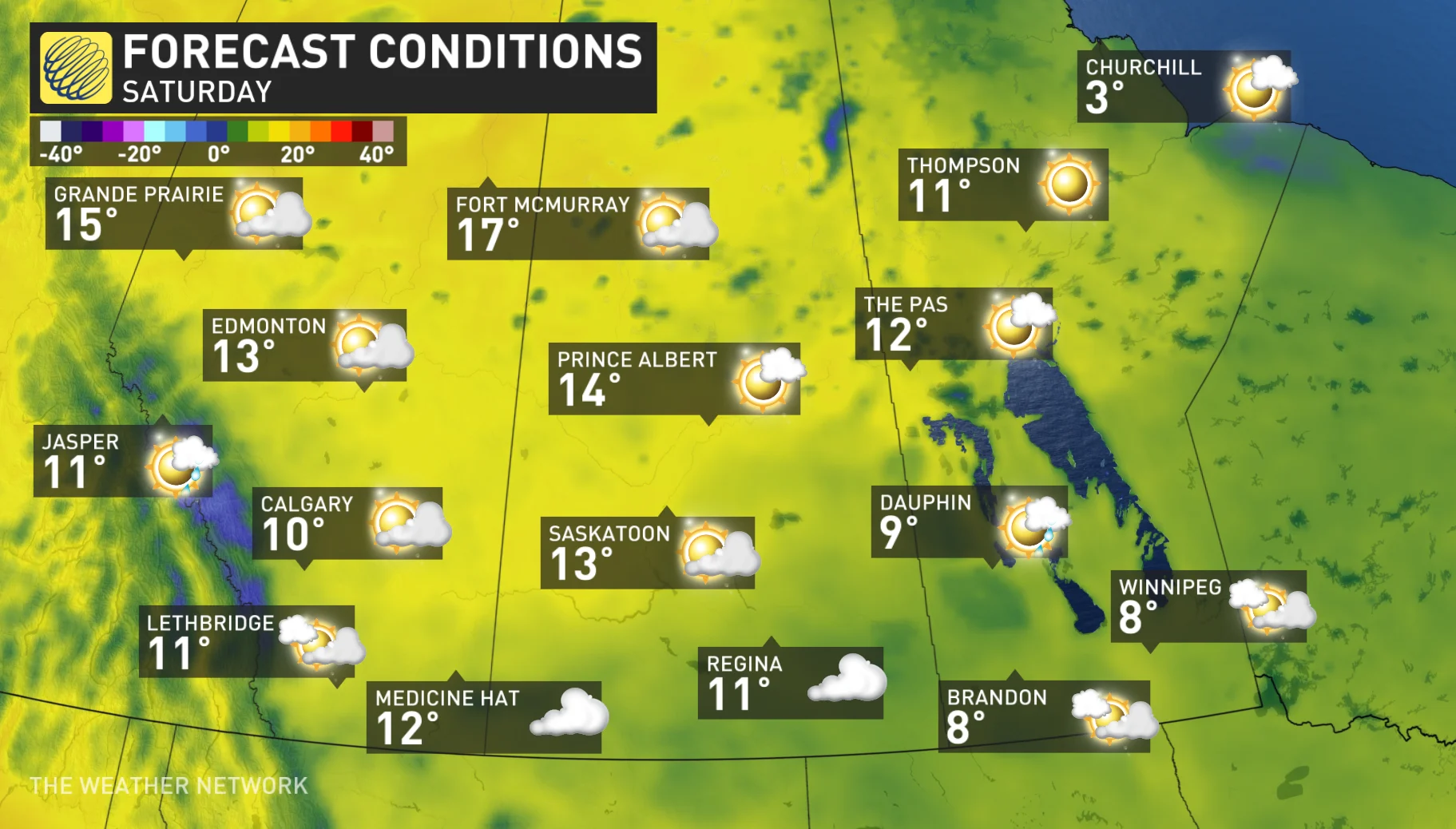
PRAIRIES:
To call the Prairies’ weather “changeable” was an understatement this week. Warmer temperatures and thunderstorms crashed into a below-seasonal chill with late-season snowfall for western parts of the region.
FORECAST: Warnings issued for up to 20 cm of spring snow over parts of Alberta
These below-seasonal temperatures will persist through the first half of the weekend before moderating somewhat in time for Sunday and Monday.
The system that brought unwelcome snow and much-needed rain to Alberta will continue across the southern Prairies, with showers lingering into Saturday. Additional rainfall will fall across waterlogged parts of southern Manitoba that certainly don’t need more precipitation.
Scattered rain showers will develop for northern areas on Sunday, with more widespread rain and thunderstorms developing across Alberta on Monday, especially near and north of the Yellowhead Highway.
ONTARIO AND QUEBEC:
Areas in southern Ontario and eastern Quebec are under severe thunderstorm threat Saturday. We’ll see a far-reaching risk for thunderstorms from Windsor to Quebec City, with severe thunderstorms possible along the Highway 401 corridor.
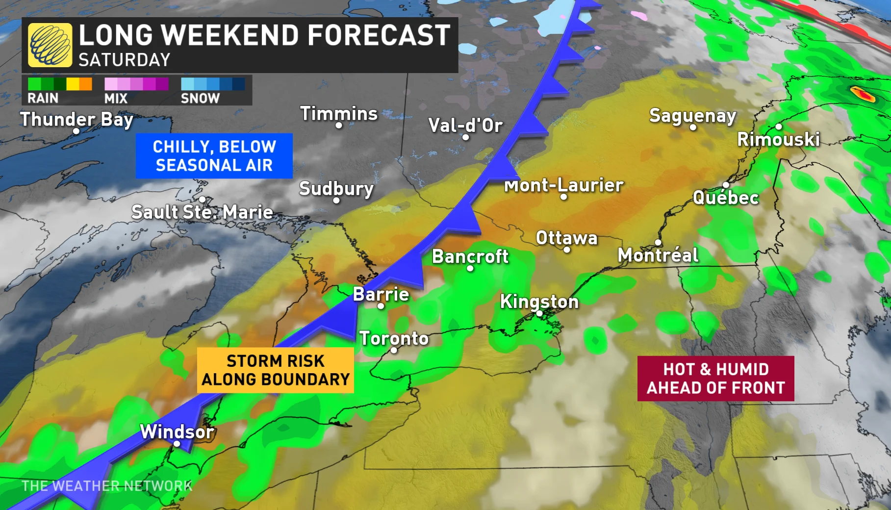
Temperatures will fall precipitously behind the cold front. Single digit high temperatures will be widespread across northern Ontario, with widespread frost and a freeze expected. There could even be signs of frost northwest of the Greater Toronto Area by Monday morning.
ATLANTIC CANADA:
While there will be some periods of unsettled weather over the course of the long weekend, a ridge of high pressure over the Atlantic will build, forcing precipitation north of the region and providing some summer warmth to inland areas.
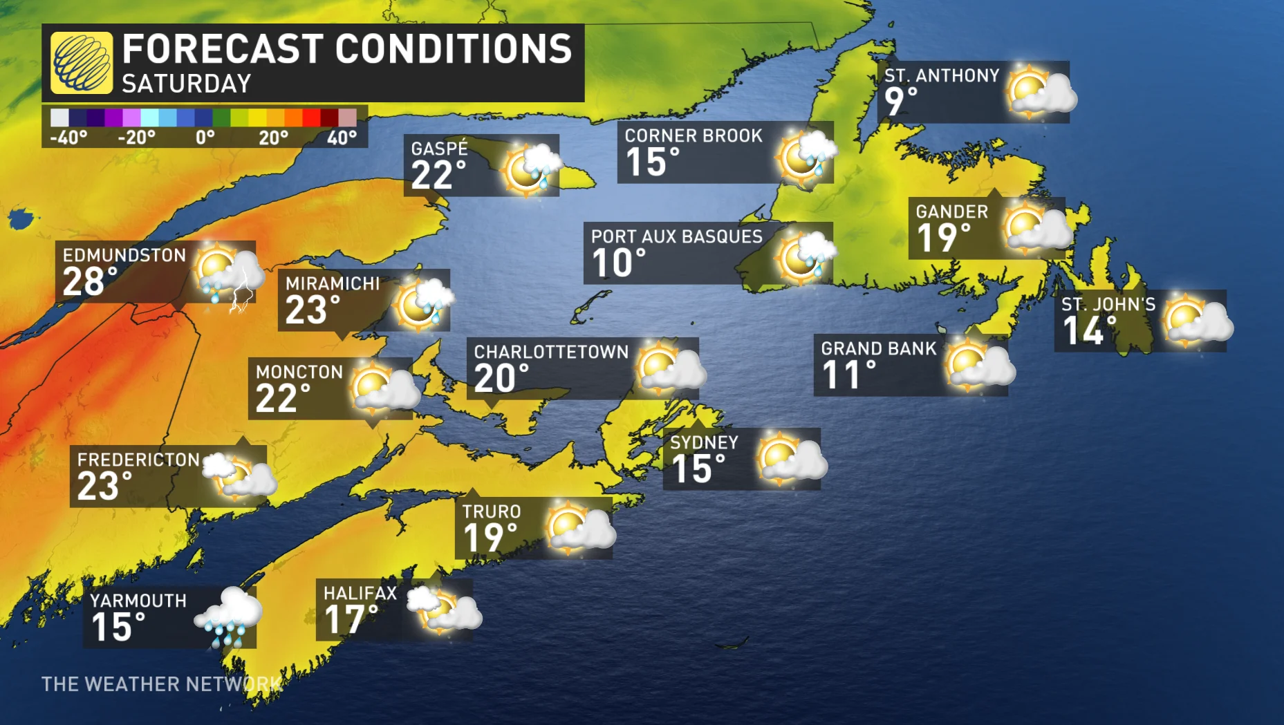
Temperatures in the mid to upper 20s are expected for a day or two for inland areas of all four Atlantic provinces. However, a strong southwest wind crossing the cold ocean water will sabotage the warm-up for most south and west facing coastal areas. These areas will be mostly cloudy and much colder with a risk for drizzle and fog. Meanwhile, much of central and northern New Brunswick will reach the upper 20s and lower 30s on Sunday.
A cold front will cross the Maritimes Sunday night, with a risk for rain showers and thunderstorms followed by much cooler weather for Monday. However, for the southern coastal areas that miss out on the heat on Sunday, Monday will actually deliver warmer temperatures due to the northwest wind, which will be blowing off the land instead of off the ocean.
Be sure to check back for the latest weather details as the long weekend approaches.