Ontario: Showers, thunderstorms loom for the start of the week

The weekend sunshine won't spill over into Monday
A sunny and warm weekend gives way to a Monday marked by soaking rains and potentially severe thunderstorms, along with rising humidity that will make temperatures feel like the low 30s for the first time in 2019. More on the risk of severe storms, and how the upcoming July long weekend will prove to be much different from last year's, below.
Summer revealed! Visit our Complete Guide to Summer 2019 for an in-depth look at the Summer Forecast, tips to plan for it and much more
WEATHER HIGHLIGHTS:
Rainy Monday morning for the southwest, spreading east through the day
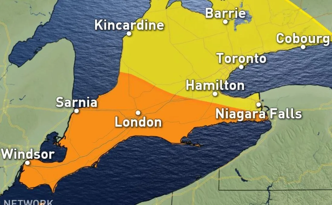
Risk of severe thunderstorms for parts of the southwest in the afternoon and evening
Humidity floods in for much of the week
Latest alerts for your area HERE
WATCH BELOW: ATMOSPHERIC MOISTURE ROLLS INTO THE PROVINCE
The first full weekend of the summer felt worthy of the name for most people in southern Ontario, but on its heels comes what will seem a return to form, at least in terms of rainfall.
A big burst of atmospheric moisture will bring a great deal of rain to the province to kick off the work week. By the time Monday begins, showers will have developed at least in the southwest, and though it will largely stay south of Highway 6 for the morning commute, by the time the system moves out Tuesday morning, most of the province will see at least some periods of rain.
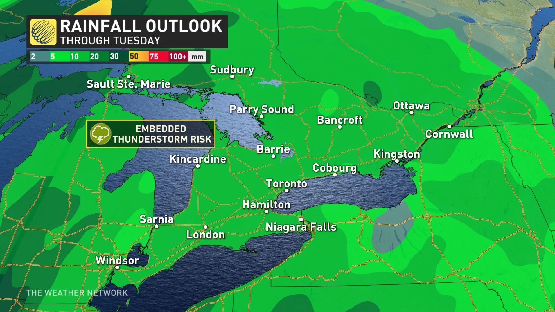
All this moisture will be coupled with a great deal of humidity, making for a chance for some scattered thunderstorms for southwestern Ontario by the afternoon.
"As the system moves east, the risk of scattered thunderstorms will include the rest of southern Ontario, including the Golden Horseshoe, during the mid-evening, and into eastern Ontario through the overnight," Weather Network meteorologist Ida Hung says.
In this case, the best dynamics for thunderstorms will still remain further south across Lake Erie.
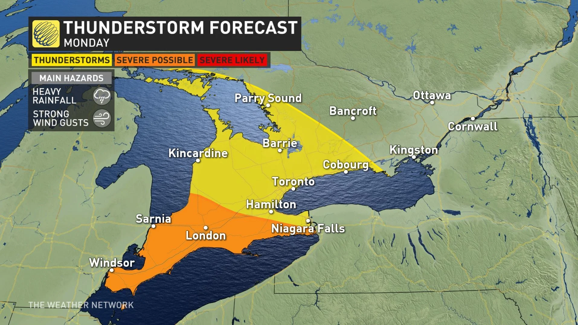
Where storms do turn severe, the risks include strong winds, and heavy rainfall, such that locally severe storms could bring as much as 50 mm of rain for some areas.
CANADA DAY SNEAK PEEK
While it's still too early to have high confidence in the weather details or rain timing of the long weekend, if it's the true summer warmth you've been looking for, the Canada Day weekend won't mark the turning point for heat.
"During the long weekend we expect a cool front will come through and knock our temperatures down a few degrees and bring the threat for a period of showers and thunderstorms," Gillham says.
Certainly a far cry from the record heat and humidity that we experienced during the same time period last year.
"At this point we do not have any extended periods of truly hot weather in sight," adds Gillham.