Ontario: Major storm takes one last swipe at region on Monday

The weekend's wintry weather has lingered into Monday morning across southern Ontario with drivers being warned to leave plenty of extra time for the commute.
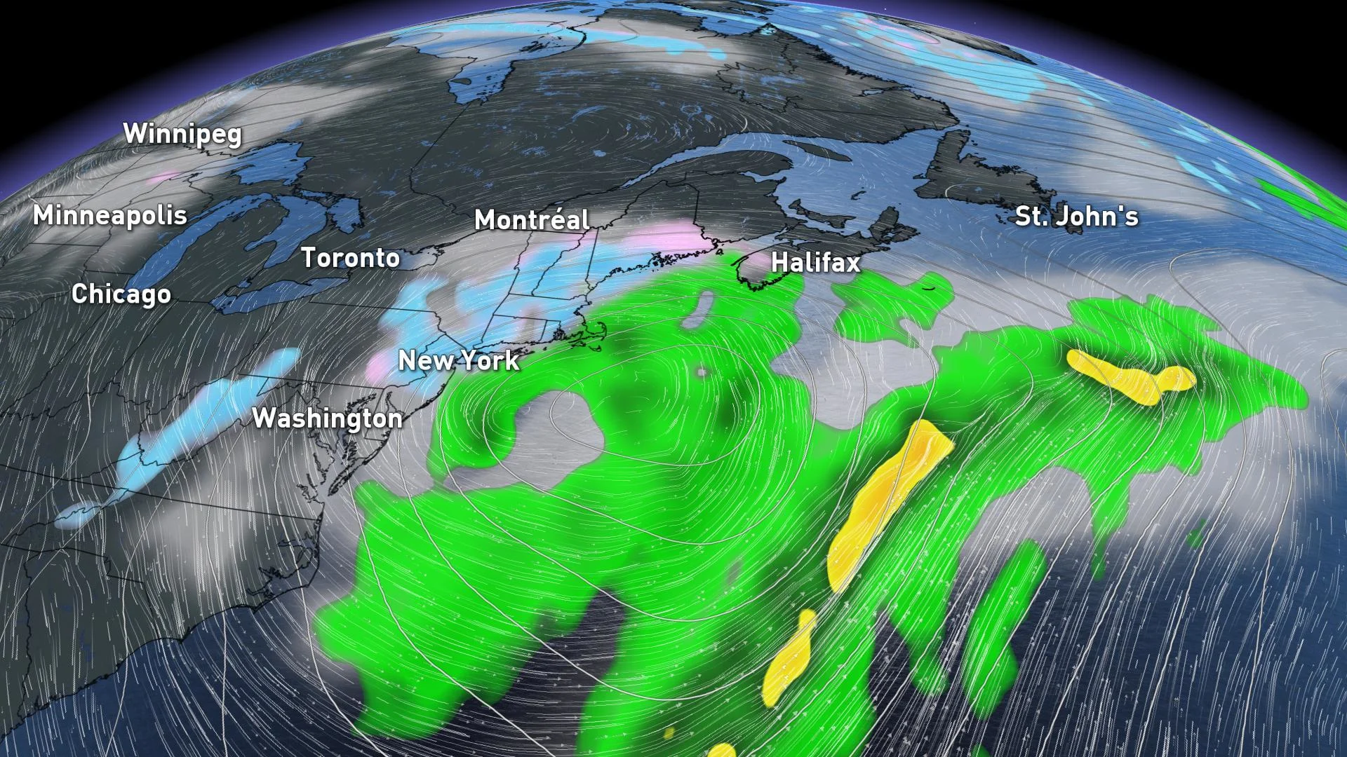
More than twelve hours of freezing rain made a mess of some of southern Ontario's busiest roads on Sunday, while heavy snow wreaked havoc farther east. And while icy precipitation will wind down early Monday, the morning commute still proved to be a challenge for parts of the GTA as this massive Colorado low takes one more parting shot at the region. We break down what you need to know for the rest of this wintry wallop, below.
Visit our Complete Guide to Winter 2019/2020 for an in-depth look at the Winter Forecast, tips to plan for it and a sneak peek at the spring season next year
WEATHER HIGHLIGHTS:
Freezing drizzle lingers for Golden Horseshoe into Monday morning
Quick shot of snow expected for Toronto, GTA, Niagara pre-dawn and early Monday morning; could make for slow commute
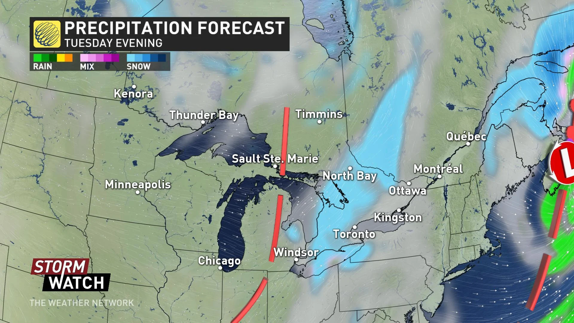
Scattered snow showers move back in Tuesday/Wednesday
Colder pattern to arrive during the second week of December
Stay up-to-date on the ALERTS in your area
WATCH BELOW: TRACKING ONE MORE BURST OF SNOW FOR THE GTA
MONDAY MORNING -- ANOTHER SHOT OF SNOW FOR A.M. DRIVE
The weekend's weather-maker isn't entirely done with us in southern Ontario. Lingering freezing drizzle will be an issue for the GTA, Golden Horseshoe, and points farther west through early Monday, while snow continues to fall north and east of the GTA. In parts of the Halton and Durham regions, school buses were cancelled early Monday morning, while most schools opted to remain open despite the wintry weather.
As the low stalls slightly in its trek over the U.S. Northeast, a parting shot of moisture will push back over the Lower Great lakes, and that means another quick shot of snow through mid-morning on Monday.
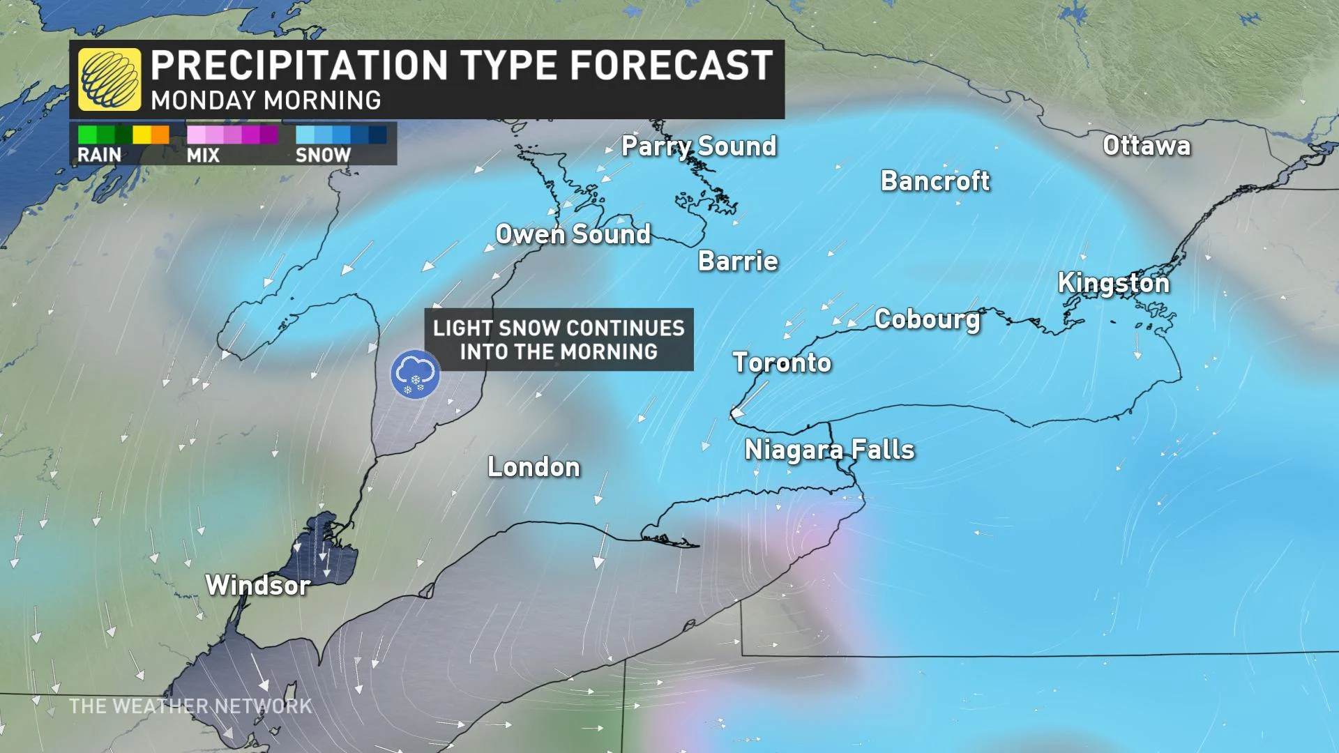
Snow will finally taper off Monday afternoon as the low pressure centre moves off the coast of New England, clearing first north of Toronto and last across Niagara.
"Monday night will be clear and cold, so untreated surfaces may become icy again," warns Weather Network meteorologist Dr. Doug Gillham.
RELATED: Massive pileup closes 401, several dead amid widespread freezing rain, heavy snow
STAYING SEASONAL BEFORE COLDER WEATHER RETURNS
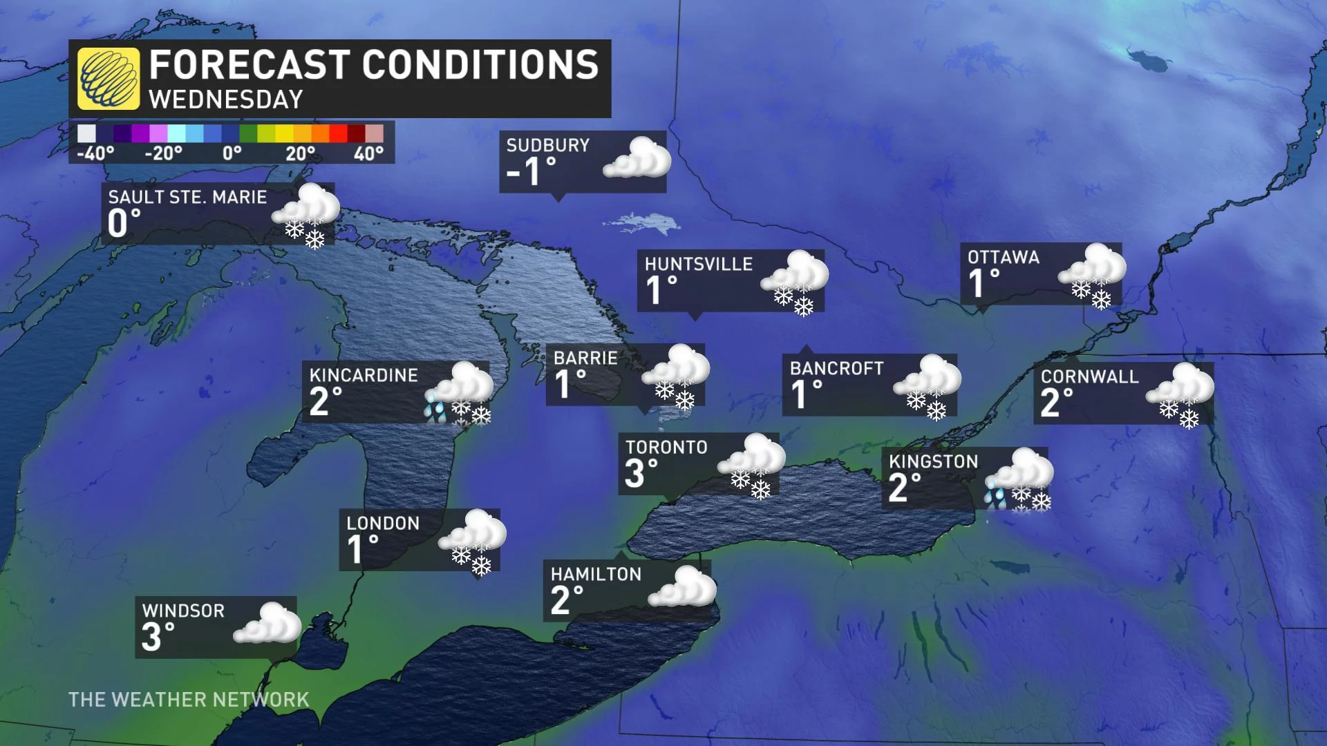
Beyond this early-week system, much of the rest of the week is expected to feature near-seasonal temperatures and a few dustings of snow across southern Ontario. Moisture-starved systems from the Prairies are expected to bring a few snow showers late Tuesday and Wednesday as they move through the Great Lakes, though little in the way of significant accumulation is in the forecast.
Temperatures will hover right near seasonal for most of the week across Ontario -- close to the freezing mark for most -- but some colder air is on the horizon.
"A brief warm-up is expected at the start of the second week of December," says Gillham, "followed by colder weather for the middle and end of the week."