Dynamic winter storm to drench East Coast in wind-driven rain and snow

A powerful storm is on the way to Atlantic Canada to end the week.
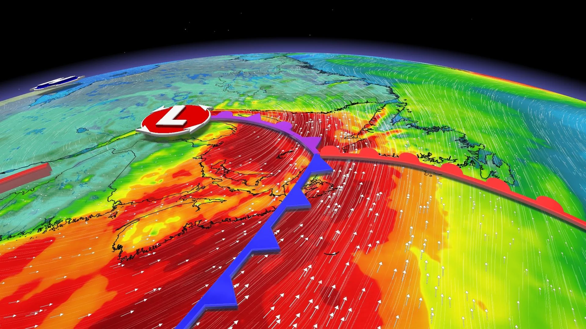
The weather alerts map over Eastern Canada is lit up like a Christmas tree, with rainfall warnings, snowfall warnings, and wind warnings blanketing the region ahead of this dynamic storm’s arrival.
Heavy snow will blanket the northern Maritimes, while a dreary, wind-driven rain will soak the rest of Atlantic Canada heading into Thursday and Friday.
MUST SEE: Texas low will leave behind 6,000-km swath of snow in its wake
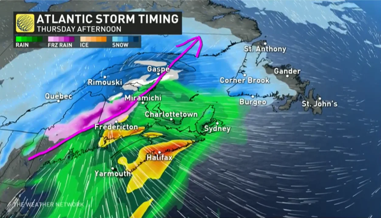
We’ll see this storm arrive in the pre-dawn hours on Thursday with widespread snow pushing over the region. Warmer air quickly arriving from the south will force much of that snow to transition over to rain, relegating the wintry precipitation to the northern half of New Brunswick and the Gaspe Peninsula.
An initial push of snow for Nova Scotia will quickly transition to a soaking rain on Thursday with 20-40 mm of rain in the forecast for the hardest hit areas there. A rainfall warning is in effect, with the threat for flash floods and water pooling on roads.
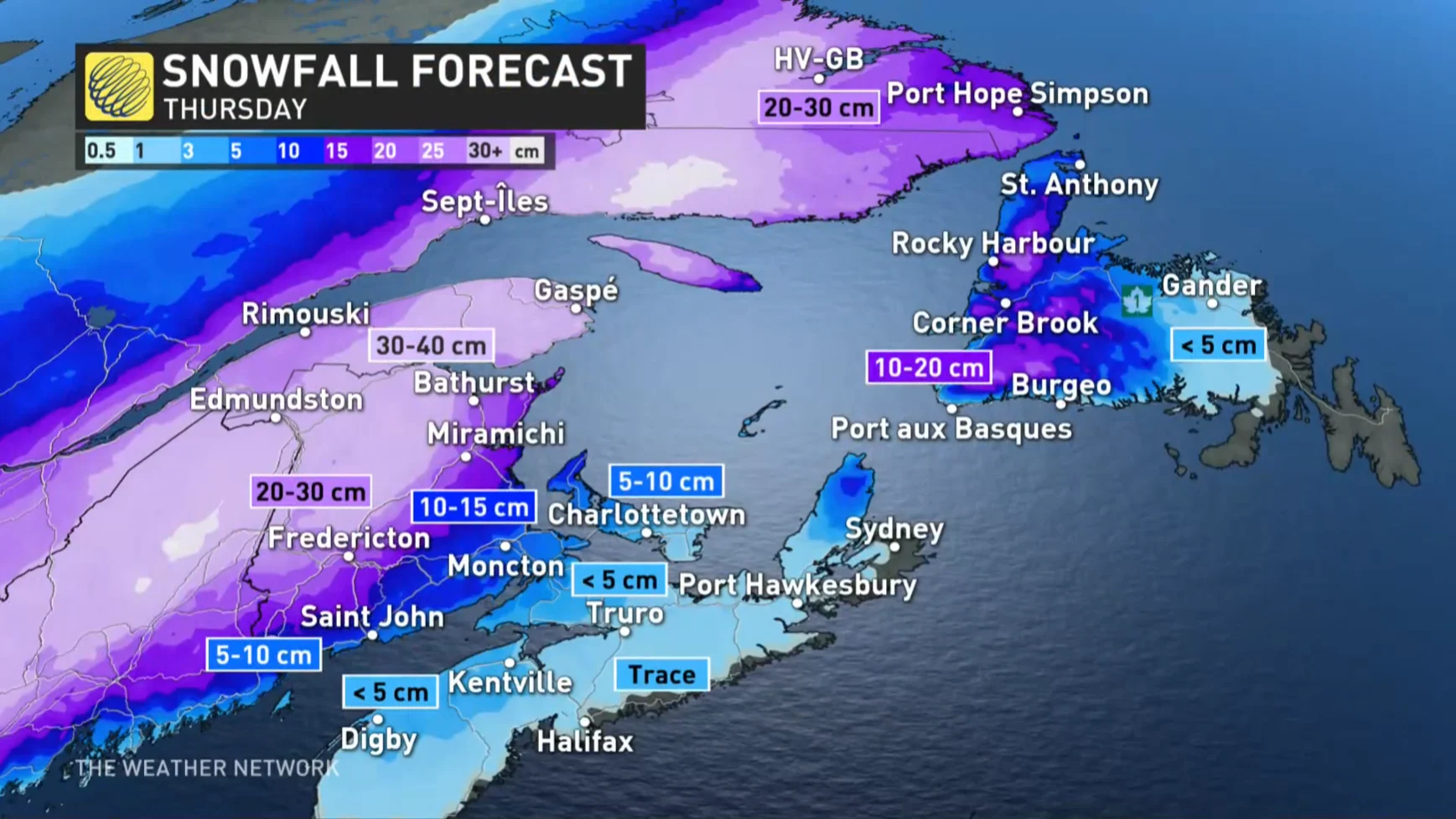
"Depending how north the centre of the low tracks will dictate how far north the mixing and rain will nudge into central New Brunswick and P.E.I.," says Kelly Sonnenburg, a meteorologist at The Weather Network. "Heavy snow is forecast across northern New Brunswick, with locally 20-30+ cm forecast by the time the system departs Friday morning."
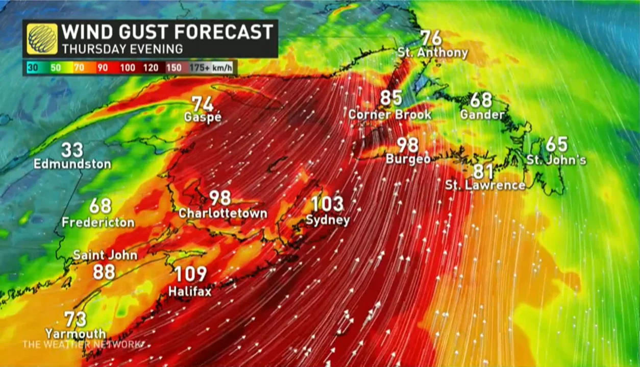
If the precipitation isn’t bad enough, the system will make its strength known through gusty winds of 60-90+ km/h on Thursday, with the strongest gusts likely for southern parts of the Maritimes. Winds near or exceeding 90 km/h will arrive in Newfoundland on Thursday night into Friday morning.
Active pattern stays locked for the start of February
A few days of quieter weather are forecast over the weekend, with near to slightly above seasonal temperatures. Forecasters expect the next system to track across the region on Monday, with rain for the south and snow for the central and northern sections the likely outcome once again.
Colder temperatures are likely for a couple days during the middle of next week, but the active pattern will continue with more storms expected late week and weekend.
WATCH: One low stretching 6,000 KM will impact over 100 million people
Be sure to check back for the latest weather updates across Atlantic Canada.


